

Follow this primitive trail of the North Fork of the Nooksack River to its headwaters in a steep-walled cirque at the base of Mount Shuksan. It's beautiful, but not without its challenges, the first of which is at the trailhead: Ruth Creek has no bridge.
To access the trail, when you see the "Nooksack Cirque" sign, look to the south. (Do not go into the woods at the sign.) Head down the trail on the opposite side of the parking lot. Walk downstream, cross the river on a large log and take the trail on your immediate left. Ignore all other trails; the one to the immediate left follows the river until you arrive at the trailhead registry.
Keep in mind that due to quickly rising water, a log that is crossable in the morning may be underwater in the afternoon. In early summer, Ruth Creek waters may be too high to wade.
Once across the creek, follow the old roadbed for 2 miles to what was the original trailhead. Another mile through second-growth trees will take you to the Mount Baker Wilderness boundary, then you will wind through old-growth forest for about a half mile and emerge on the bank of the North Fork of the Nooksack River at the end of this well-defined trail.
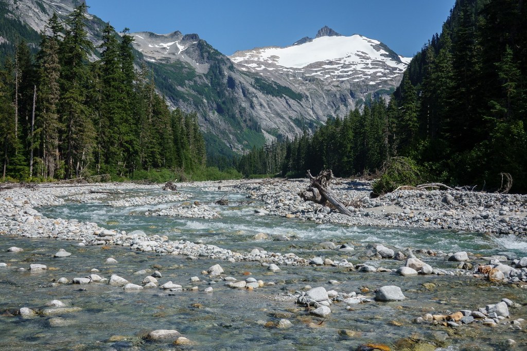
After crossing a tributary stream, the route continues by way of either gravel bars during periods of low water or bushwhacking through riparian vegetation alongside the river.
The North Cascades National Park boundary is about a mile away. Past the park boundary, you can continue through fierce brush as far toward the cirque as your cross-country travel skills allow. Pushing past the boundary to 2,950 feet of elevation at 5.1 miles from the trailhead is a sight to behold — Ruth Mountain, Icy Peak, Seahpo Peak, Jagged Ridge and Mount Shuksan spread out for you to enjoy.
The best time to hike the Nooksack Cirque Trail is in the fall. During cool weather, the water levels are low, allowing easier travel on gravel bars. If it's not readily apparent, this trail receives limited maintenance.

 Trailhead


