Trails for everyone, forever

Home Go Hiking Hiking Guide Panorama Point Snowshoe
link

Panorama Point Snowshoe

Mount Rainier Area > SW - Longmire/Paradise
46.7829, -121.7284 Map & Directions
Length
5.0 miles, roundtrip
Elevation Gain
1,900 feet
Highest Point
7,070 feet
Calculated Difficulty About Calculated Difficulty
Moderate/Hard

Paradise Valley Road is closed for the season. The road from Longmire to Paradise is closed Monday through Friday until further notice.

The view from Panorama Point. Photo by snow Cat. Full-size image
  • Mountain views
  • Dogs not allowed

Parking Pass/Entry Fee

National Park Pass

The route to Panorama Point in the snow can vary depending on how much snow is on the mountain, and how many other visitors have tromped a path up the hillside. One thing is certain -- you'll want to consult the Paradise Green Trails map No. 270S, which includes both summer and snowshoe routes for the area. Continue reading

Rating
3.88 out of 5

(8 votes) Log in to rate

Hiking Panorama Point Snowshoe

The route to Panorama Point in the snow can vary depending on how much snow is on the mountain, and how many other visitors have tromped a path up the hillside. One thing is certain -- you'll want to consult the Paradise Green Trails map No. 270S, which includes both summer and snowshoe routes for the area.

From the parking lot at Paradise, head onto the snow, passing the large restroom building where there will likely be climbers gearing up for an ascent. Hiking straight towards Rainier's summit block, you're following the Skyline Trail. After an initial push uphill, the trail grade becomes more gentle, traversing west and passing Myrtle Falls.

Here the trail reaches a flat part, with Edith Creek in a basin to your left. Straight ahead is a steep slope favored by skiers heading downhill. A trail may switchback across this face, but its grade means it has a high likelihood of sliding, particularly in less-than-ideal snow conditions.

In fact, the safer route from here can be found by going left, crossing Edith Creek (carefully), then heading uphill, over the lower ridge, turning right toward the mountain, and going up a steep slope on the right.

Most snowshoers and skiers take this route, so unless you are visiting just after a big dump of snow, it's likely there will be tracks following the route described above.

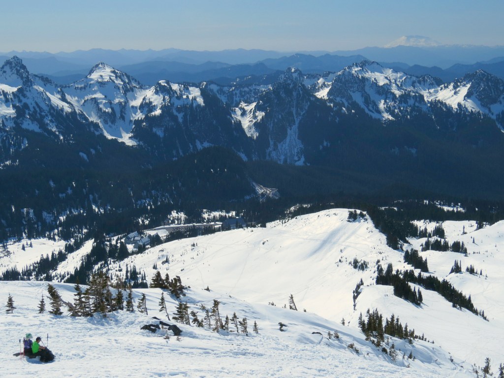
By following that route, you'll take a more direct route to Panorama Point. Upon cresting the ridge, you're at Panorama Point. The views from here are matchless. Look for Mounts Adams, Hood, and St. Helens, and the black crags of the Tatoosh Range.

Hike Description Written by
Multiple authors contributed to this report, WTA Community

Panorama Point Snowshoe

Map & Directions

Trailhead
Co-ordinates: 46.7829, -121.7284 Open in Google Maps

Before You Go

Paradise Valley Road is closed for the season. The road from Longmire to Paradise is closed Monday through Friday until further notice.

See weather forecast

Parking Pass/Entry Fee

National Park Pass

WTA Pro Tip: Save a copy of our directions before you leave! App-based driving directions aren't always accurate and data connections may be unreliable as you drive to the trailhead.

Getting There

Enter the west (Nisqually) entrance to Mount Rainier National Park, 13.5 miles east of Elbe on State Route 706. Drive 17 miles to the lower parking lot at Paradise. Park here. 300 yards further is the Visitor Center and upper parking lot.

There is room for about 200 vehicles in each of the parking lots, plus more parking beyond the upper lot on the one-way exit road. The Visitor Center has restrooms, food, water, information, and much more.

More Hike Details

Trailhead

Mount Rainier Area > SW - Longmire/Paradise

Mount Rainier National Park

You can improve or add to this guidebook entry

Panorama Point Snowshoe

146 Trip Reports

Hiked here recently?

Submit a trip report!
 
Trip Reports