Trails for everyone, forever

Home Go Hiking Hiking Guide Polallie Ridge
WTA is a nonprofit that needs you

We're just as excited as you to get the summer hiking season started. We're psyched our website, app and work for trails help you get outside.

But we're a nonprofit that runs on donations from regular people. If everyone who visited this site this holiday weekend donated $9/month, it would fully fund our work for the next 2 years. Time spent outdoors is priceless, but every donation large or small helps us support those experiences for everyone. Thank you and happy hiking!


Please take 2 minS to chip in $9

link

Polallie Ridge

Snoqualmie Region > Salmon La Sac/Teanaway
47.4093, -121.1067 Map & Directions
Length
8.0 miles, roundtrip
Elevation Gain
3,000 feet
Highest Point
5,300 feet
Calculated Difficulty About Calculated Difficulty
Hard
One of the few extensive views from the Polallie Ridge Trail. Photo by Anna Roth. Full-size image
  • Wildflowers/Meadows
  • Mountain views
  • Wildlife

Parking Pass/Entry Fee

Northwest Forest Pass
Saved to My Backpack

Heading right up the nose of the ridge it’s named after, Polallie will give you a workout. It’s steep, it’s rocky, and there are very few views. Head all the way to Diamond Lake for an overnight, go further into the Alpine Lakes wilderness, or call it quits whenever your glutes have had enough. Continue reading

Rating
2.83 out of 5

(12 votes) Log in to rate

Hiking Polallie Ridge

Heading right up the nose of the ridge it’s named after, Polallie will give you a workout. It’s steep, it’s rocky, and there are very few views. Head all the way to Diamond Lake for an overnight, go further into the Alpine Lakes wilderness, or call it quits whenever your glutes have had enough.

From the trailhead it shares with Cooper River and Waptus River trails, head towards the river. Turn right, behind a kiosk, and begin paralleling the river as the trail heads gently uphill. Within a few hundred feet, the Cooper River trail splits off to the left, and soon afterwards the Waptus River Trail veers off to the right, leaving you to head straight on the Polallie Ridge Trail.

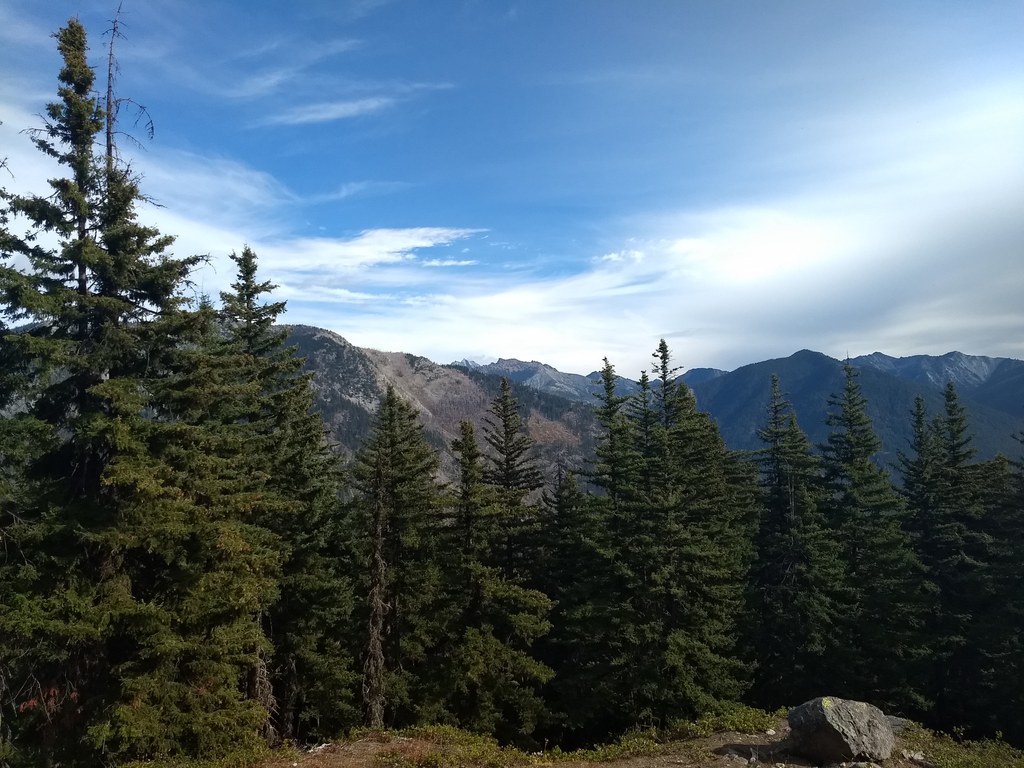
Almost immediately after the split with Waptus the trail begins climbing in earnest. In the first two miles, you’ll gain nearly 1500 feet of elevation, with a very few short flat sections on which to catch your breath. After about 2.2 miles, the trail flattens out on what you may think is the ridgetop. Don’t be fooled – you’ve got more climbing to do! Relish this flat section while it lasts.

Up ahead, through the trees you may spot a tree-covered knoll. You’re climbing up the right-hand side of that little knoll, and it’s steeper than it looks. Take a snack break before climbing. It’s 480 feet in less than a half-mile to the Alpine Lakes Wilderness boundary, and there’s a short section of descent in there to contend with as well.

From the wilderness boundary, the trail moderates a bit as it descends and then traverses before beginning yet another climb. You can see through the trees the small saddle you’re heading to. Keep your energy up – the last pitch to the saddle is quite steep. Coming through the saddle, there are unfortunately no views, but the trail mercifully flattens out as you walk through a large open meadow to another saddle, through which lies your destination: Diamond Lake.

Pass through that second saddle and begin a moderate descent through the trees to the lake, invisible until you are nearly upon it.

Take a rest here and enjoy the quiet. You’re likely to be alone here, and the lake itself offers a lovely reflecting place to eat your lunch in peace before heading back down the knee-jarring descent.

WTA worked here in 2014!

Hike Description Written by
Anna Roth, WTA Staff

Polallie Ridge

Map & Directions

Trailhead
Co-ordinates: 47.4093, -121.1067 Open in Google Maps

Before You Go

See weather forecast

Parking Pass/Entry Fee

Northwest Forest Pass

WTA Pro Tip: Save a copy of our directions before you leave! App-based driving directions aren't always accurate and data connections may be unreliable as you drive to the trailhead.

Getting There

Drive I-90 to exit 80 signed for Roslyn/Salmon la Sac. Turn north onto State Route 903. You’ll drive for nearly 15 miles, skirting Cle Elum Lake before arriving at a Y-junction in the road near the Salmon La Sac Campground. Veer left onto Road 111, crossing the bridge over the Cle Elum River and following the sign for the Cooper River Trail. Arrive at the large trailhead in another half mile.

More Hike Details

Trailhead

Snoqualmie Region > Salmon La Sac/Teanaway

Polallie Ridge (#1309)

Okanogan-Wenatchee National Forest, Cle Elum Ranger District

Guidebooks & Maps

Day Hiking: Snoqualmie Pass (Nelson & Bauer - Mountaineers Books)

Green Trails Kachess Lake No. 208

Buy the Green Trails Kachess Lake No. 208 map

You can improve or add to this guidebook entry!

Polallie Ridge

128 Trip Reports

Hiked here recently?

Submit a trip report!
 
Trip Reports