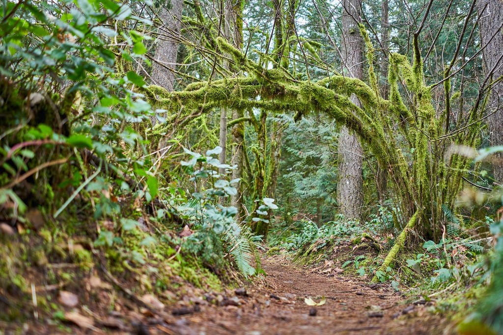

The Wetlands Trail is a short (0.65 mile) trail on Tiger Mountain's Tradition Plateau. As the name suggests, it passes through some areas that often are moist and have a prolific growth of ferns. Also, it passes tiny, aptly-named Round Lake, whose level fluctuates from year to year, and with the seasons.
The trail is one of several in the Tigers that do not have a trailhead of their own, so it only can be hiked in combination with other trails. Because the network of trails on the Tradition Plateau is fairly complex, it will be helpful to refer to the Green Trails Map, No 204S, and it will be clear from the map that there are several options for a loop hike that includes the Wetlands Trail.
Many hikers will find our Tradition Lake Loop a particularly satisfying route. It leaves the main High Point Trailhead and takes the Around the Lake Trail and the Bus Trail to reach the Wetlands Trail.
As you hike the Wetlands Trail, please respect the signs marking some unofficial side-trails as "Closed," and urging you to stay on the main trail to protect fragile wetlands.
Once you have hiked the Wetlands Trail, the route continues on via the Brink Trail (briefly,) the Big Tree Trail and the Swamp Trail to return to the main trailhead.
Other routes leaving the main High Point Trailhead that include the Wetlands Trail will be evident from the map. Or, for a completely different hike, park near Issaquah High School and begin on the High School Trail. For more info, check the WTA's entry for Poo Poo Point Trail that begins the same way. Before the High School Trail reaches the power line, you will note a sign on the left for the Adventure Trail, and that will be your return route. Continue on the High School Trail until you reach the power line, then take the Bonneville Trail 0.3 miles north along the power line to find the southeast end of the Wetlands Trail. Hike the Wetlands Trail, and when you reach a sign for the Adventure Trail take that trail back to the High School trail and return to your trailhead.
Note: A copy of the Green Trails map is posted on the bulletin board at the Main Highpoint Trailhead and another is posted at the southeast end of the Wetlands Trail. You can refer to these maps if your own copy is buried deep in your day pack.
The names and locations of Tradition Plateau trails shown on the Green Trails map correspond most closely with what you will find on signs placed along the trails.
Wetlands Trail

-
 Length
- 1.3 miles, roundtrip
-
 Elevation Gain
- 90 feet
-
 Highest Point
- 570 feet
Parking Pass/Entry Fee
Discover Pass
The Wetlands Trail is a short (0.65 mile) trail on Tiger Mountain's Tradition Plateau. As the name suggests, it passes through some areas that often are moist and have a prolific growth of ferns. Also, it passes tiny, aptly-named Round Lake whose level fluctuates from year to year, and with the seasons.
Continue reading
Hiking Wetlands Trail
Map & Directions
 Trailhead
Before You Go
Parking Pass/Entry Fee
Discover PassWTA Pro Tip: Save a copy of our directions before you leave! App-based driving directions aren't always accurate and data connections may be unreliable as you drive to the trailhead.
Getting There
Driving Directions
From I-90, a few miles east of Issaquah, take Exit 20 (High Point) and turn south on 270th Ave SE. Just a few yards south of I-90, turn right onto SE 79th St and continue on west. The pavement ends in 0.4 miles, and a gate there is open each day from dawn until dusk. If you arrive earlier, or expect to leave after dusk, you will need to park along either side of the road here and follow the obvious trail 0.5 miles to the parking lot. Otherwise, you are welcome to drive on through, watching for possible potholes, and park in the lot. A Discover Pass is required. A toilet is available, but no regular water source.
Take Transit
As a possible alternative for hikers who don't have the use of a car, King County Metro bus Route 208 runs between Issaquah and North Bend, and on weekdays it has a stop at 270th Ave SE. It's a short walk to reach SE 79th St, but then about 0.9 miles to the main parking lot. There are only a few buses each day, so if you use this option be sure to check schedules carefully, including those for any connecting routes.