
The under-appreciated Shriner Peak is one of the loneliest trails at Mount Rainier. It's long, steep, and exposed, making it nearly intolerable in the stale summer heat. But enter fall, when the change of season ushers in majestic color and cooler temps, it's the ideal time to hit this high-alpine trail before the snow starts falling again.
From the get-go, the Shriner Peak Trail steadily ascends 3,424 feet in 4.25 miles. Bring lots of water--you'll need it , and there aren't many sources along the way. The trail runs parallel to Panther Creek through shade Douglas-fir, cedar, and hemlock for 0.75 miles before entering an old burn area. Traverse this shadeless stretch for another mile to a steep series of switchbacks to the top of a ridge under Shriner Peak.
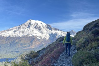
This is where things get incredible. At 2.5 miles, catch your first view of the east side of The Mountain. Sprawling with wildflowers just weeks ago, it's now carpeted with autumn color: Vine maple, mountain ash, golden larch, and crimson huckleberries transform Mount Rainier's hillsides into deep shades of red, yellow, and orange. After another 0.75 miles of steep climbing, you're rewarded with a high view of Shriner Lake far below. From here, the finl mile to the summit turns dusty and rocky.
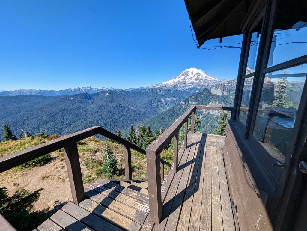
Just 0.25 miles from the summit, catch your first view of the lookout tower standing tall on Shriner Peak. Once the first line of defense for forest fires, the two-story tower now serves as a rest area for weary hikers taking in the view from the summit: Mount Rainier, Little Tahoma, Sourdough Ridge, the Cowlitz Divide, Mount Adams, Goat Rocks, and Mount St. Helens. With high-elevation panoramas, a historic landmark, and gorgeous autumn color, you'll be thankful you gave this lonely trail a chance.
Shriner Peak

-
 Length
- 8.5 miles, roundtrip
-
 Elevation Gain
- 3,434 feet
-
 Highest Point
- 5,834 feet
SR 123 (Cayuse Pass) is closed between the junction with SR 410 to the north and the Mount Rainier National Park boundary (near Ohanapecosh Campground) to the south for the winter season.
Parking Pass/Entry Fee
None
Gorgeous weather and late-season color make this one of the most beautiful autumn hikes in Mount Rainier National Park. This hike is a tough climb, but the payoff is great views and lots of solitude.
Continue reading
Hiking Shriner Peak
Map & Directions
 Trailhead
Before You Go
SR 123 (Cayuse Pass) is closed between the junction with SR 410 to the north and the Mount Rainier National Park boundary (near Ohanapecosh Campground) to the south for the winter season.
Parking Pass/Entry Fee
NoneWTA Pro Tip: Save a copy of our directions before you leave! App-based driving directions aren't always accurate and data connections may be unreliable as you drive to the trailhead.
Getting There
From Enumclaw, drive east 47 miles on SR-410 to SR-123 at Cayuse Pass. Stay right to merge onto SR-123 (Cayuse Pass Highway). The parking area is on the right about 7.5 miles south of that junction. The trailhead is on the east side of the road. If coming from Ohanapecosh, drive north about 11.5 miles on SR-123 to the parking area on the west side and find the trailhead on the east side.