
If you need to take a break before braving the traffic coming back into Seattle on a Sunday evening, or if you want to stretch your legs on the way over the pass to adventures in Leavenworth, the Skyline Lake Trail is just the thing. But be warned, it’s a steep one, with loose gravel and rock. Rising 1050 feet in a mile and a quarter, you’ll get a workout heading up and coming back down. Be sure to bring hiking poles or good shoes – the descent can be almost as challenging as the uphill.
Your trail begins from the large parking area on the north side of Stevens Pass. This is a large lot, so to better orient yourself, find the Pacific Crest Trail (PCT) trailhead at the far east end – a wide pathway disappearing into a green tunnel. Just west of this trailhead is a red building and a service road to the left of the building. That’s where you’re heading.
Follow the service road as it passes some lodgings for Stevens Pass employees, then turns north. The trail passes under powerlines as you head towards a gated, even steeper service road. Continue on the road (which makes up the majority of this trail). Within a three quarters of a mile, you will pass a large structure on the left. This is a utility tower for the ski resort. Continue past this and carry onwards and upwards.
The trail eventually opens out to an excellent view of the Stevens Pass Ski Area across the highway. In summer, you’ll see the mountain bike trails lacing the hill across the way, making a great vista and photo opportunity.
Continue up, up and up, switchbacking steeply through huckleberry and pine trees on the service road.
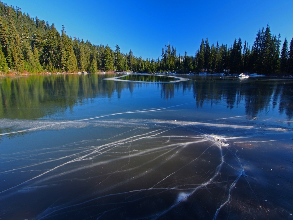
One mile from the parking lot is an easy-to-miss junction. A faint trail to the left may be marked by cairns – this is your trail to the lake. The last quarter mile is a reprieve from the incessant climbing – you’ll gently climb through a field of heather and huckleberries to a lake that lies quietly high above Stevens Pass.
In summer when the lake has receded a bit, there are many spots along the shoreline to sit on the beach and have a snack, and the clear waters, lush pine trees, and flitting birds make this a relaxing getaway for an area so close to a major Washington highway.
WTA Pro Tip: If you want a little more climb, head back to the main trail and turn left. The trail continues up a little ways more to views over Nason Ridge. This will give you about a half mile more round trip before you return to your vehicle in the pass.
Skyline Lake

-
 Length
- 2.5 miles, roundtrip
-
 Elevation Gain
- 1,050 feet
-
 Highest Point
- 5,100 feet
If you need to take a break before braving the traffic coming back into Seattle on a Sunday evening, or if you want to stretch your legs on the way over the pass to adventures in Leavenworth, the Skyline Lake Trail is just the thing.
Continue reading
Hiking Skyline Lake
Map & Directions
 Trailhead
Before You Go
Parking Pass/Entry Fee
NoneWTA Pro Tip: Save a copy of our directions before you leave! App-based driving directions aren't always accurate and data connections may be unreliable as you drive to the trailhead.
Getting There
driving directions
From Seattle, drive east on Highway 2 to Stevens Pass (65 miles from the beginning of Highway 2 in Everett). Drive under the pedestrian overpass and turn left into the large parking lot on the north side of the pass. Park here, being careful not to block in other cars or block driveways or access roads.
From Leavenworth, drive to Stevens Pass. Just before the pedestrian overpass, turn right into the large parking lot on the north side of the pass. Park here, being careful not to block in other cars or block driveways or access roads.
take transit
Take the bus to the trailhead! Plan your trip by bus using TOTAGO.


