
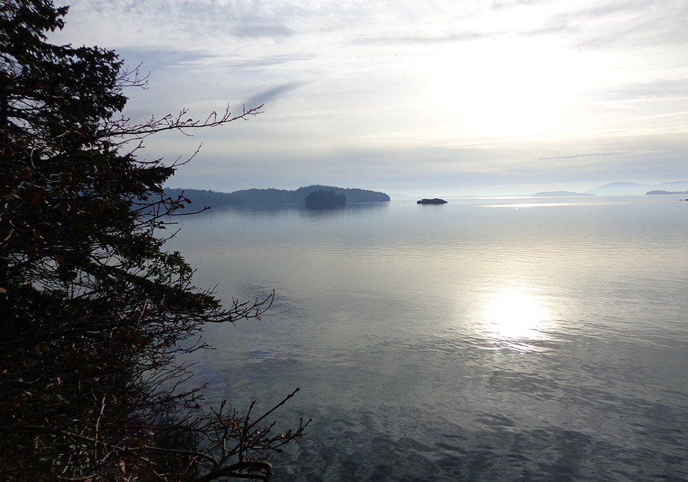

Teddy Bear Cove encompasses more than nine acres and 1,430 feet of shoreline along beautiful Chuckanut Bay. Explore two small beaches for sea critters, fascinating Chuckanut sandstone formations and views out over Chuckanut Bay to the the San Juan Islands. A headland hike topped with cedars and twisted madronas offers views of both beaches from a high perspective. This is a fine all-season hike for a bit of seclusion in the winter months.
From the North Chuckanut Mountain trailhead, take the Hemlock Trail with a slight elevation gain on a boardwalk over a swampy area of skunk cabbage in the spring. In 0.2 miles, cross California Street onto the Interurban Trail and continue for half a mile to a trail on the right down a short flight of stairs to cross Chuckanut Drive. The trail picks up again on the other side of the road and descends on stairs and dirt through Western redcedar, Douglas fir and Pacific madronas to the railroad tracks.
Once you carefully cross the railroad tracks, you can proceed either to the north or south coves, or climb the trail that will take you through a forest of Pacific madrone and Garry oak to the Chuckanut sandstone bluff and spectacular views of Chuckanut Bay and Clark’s Point, across the water to Lummi and Cypress Islands, and beyond to the Olympic Mountains.
Park hours are sunrise to sunset. If you have more time and energy, you can take the Interurban Trail to the south where it connects to Larrabee State Park and north to Arroyo Park.
Notes on the area
The bright white south-facing beach is the result of centuries of crushed clam shells that collect there. Archeological evidence suggests that this unusual concentration may actually be the eroded remains of shell middens, piles from centuries of shellfish gathering and processing by native peoples.
Historically, Teddy Bear Cove was once known as the area’s nude beach. Although never officially designated as such, you are now more likely to see families and college students appreciating the calm waters and spectacular views.
A brick factory operated in the area from about 1915 to 1925. Shale and clay were mined and formed into brick and industrial tile there so you’ll likely see fragments along what was once called Brickyard Beach. Many local masonry buildings constructed during that period were built with brick manufactured there.
 Trailhead


