
Compared to its jagged and lofty neighbors to the west, the Tiffany Highlands consist of gentle alpine balds cresting atop thousands of acres of arid forest. And as a confluence for the dry Okanogan Highlands and boreal forest that is more common in the far north, the Tiffany Highlands hosts a unique mix of habitats, where sagebrush and peat bogs rub elbows.
Begin this easy trek amongst scattered lodgepole pine and Douglas-fir before immediately breaking out onto grassy knobs. Thanks to a recent wildfire that left little but ghost snags standing in its stead, shade is scarce. Recovery from wildfires is slow in this unforgiving environment, but myriad wildflowers,--western pasqueflower, yellow columbine, lupine and others-- provide welcome color. To the south, always in full view, is Tiffany Mountain. A sign, installed in 2004 by the Forest Service and Washington Native Plant Society, explains the history and biological significance of the Tiffany area.
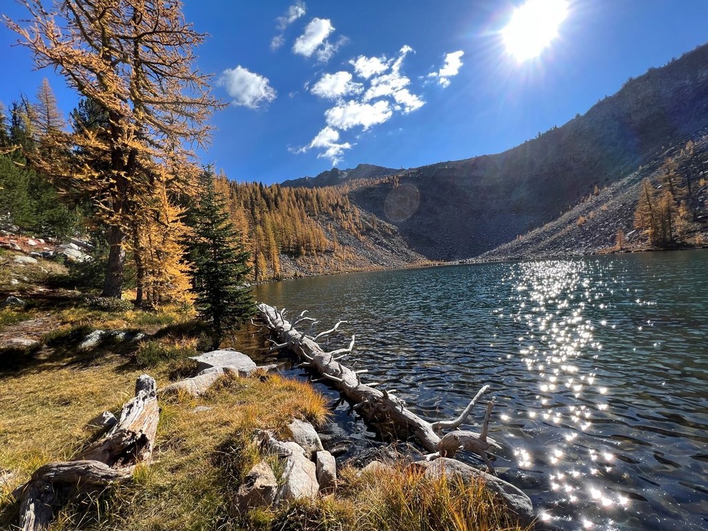
In just over one mile, reach glacier-carved Tiffany Lake. The lawnlike shore provides a perfect setting for picnicking and dangling feet in the bracingly cold waters of the lake. However, ambitious hikers can continue clockwise around the shore and climb 600 feet up to Honeymoon Pass, where options await. A short cross-country trek bags Little Tiffany Lake. Parties who leave a second car at Freezeout Ridge can continue over windswept Whistler Pass to Tiffany Mountain's grassy summit and back down Freezeout Trail, an open loop of about 11 miles.
Tiffany Lake

-
 Length
- 3.0 miles, roundtrip
-
 Elevation Gain
- 200 feet
-
 Highest Point
- 6,750 feet
This short, family-friendly trail with numerous add-on options visits a pretty lake basin at the easternmost edge of the North Cascades and provides long-distance views of some of Washington's loneliest country.
Continue reading
Hiking Tiffany Lake

WTA worked here in 2019, 2017, 2016 and 2015!
Map & Directions
 Trailhead
Before You Go
Parking Pass/Entry Fee
Northwest Forest PassWTA Pro Tip: Save a copy of our directions before you leave! App-based driving directions aren't always accurate and data connections may be unreliable as you drive to the trailhead.
Getting There
From Winthrop head north on CR-9137/East Chewuch River Road toward Pearrygin Lake State Park. After 6.5 miles, before crossing the Chewuch River, turn right onto FR-37. After 13 miles on FR-37, turn left onto FR-39 for 7.5 miles to Tiffany Spring Campground. Tiffany Lake Trail No. 373 starts across the road from the campground.