Trails for everyone, forever

Home Go Hiking Hiking Guide Tiger Mountain Trail South

Tiger Mountain Trail South

Issaquah Alps > Tiger Mountain
47.4425, -121.9776 Map & Directions
Length
3.5 miles, roundtrip
Elevation Gain
520 feet
Highest Point
1,100 feet
Calculated Difficulty About Calculated Difficulty
Easy/Moderate
The Tiger Mountain Trail along Carkin's Cliff in the fall. Photo by Quantum Guru. Full-size image
Saved to My Backpack

Hike the southernmost part of the Main Tiger Mountain Trail - the TMT - for a gentle introduction to the southern slopes of the Tigers. The trail is usable all year unless there has been significant lowland snow. In spring, enjoy blooms of trilliums and other wild flowers. In the fall, appreciate the colors of leaves that carpet parts of the trail. Continue reading

  • Wildflowers/Meadows
  • Wildlife
  • Good for kids
  • Dogs allowed on leash
  • Fall foliage

Parking Pass/Entry Fee

None
Rating
3.10 out of 5

(10 votes) Log in to rate

Hiking Tiger Mountain Trail South

Hike the southernmost part of the Main Tiger Mountain Trail - the TMT - for a gentle introduction to the southern slopes of the Tigers. The trail is usable all year unless there has been significant lowland snow. In spring, enjoy blooms of trilliums and other wild flowers. In the fall, appreciate the colors of leaves that carpet parts of the trail.

The TMT initially follows the grade of the former Woods and Iverson railroad, built in the 1920s to haul timber from the Tigers to a mill in Hobart. It's a quieter walk today, although you may hear occasional traffic sounds from nearby Highway 18.

If you are hiking in early spring, be alert for some of the first trilliums to bloom in the Tigers. As the season progresses, other wildflowers will follow. Most of your hike is in mixed deciduous-coniferous forest, and in the autumn sections of the trail will be carpeted with the browns and golds of fallen maple leaves.

The first mile of your hike gains 500 feet along second-growth forested hillsides. The final 0.9 miles has little elevation change.

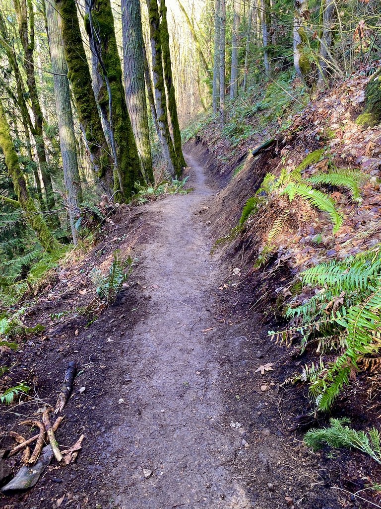
Your hike follows trails shared seasonally with trail riders (equestrians) and, at 1.1 miles, a sign directs riders to turn onto the "Horse Bypass" while your foot trail continues straight ahead. In another 0.2 mile, your trail narrows and traverses the steep hillside of Carkin's Cliff - the reason horses take a different route. (Names such as "Carkin's" honor volunteers who helped construct the TMT in the 1960s.) Beyond the traverse, arrive at the sign identifying Hobart Gap, where the foot and horse trails rejoin.

From Hobart Gap, continue a short way east on the TMT as it follows the route of another 1920s logging railroad. In 0.3 mile or so, come to the crossing of a small creek. It's a tributary of Holder Creek, and early in the season the creek will be flowing with a bit of white water visible upstream of the trail. This is a pleasant spot to stop and, for an easy hike, it makes a good turn-around point. Or, if your enthusiasm and energy permit, some hike extensions are possible.


Extending Your Hike

Feeling more ambitious? If an extra 2.5 miles or so, and 300 feet of additional elevation gain, does not sound daunting, consider a loop hike all the way around South Tiger Mountain, returning to Hobart Gap via the South Tiger Traverse. For details, see South Tiger Mountain Loop in our Hiking Guide.

Also, the TMT itself rambles on much farther, eventually reaching the High Point Trailhead on I-90 some 15 miles from your trailhead today. There are many potential turn-around points along the way, so a hike on the TMT can be as long as you like. For details, see Tiger Mountain Trail in our Hiking Guide.

WTA worked here in 2015 and 2011!

Hike Description Written by
Alan Gibbs, WTA Correspondent

Tiger Mountain Trail South

Map & Directions

Trailhead
Co-ordinates: 47.4425, -121.9776 Open in Google Maps

Before You Go

See weather forecast

Parking Pass/Entry Fee

None

WTA Pro Tip: Save a copy of our directions before you leave! App-based driving directions aren't always accurate and data connections may be unreliable as you drive to the trailhead.

Getting There

From I-90 in Issaquah, take Exit 17 (Front Street) and head south on Front Street through the picturesque old part of town. At the southern end of town, Front Street changes names to Issaquah-Hobart Road. About 8.5 miles from I-90, just before the Highway 18 overpass, turn left onto the southern end of Tiger Mountain Road SE (on your way here, you will have passed an earlier turn onto the northern end of Tiger Mountain Road SE.) Proceed 0.2 miles and look for places to park along the left (west) shoulder of the road. There is no official trailhead parking here so this is your only option. (You may find it easier to continue on 0.15 miles to SE 175th Place, make a U-turn, and come back to park on the shoulder.) The shoulder is highway right-of-way, so you do not have to display a Discover Pass to park there. There are no facilities. Your hike on the TMT begins across the road, a few feet south of the sign "School Bus Stop Ahead."

More Hike Details

Trailhead

Issaquah Alps > Tiger Mountain

Washington State Department of Natural Resources

Guidebooks & Maps

Harvey Manning and Penny Manning

Winter Walks and Hikes Puget Sound

Ed. 2

Mountaineers Books

2002.

Green Trails Tiger Mountain / Taylor Mountain

Map 204S

You can improve or add to this guidebook entry!

Tiger Mountain Trail South

124 Trip Reports

Hiked here recently?

Submit a trip report!
 
Trip Reports