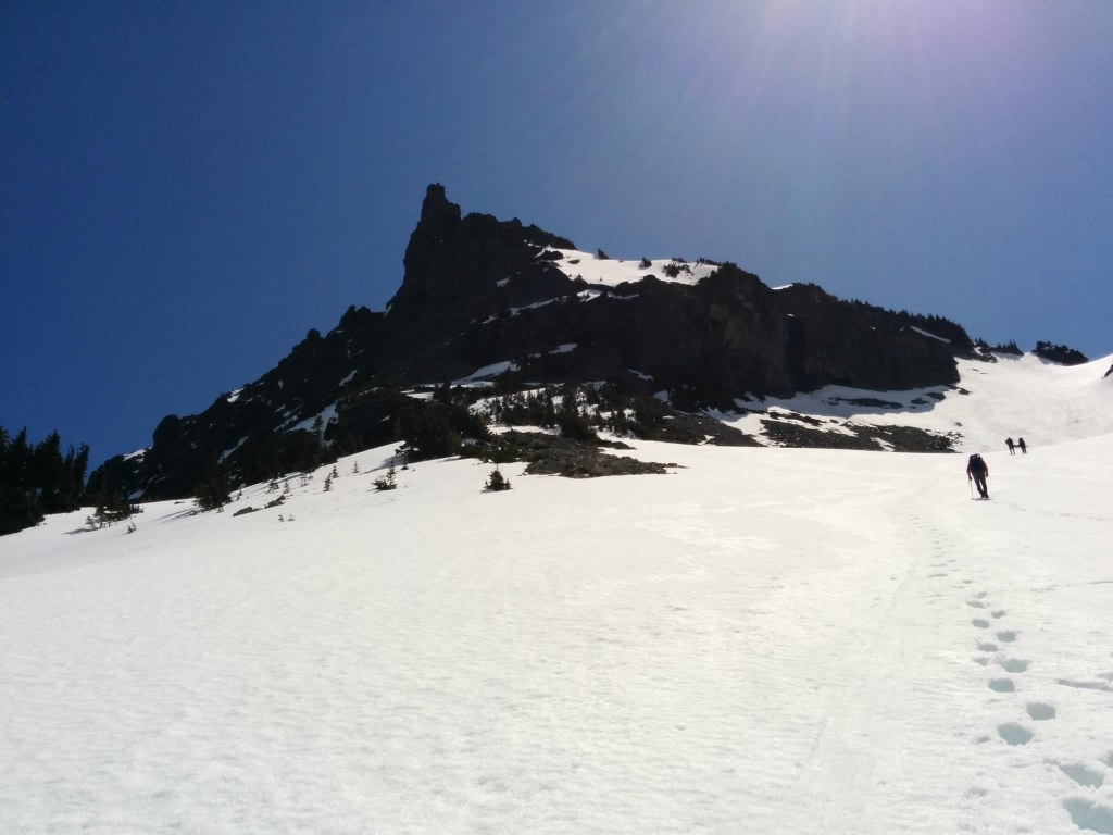

Unicorn peak is the tallest in the Tatoosh Mountain Range and offers spectacular views of Mount Rainier. It's top is somewhat jagged which looks like a Unicorn's horn, hence the name.
Unicorn Peak is the tallest in the Tatoosh Mountain Range and offers spectacular views of Mount Rainier. It's top is somewhat jagged which looks like a Unicorn's horn, hence the name. Climbing expertise and gear is required to summit Unicorn.
Unicorn Peak

-
 Length
- 4.8 miles, roundtrip
-
 Elevation Gain
- 2,397 feet
-
 Highest Point
- 6,971 feet
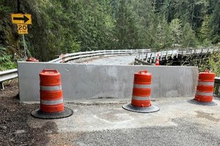
Stevens Canyon Road is closed for the winter season.
Parking Pass/Entry Fee
National Park Pass
Unicorn Peak is the tallest in the Tatoosh Mountain Range and offers spectacular views of Mount Rainier. It's top is somewhat jagged which looks like a Unicorn's horn, hence the name. Climbing expertise and gear is required to summit Unicorn.
Continue reading
Hiking Unicorn Peak
Unicorn Peak
Map & Directions
 Trailhead
Before You Go
Stevens Canyon Road is closed for the winter season.
Parking Pass/Entry Fee
National Park PassWTA Pro Tip: Save a copy of our directions before you leave! App-based driving directions aren't always accurate and data connections may be unreliable as you drive to the trailhead.