Trails for everyone, forever

Home Go Hiking Hiking Guide West Rocky Prairie Wildlife Area

West Rocky Prairie Wildlife Area

Olympic Peninsula > Olympia
46.8805, -122.8757 Map & Directions
Length
4.3 miles, roundtrip
Elevation Gain
142 feet
Highest Point
265 feet
Calculated Difficulty About Calculated Difficulty
Easy/Moderate
Walking through the field. Photo by Jessica Kelley. Full-size image
  • Dogs allowed on leash
  • Good for kids
  • Wildflowers/Meadows
  • Wildlife

Parking Pass/Entry Fee

Discover Pass
Saved to My Backpack

Hike through a riparian area on a gently rolling double-track before arriving at an expansive prairie with big skies, swooping birds and native vegetation. Continue reading

Rating
4.00 out of 5

(3 votes) Log in to rate

Hiking West Rocky Prairie Wildlife Area

This is a relatively easy lollipop loop through a wildlife area just outside of Olympia. Begin your hike on an old road bed lined with aspen trees and wild blackberries. Enjoy the shade — you’ll be out on the open prairie soon enough. At 0.8 miles, you’ll emerge from the woods and reach your first junction — keep going straight and cross a small ditch that spans the trail and can be filled with relatively deep water during the rainy season. Plan to get your feet wet in the spring and winter! By late summer, this will likely be dry. 

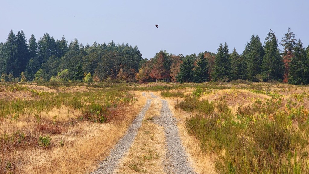
At almost exactly 1 mile, you’ll come upon a 3-way junction that marks the start of the loop. Pause here to read an informational sign about the West Rocky Prairie Wildlife Area before continuing straight through the junction. The trail flattens out noticeably as you make your way around the prairie, and — if you visit in May — there’s a good chance you’ll find abundant wildflowers. 

At approximately 2.2 miles, you’ll hike through an area recently part of a prescribed burn, which the Washington Department of Fish and Wildlife uses to maintain the native grassland habitat. At 2.4 and 2.5 miles you’ll encounter two additional junctions — stay left at these junctions to keep on the main loop. At 3 miles, you’ll reach the end of the loop. Turn right here to retrace your steps back to your car.

Seasonal tip: This trail is a great option when higher-elevation routes are snowed in. If you’re planning a trip to the coast, this is also an excellent leg-stretcher on your way to Westport or Ocean Shores. 

Toilet Information

  • No toilet at trailhead

More information about toilets

Hike Description Written by
Jessica Kelley, WTA Correspondent

West Rocky Prairie Wildlife Area

Map & Directions

Trailhead
Co-ordinates: 46.8805, -122.8757 Open in Google Maps

Before You Go

See weather forecast

Parking Pass/Entry Fee

Discover Pass

WTA Pro Tip: Save a copy of our directions before you leave! App-based driving directions aren't always accurate and data connections may be unreliable as you drive to the trailhead.

Getting There

From Olympia, take I-5 south. Get off at exit 99 for WA-121 S/93rd Ave SW. Turn left onto WA-121 S/93rd Ave SW. Stay on WA-121 for just under 7 miles before turning left again onto 43rd Ave SE/Arrowhead Ln SE. Go 1.9 miles and turn left onto Powder Plant Rd SE, which is the trailhead parking lot. This can be easy to miss, so be sure to slow down as you’re approaching the turn-off.

The trailhead has room for 5-6 cars. There are no bathrooms or facilities — make a pit stop before you arrive!

More Hike Details

Trailhead

Olympic Peninsula > Olympia

Washington Department of Fish and Wildlife

You can improve or add to this guidebook entry!

West Rocky Prairie Wildlife Area

10 Trip Reports

Hiked here recently?

Submit a trip report!
 
Trip Reports