If you are bored at the thought of yet another hike up West Tiger #3, here is an option for a more ambitious hike. First, the route will take you to Poo Poo Point, a knoll on a shoulder of West Tiger Mountain, for the view and perhaps to see paragliders launching into the sky. Then, you'll continue via a sequence of short trails to reach and traverse all three numbered summits of West Tiger Mountain before returning to your trailhead.
From the High Point trailhead on Tradition Plateau, follow the wide graveled trail 0.1 mile south. Pass the signed turnoff to the West Tiger #3 Trail and the Tiger Mountain Trail (TMT,) and follow the wide trail around to the right. In 100 yards cross a small bridge and, 100 feet beyond that, turn left onto the signed Nook Trail.
Follow the Nook Trail, at first gently uphill. The trees you pass here, heavily draped with moss, may seem to endow the forest with an ancient quality, but it's all regrowth. Here and there along your route, occasional remnants of huge stumps hint at the truly-ancient forest that once graced these slopes.
Your route gradually becomes steeper. At 0.7 miles, take a sharp right turn onto the signed Talus Rocks Trail and, in another 0.25 miles, come to the Section Line Trail. Perversely, the sign there shows only an arrow pointing to the right (downhill, toward the High School Trail.) Ignore that arrow! Take a sharp turn left, uphill, onto the Section Line Trail. In a few feet, pass a sign proclaiming "Unmaintained Trail," which just means that maintenance is done by volunteer crews.
The first part of the Section Line Trail may not seem too steep, but that changes. Short sections of the trail are among the steepest in the Tigers. In 0.2 miles come to the first steep section. Beyond that, the grade eases just a bit then reaches another steep section passing around a rocky outcrop.
In summer, as you hike parts of the trail where little sunlight reaches the forest floor, look for saprophyte plants such as Indian pipe, coral root and candy stick.
Press on, and soon come to the West Tiger RR Grade. (The Section Line Trail continues on to the West Tiger #3 summit, and will provide your return route.) Turn right onto the RR Grade. Most of the grade is nearly level, so this is a chance to catch your breath. In the century since logging trains last puffed along the grade there have been some wash-outs and slides, so expect occasional downs and ups.
In 0.3 miles, come to an unsigned trail fork. Take the right fork (the trail heading uphill to the left is the Seattle View Trail that connects with the TMT.)
Over the next 1.3 miles, the West Tiger RR Grade traverses Many Creeks Valley, crossing a number of small creeks on bridges constructed in recent years. Some of the creeks are seasonal, others run all year. In summer, some parts of the trail may be overgrown.
Come to a three-way trail junction. From the downhill side, the Poo Poo Point Trail arrives from the direction of Issaquah High School. The trail continuing on uphill is the One View Trail, and that will be your route AFTER you have visited Poo Poo Point.
For now, continue on the level grade. It changes names, becoming the ongoing part of the Poo Poo Point Trail, and it will take you to the point in 0.5 miles. Soon, drop over 150 feet on switchbacks, then resume a gentle uphill climb to reach Poo Poo Point. (The folksy name is a reference to the steam whistle sounds heard throughout the Tigers in the early days of logging.)
Poo Poo Point lies on a shoulder of West Tiger Mountain, and a small knoll there is topped by a mast with a windsock. The knoll is only a few feet higher than the surrounding area, but it qualifies Poo Poo Point - if minimally - as one of West Tiger Mountain's summits.
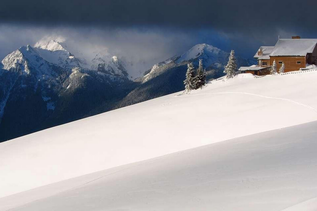
The point offers a great view northwest across Issaquah and Lake Sammamish toward Bellevue's downtown. To the west are Squak and Cougar Mountains, with a hint of Seattle's tallest buildings showing beyond. On a clear day, more distant mountains may be visible.
If your timing is right you can enjoy watching paragliders launch into the sky from the steep northwestern face of the point. You also may see hikers at the point who have arrived there via the Chirico Trail.
To continue, return to the three-way trail junction and turn right onto the One View Trail. It's mostly uphill, but with an occasional downhill section, including a significant drop into Fifteen Mile Gap (there, streams to your right flow into Fifteen Mile Creek and those to your left into Gleason Creek.) Beyond the Gap, a short climb brings you to a junction with the TMT.
Turn right on the TMT and, in 0.1 mile, come to the sign for Larry's Crossing. There, turn left onto the Hidden Forest Trail (Sorry, the most interesting part of the forest is downhill to your right, but that's a different hike.) Follow the Hidden Forest Trail uphill, at first climbing steeply then leveling out. After 0.2 miles from the TMT, cross the Main Tiger Mountain Road (Road 4000,) one of several non-public service roads in the Tigers.
Across the road, your trail continues with a new name. It becomes the Poo Top Trail, and follows a ridge leading toward West Tiger #1. As ridges often do, this one has some ups and downs, so accept that your route to West Tiger #1 will cross several false summits.
After hiking 0.7 miles beyond the road you do reach the West Tiger #1 summit. It's next to a tower at 2948 feet, and is the second highest point in the Tigers, after East Tiger Mountain (3004 feet.) It's the highest point on your hike today. But it's forested, so you have to go a bit farther for the view.
Drop a short distance down the north side of the ridge, on switchbacks, and reach the signed Preston / Bypass Trail. (Names change in the Tigers, and your map may show a different trail name.) Turn sharply left there and continue 0.1 mile through dark forest to reach the Hikers Hut Viewpoint. (The hut itself is a small domed metal structure that might serve as a rudimentary shelter in winter.) Emerge abruptly from the dark forest into the open air and bright sunlight (clouds permitting,) and take a seat on the bench facing Mount Rainier. A swath of the Olympics may be visible too, from Mt. Ellinor at the south end to Mt. Constance as far as you can see around to the north.
In season, look for lupine and tall white daisies and, occasionally, tiger lilies. As you sit, you are likely to see humming birds and large dragonflies, and are almost certain to be visited by two or three gray jays hoping to beg a lunch offering. It's a good stopping point, so stay a while and enjoy the view.
When you are ready to continue, hike down the service road, dropping 400 feet. Come to a gate adorned with crude metal lettering "No Trespassing." That's just meant to discourage unauthorized vehicles, and hikers are welcome to proceed via a trail around the right end of the gate.
Continue on the service road, gaining 250 feet, to reach the West Tiger #2 summit. It you are seeking the highest accessible point, take the one minute side trip from the road up to the tower fence and the summit sign. There is not much of a view.
Then return to the road and take the signed trail 0.4 miles on to the West Tiger #3 summit, crossing the TMT along the way. There often is a small crowd at West Tiger #3, and folks of all abilities hike to that summit from the north side. A few may have struggled to get there, so it's probably politic not to reveal that it's your fourth summit of the day.
Now it's time to descend back to the lowlands. Take the wide trail that leaves the summit toward the northwest. As the trail begins to level out, about 200 feet from the summit, be alert for an unsigned trail heading downhill to your left. That's the upper end of the Section Line Trail. As confirmation, a few feet down the trail come to one of those signs announcing "Unmaintained Trail."
The footing on the Section Line Trail is not too bad when the trail is slightly moist. But when the trail dries out in summer it becomes gritty, and the small pebbles tend to roll beneath your boots. So watch your step, particularly in the steeper places. Trekking poles are advisable here.
Cross over the intersection with the West Tiger RR Grade, completing your loop, and continue on down the Section Line Trail another 0.5 miles. Be alert for the sharp right turn onto the Talus Rocks Trail and, a quarter mile later, for the sharp left turn onto the Nook Trail. Failure to make these turns could take you well out of your way.
Once you are back on the Nook Trail, it's an easy descent to Tradition Plateau, where a right turn on that wide graveled trail will take you back to your trailhead.
WTA Pro-Tip: The four-summit hike can be done from the High Point Trailhead as described above. Alternatively, with minor variations, your hike can begin and end with the High School Trail, or with the Chirico Trail. Each option takes you to the same four summits in the same order, and includes the West Tiger RR Grade. Check the Green Trails Map 204S and, for additional details, refer to the hike descriptions for the Poo Poo Point hike, or the Poo Poo Point - Chirico Trail hike.

 Trailhead