

To begin, step over the white gate just south of I-90, Exit 20 (High Point,) and proceed east a quarter mile on the paved road, dropping slightly. Cross over High Point Creek and, where the pavement ends, find the signed beginning of the High Point Trail. The trail loops around tiny High Point Pond and heads south, gaining about 200 feet in 0.3 miles before reaching a power line.
A sign here indicates "Lingering Trail," with a single arrow pointing south along the route. But you're still on the High Point Trail. The sign is there because this is the former location of a junction with the Lingering Trail. That trail has been rerouted, and you now will pass the junction 100 yards south of the power line. (The Lingering Trail is an option for your return hike.)
Continue south on the High Point Trail about 0.4 miles, come to a signed junction with Dwight's Way, turn left and climb a few steps. Continue on Dwight's Way about 0.7 miles, crossing over the Lingering Trail.
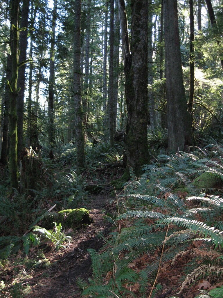
Dwight's Way has some gentle ups and downs with a net gain of about 100 feet. Along the way enjoy some of the nicest second-growth forest in the Tigers. Cross small streams on rustic bridges and, in one case, on a large log. Appreciate the exuberant growth of moss and ferns, and note occasional huge stumps, remnants from logging a century ago.
Reach a signed junction with the Preston Trail (formerly the "West Tiger No. 1 Trail," a name your Green Trails map still may use.) At this point, prepare for some uphill. You'll gain about 350 feet before the grade begins to level off.
After 0.4 miles on the Preston Trail you might notice a faint trail merging with your route on your left, but you would be forgiven for thinking it's just another path where water runs off the trail. Actually, it's the route shown on your map as the Lower Bootleg Trail, a path that arrives here (via part of the Preston Trail) from near the D.O.T. Highway Facility on SE Preston Way. Also, it's part of a route by which a few mountain bikers access these trails, even though the trails officially are closed to bikers. You might not encounter bikers on your hike, but you could see tire tracks here, and along the ongoing Bootleg Trail if you return via that route.
Continue on another 0.1 miles and come to a signed trail junction where the Middle Bootleg Trail heads off left. The ongoing Preston Trail, your route, climbs steeply uphill to the right. Gain about 500 feet in a half-mile, cross over a gently rounded knoll, and enjoy a brief stretch of downhill. But it's elevation you will have to gain back.
At the low point, where the uphill resumes, note an old railroad grade heading left with a faint path visible along it. If you are here on a future hike and feel adventurous that's a path you could explore. It's rudimentary, but it does go through to join the Bootleg Trail. For today, just stay on the Preston Trail, climb another 100 feet and reach a signed trail junction where the West Tiger RR Grade arrives from Fred's Corner.
By now you probably are thinking this hike has a lot of uphill. It does, and there's more. Stay on the Preston Trail and climb another 600 feet in a half-mile to reach a signed junction with the upper end of the Bootleg Trail.
From here, the ongoing Preston Trail continues west below a ridge top. In 2014, the slope above the trail was clear-cut. Trees at the edge of the trail now are subject to the full force of storm winds, and there have been some blowdowns.
As of early 2015, this part of the Preston Trail was completely blocked by a massive blowdown. (Check recent trip reports for the current status, and for any advice.)
In less than a quarter-mile, come to a signed junction with the Poo Top Trail. Here, to reach the summit of W. Tiger No. 1 (or as close as an electronics tower will allow) you need to take a short side trip. Hike up the Poo Top Trail, gaining about 75 feet on four short switchbacks to reach a high point next to a large granite boulder. At 2948 feet, this is the second highest summit in the Tigers (only East Tiger, at 3004 feet, is higher.) It may seem somewhat anti-climactic, both because of the adjoining tower, and because there is no view. But don't despair! You soon will have your view.
The Poo Top Trail continues on south to meet up with the Hidden Forest Trail, but that's for a different hike! For today, turn around and take the Poo Top Trail back down to the Preston Trail (from this side the sign says it's the Bypass Trail, because it bypasses the electronics.) Turn left and continue west on the Preston/Bypass Trail a quarter mile. Pass through some very dark forest and emerge abruptly into the bright sun (clouds permitting) at the Hiker's Hut Viewpoint.
The hut itself is a small, round metal structure that might serve as a very basic storm shelter in winter. A graveled service road arrives here from the west to reach the electronics gear, and a bench is available across the road. Sit and take in the view. On a clear day, Mt. Rainier will be directly in front of you and of a large swath of the Olympics will be visible to your right.
While you are at the viewpoint, you may be visited by a few gray jays. Humming birds also often are seen here and, in summer, large dragon flies. In spring, check the surroundings for wildflowers such as lupine and tiger lily (a few years ago tiger lilies bloomed right under the bench!)
When you have had your fill of the view, and finished your lunch, it's time to think of returning. Either return the way you came, possibly taking the optional Lingering Trail, or see below for another possibility.
extending your hike
On your hike up to W. Tiger No. 1 you passed two ends of the Bootleg Trail, so it's an obvious option for your return hike that will add about a half-mile to your distance.
If you decide to return that way then, when you reach the junction at the upper end of the Bootleg Trail, turn right, follow it a short distance below the ridge top, then begin to descend steeply. At the point where the trail steepens, another short trail arrives from the right. It just leads up to the ridge top service road. (If, in the future, you are hiking the Bootleg Trail in the uphill direction, be alert for this unsigned junction near the ridge top, and watch for a large red arrow painted on a tree trunk to indicate where the Bootleg Trail bends west.)
Descend the Bootleg Trail another 0.6 miles and approach a junction with the Paw Print Connector. Above the junction you might notice, off to your right, a small fir tree that sports holiday decorations, even in summer. It's one of two (at least) such trees in the Tigers (another is along the TMT above Ruth's Cove.) It is not known who adds the decorations, or who sometimes removes them.
Continue down the Bootleg Trail. Eventually, it reaches another old railroad grade and abruptly levels out. The trail may seem to go both directions along the railroad grade, but the left branch is your ongoing trail. The right branch used to be very indistinct, but in recent years it has enjoyed more traffic and become more visible. It connects with an old logging road that is shown on your Green Trails map.
Beyond the railroad grade, cross the East Fork of Issaquah Creek. Generally, this is an easy crossing on stones although the water level can be higher after a recent heavy rain, or when snow is melting above. After the crossing, continue down the Bootleg Trail to reach its junction with the Preston Trail. Follow the Preston Trail back to Dwight's Way, and return to your trailhead.
Optionally, along Dwight's Way, when you come to the crossing of the Lingering Trail you can turn right and take it back to rejoin the High Point Trail above the power line.

 Trailhead


