

Our route:
Thirtymile up Chewuch river 6 miles to Basin Creek. Up Basin Creek trail, over Mt Topaz to Windy Lake, and Sunny Pass in Horseshoe basin. Boundary trail past Teapot Dome, Tungsten mine, Cathedral lakes. South to Remmel Lake, Airview, up to Peepsight mtn and back down to Thirtymile. We were a scout group.
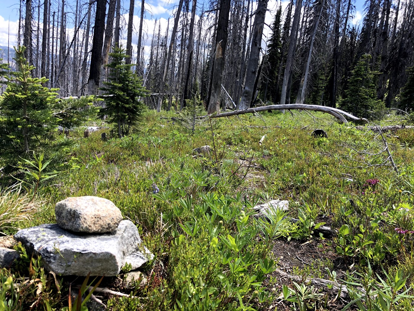
The entire way from Thirtymile to Horseshoe basin was burned out by the Thirtymile fire in 2002.
The trip was spectacular. Type 1 and type 2 fun. The main things about the route to call attention to are:
- Chewuch river trail was burned completely in the 30 mile fire in 2001. The trail is logged out.
- Basin Creek trail has a 3 mile, very rugged stretch in the middle that involves climbing over many trees.
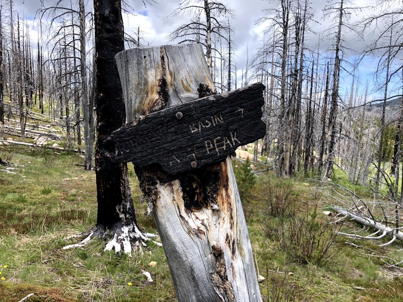
- The route up from Andrews creek over Crazy Man Pass, past Peepsight mountain and back to Andrews is reasonably well cairned, but south of Peepsight mountain there is a 1 mile stretch that we couldn’t find the trail and the entire stretch south of Peepsight has many downed trees with lots of rugged climbing over logs.
- Andrews Creek valley is also completely burned up from the Diamond Creek fire in 2017. It’s logged out and in good shape.
- The Boundary trail is not in the burned area and is in good shape.
- If you hike over to Peepsight lake on the 1 mile trail that is shown on the maps, the route on the ground is not where the map shows. The actual route goes lower and is about ¼ mile further south before climbing back up to the pass above Peepsight Lake. There were cairns showing the way. The route down from the pass to Peepsight lake (.5 mile) is easy to follow.
Be warned that the Basin creek trail is a mess of stacked trees, rugged and very difficult to follow for about 3 miles from 3000 feet to 6000 feet. It starts out maintained from Chewuch, but the middle part is very difficult. We slowed to about 1/2 mile per hour. GPS helped with navigation and staying on route. Carry a light pack. From about 6000 feet over Topaz and beyond the conditions are better. One of us spooked a moose at about 5500 feet.
From Horseshoe basin to Cathedral the trail is in good shape, camping very nice and out of the burned area. Bugs came in waves but a cool weather pattern kept them at bay.
Cross country up from Remmel lake to Cornwell and Airview. Lots of bugs here which tested us. Following the route was a bit challenging but the gps and compass helped.
The route from Airview down to Andrews Creek has many trees but is short and straightforward. From Andrews (at Airview junction) up to Peepsight mountain (past Rock lake, Crazy man pass), there were nice cairns to follow through the burned forest. Many trees down, but mostly straightforward. Follow the cairns and if you can’t find them, double back and look again. The trail has been maintained in the past, but lots of blowdown of dead trees have accumulated. This stretch is in better condition than the next.
From Peepsight mountain, south back to Andrews creek is rugged. Many, many downed trees and we were not able to follow the trail until about 2 miles south of Peepsight mountain where it reappeared. As you head south from the pass by Peepsight mountain, the country is open and there are nice cairns. We tried to find the junction where the trail down Peepsight creek would head south. But we only saw cairns starting to head west towards Peepsight lake. So we hiked down a boulder field about 300m from the creek to a flat area and eventually reconnected with cairns that lead the way south towards Andrews creek. Note that the map shows a trail to Peepsight lake which I tried to follow as a side excursion, but the location of the trail on the map does not correspond with the ground where it’s cairned about ¼ mile lower, and also has a tread (in places).
If you are trying to get up Peepsight mountain/lake area, I’d recommend hiking up the Andrews creek trail to the junction with the trail that heads south past Rock Lake and Crazy Man Pass.
Comments