

I'd been wanting to do this loop hike up and around the North Fork of the Sauk for a long time and this year was the year! My buddy and I got a late start on Tuesday from the trailhead where we were shocked at all the cars parked there mid-week! No matter. We hefted our packs and walked the gentle six miles to the Mackinaw Shelter remains and made camp next to a roaring Sauk river. (The bugs were kind of bad there so I'd highly recommend taking along a mosquito head net.)
The next day we got an early start in anticipation of the twenty-six switchbacks ascending 3000' in three miles. Thankfully the weather was cloudy and cool so we didn't have to bake in the sun. If you do this on a sunny afternoon, be prepared with lots of water...although there was a gushing stream at switchback fifteen you have to climb down to. Not sure if it will be there in a month or two, but good to know for future hikes.
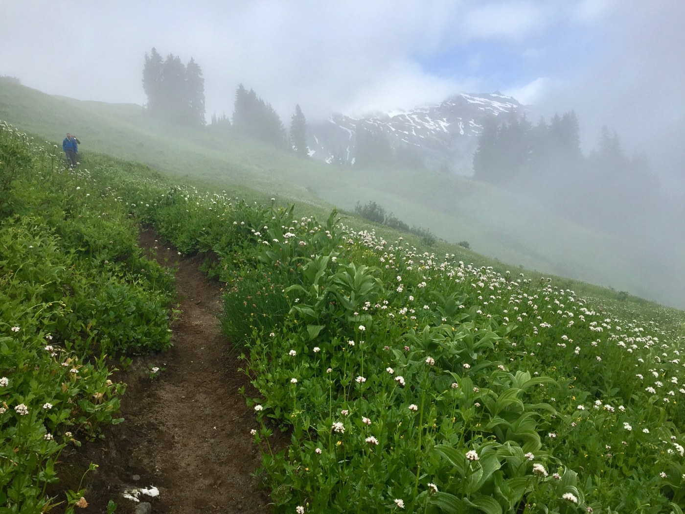
We crested White Pass late morning as the clouds began breaking up, revealing stunning views of Glacier Peak and expansive vistas east and south, all framed by a mind-blowing array of lupines, paintbrush, glacier lilies and gobs of LWF - little white flowers. Since the weather had become so incredibly nice, we decided to lollygag the day away watching the clouds float by and ambling along the ridge top meadows.
We spent the next day hiking north on the PCT to Red Pass for a look-see down into White Chuck Basin. Beware: the trail down into the basin is chock full of snow - I wouldn't want to descend into that valley until the boot-packed trail had thawed a bit.
That night it rained and blew and we woke to quite a different, damp world. Views were nil but the cloud banks racing past were lovely nonetheless. We packed up early and sloshed southward down the PCT towards Dishpan Gap where we hooked a right and headed towards Blue Lake. Not sure of the potentially snowy northwestern aspect of the high route to Blue (we later saw that it was just fine) we decided to take the longer/lower route which took us across some of the most challenging snowfield crossings we would encounter. Nothing you can't do if you have hiking poles, take your time and do it when the snow is soft. Finally arriving at Curry Gap, we descended about 600' and then climbed back up the same to Blue Lake, passing lovely Little Blue on the way.
The weather had improved dramatically and we made camp after having hiked about fourteen miles that day. Next day we filled our water bladders extra full (there's none to be had until partway down the last descent) and set out for a much-anticipated walk up Johnson Mtn and then along Pilot Ridge. The trip reports are quite correct when they state it's a breathtaking hike full of wildflowers, views of Rainier and Sloan Peak and many, many ups and downs. "Where's that dern last down?", I kept asking myself. Careful for what you wish for, because the last down is 2.5 miles of put-on-the-breaks, quad-quivering, knee-aching descending of a steep, poorly maintained track at times not worth calling a trail. Whine, whine, whine...eventually the end came in site which was a long, not-so-wide log across the rushing Sauk River. Coaxing my pup across was a bit of a challenge, not to mention my Gumby legs not exactly being in the best of shape but we survived without mishap and managed to hike another day.


Comments