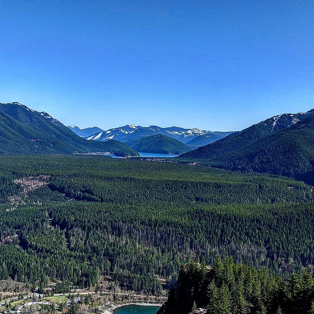
Having exhausted the substantial snow-free options nearby, it was time to stop making excuses and just go for something more creative. I'd only ever been to Rattlesnake Ledge once and thereafter vowed on principle never to return, but the approach thereto is peskily in the way of the loftier destinations on Rattlesnake Mountain. So it was with some consternation that I arrived at 9am on a Friday to find the parking lot already 25% full. But I'd done my homework and knew I could avoid most of the trail to the main ledge with some judicious scrambling.
Now, I'm sure the city and whoever else aren't keen on having people wander around off trail in the area, so I'll just say it's possible to get straight up to the middle ledge, but you probably shouldn't try. Hazards include getting weird looks when you thrash through the brush to leave the trail and being pelted by apple cores, water bottles, articles of clothing, or whatever else people are ejecting off the cliffs. The payoff was having the middle ledge nearly to myself and the upper ledge completely to myself on an absolutely astounding April day.
Ascending on the trail beyond the ledges, the snow began intermittently at about 2800' and became unavoidable by 2900'. Fairly hard-packed stuff on the shaded trail; I had poles but no spikes and was okay (for now), but for extra security or speed spikes might be nice. The trail has seen some traffic and is easy to follow to the East Peak, which is the highest on the ridge. The snow is quite deep in the more open spots around the summit and nearby roads. Atop the summit sits a deteriorating relic: a decommissioned airway beacon, of which few remain. I'm a bit surprised that with the number of aviation nerds around here (myself included) there is not more attention paid to preserving the structure, or at least documenting its history. I'm counting on the retired folks to do something about this while I continue to make sure their pensions will be paid out.
Beyond the East Peak, the trail has seen significantly less traffic. Soon, it enters a large clear-cut area that would make a lovely snowshoe right about now. Unfortunately for me, it was more a choose-your-own-adventure post-holing party. There are a few tracks that do a decent job of sticking with the trail (according to GPS), but it's not easy going for the unequipped. The nice thing about following the trail vs. the roads is that the trail tends to be more in trees, which gives it marginally better hiking properties in the snow. I say this in hindsight. My next summit was Donna's Pinnacle, where if you continue behind the small structure you are met with a rock knob that has a commanding view to the southeast.
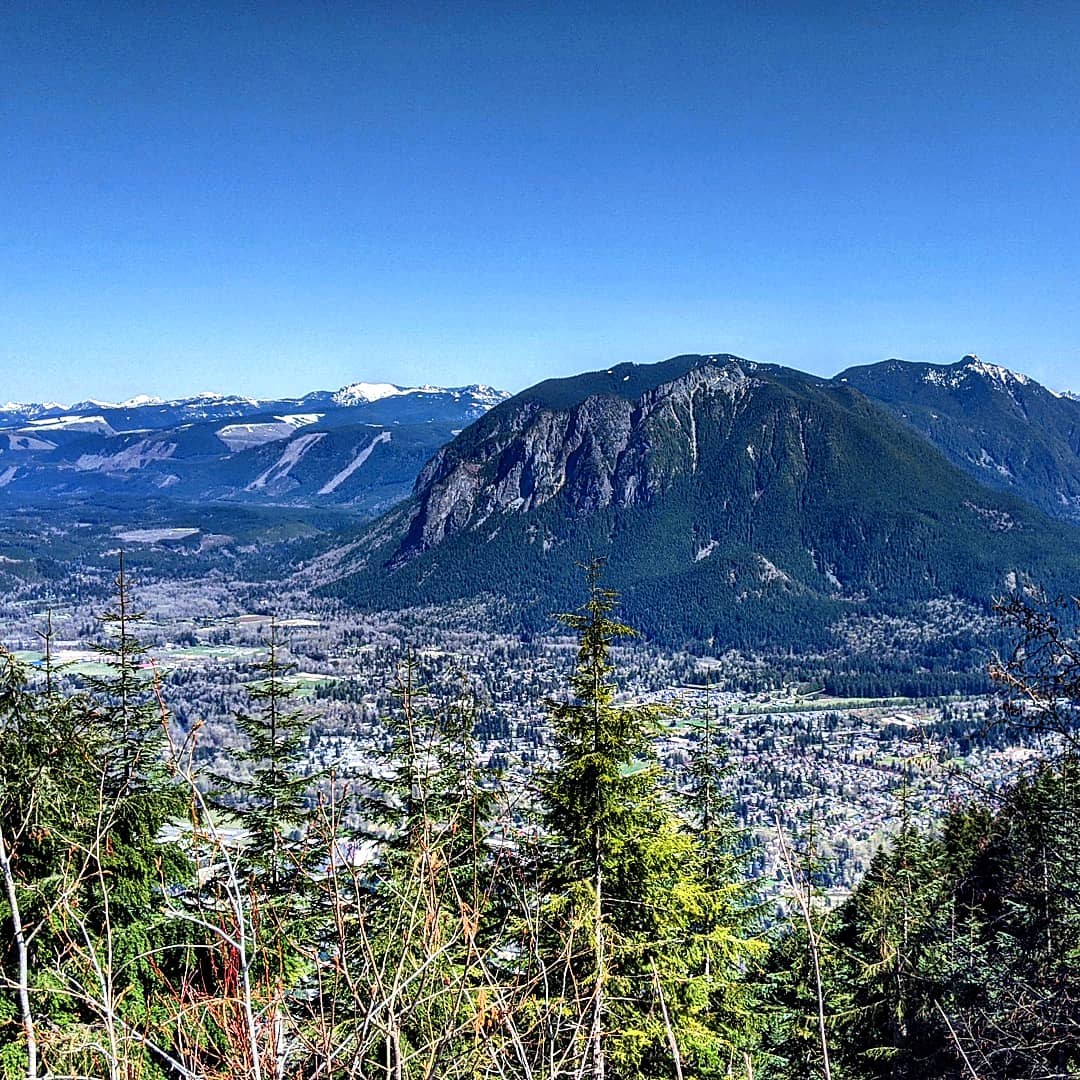
I slogged my way down from there on the road (lacking the aforementioned hindsight) but hopped over to the trail in hopes it would get me closer to the summit of the Middle Peak. Indeed it did, and just a short walk along the ridge ensured that I had stepped close enough to the highest point to bag it. I then continued along the trail to the Grand Prospect viewpoint, which offers a unique perspective on Mount Si and beyond. Even Mount Baker and Three Fingers were out today.
From there, I headed straight up the ridge to the West Peak and its network of huge radio towers and supporting infrastructure. Interestingly, several of the security gates around them were unlocked and left open, despite there being no one around and not even footprints in the vicinity. In fact, it seems to have been some time since anyone was there at all, as I was breaking trail the entire way on completely untouched snow. Views of Mount Rainier from here are stunning, and today it was possible to see out over most of the South Sound and some of the Olympics from key places in the clear-cut. I ambled down (laboriously) eastward to briefly intersect and follow the mountain-bike trail back to the road, upon which I tracked southeast until a good spot to jump back onto the trail.
It was quite toasty by this point with the vast expanses of snow reflecting the direct sun. I'd loaded up my pack extra heavy for training purposes, which I tried to forget about, but the fun was quickly becoming type-two with all my peakbagging objectives behind me and nothing visible before me but a sweltering snow slog. When I finally reached the forest again, I was so relieved that I decided it would be a good time to check out the remnants of the logging road that begins at Windy Landing. The landing itself must have had some views at some point, but the trees have grown up so as to render it a rather nondescript wide spot. I could have extrapolated those conditions to the old roadbed itself and just gone back to the trail like a normal person (inasmuch as a normal person would be there in the first place), but former roads just entice me to an unreasonable degree so off I went.
The next hour was spent in a post-holing, tree-welling hell as my boots filled with water and I tried not to slide 2000 feet down the mountain to I-90. It actually might not be such a bad alternate route with the snow melted or with snowshoes, but even my high tolerance for relentlessly bad conditions was being tested, and that was with fine weather. Unfortunately by the time of this test it was just as easy to keep going as to turn around, so I continued below the summit of the East Peak and and after one mile reached the intersection with the maintained road. There was still enough snow to warrant more than the boots I had, but at least it was flat and there were no surprises underneath. I continued down the road until it curved off to the west, at which point it was a short bushwhack to rejoin the trail.
When I got below the snow line, I took a moment to pour the water out of my boots and wring several gallons out of my socks. Since leaving the middle ledge I'd seen about ten people (zero since turning around at Grand Prospect), but I could already hear the cacophony of afternoon hikers I would soon encounter back in the ledges area. I decided at that point to descend via the scramble route for social-distancing purposes as much as anything. An added social-distancing bonus was the low level of Rattlesnake Lake, which allowed me to bypass the lowest part of the trail by simply walking straight across from the kiosk to the parking lot rather than taking the bend around the lake.
I got way more than I bargained for in 11 miles and 3400 feet of elevation, but I earned every inch of each. It felt like three times that much.


Comments