
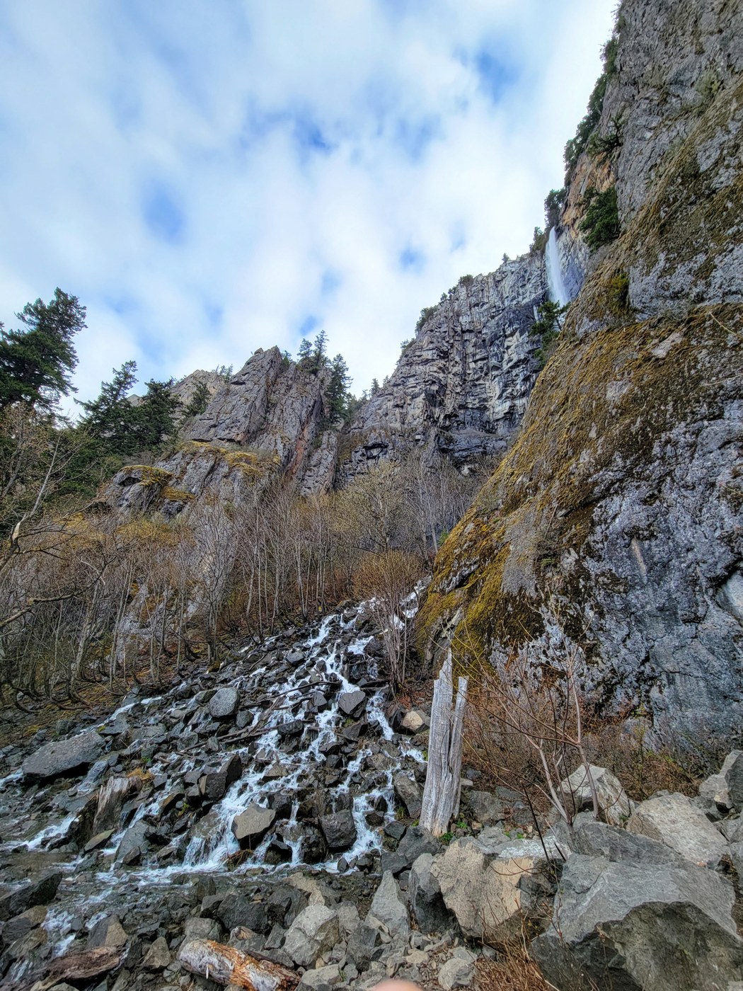
I completed a 13.1 mile loop that included Snoquera and Skookum Falls. Starting at the north Skookum flats trailhead, I hiked clockwise, see the attached caltopo map. There is only 1 blowdown that presents a little challenge, it is on the southern part of the Snoquera Falls portion, there is a steepish boot path going around it, 19 out of 20 people will not have an issue with this (but, I was glad that I had poles). Crossing Snoquera Creek by the falls was not difficult, my boots got wet in a few places, an inch above the sole was the deepest and that was just for a moment. There are a few spots on the northern portion of the Snoquera Falls loop that are quite rocky, especially the chute where there was a landslide at some point, but all of these were easy to cross, they just took some care with boot placement and going slowly. I was glad that I had poles and that I was going uphill. Other than those short sections, the tread on this route is quite good and fast.
A description of the route:
- From the parking lot take FS road 73 over the White River
- immediately after the bridge, on the right/south is the signed Dalles River Trail, this runs for about .6 mile and comes out at the Dalles Campground near a huge stump and fallen tree
- at the campground veer to the left to take the road that runs closest to 410, take that until it exits onto HWY 410
- directly across 410 is FS road 7150, cross 410 and hike on residential FS 7150, it goes east and rises for a bit, then turns south/right and runs for about .5 mile before turning right/west and going down to meet 410. There are some very quaint cabins on this road and it is a pleasant walk.
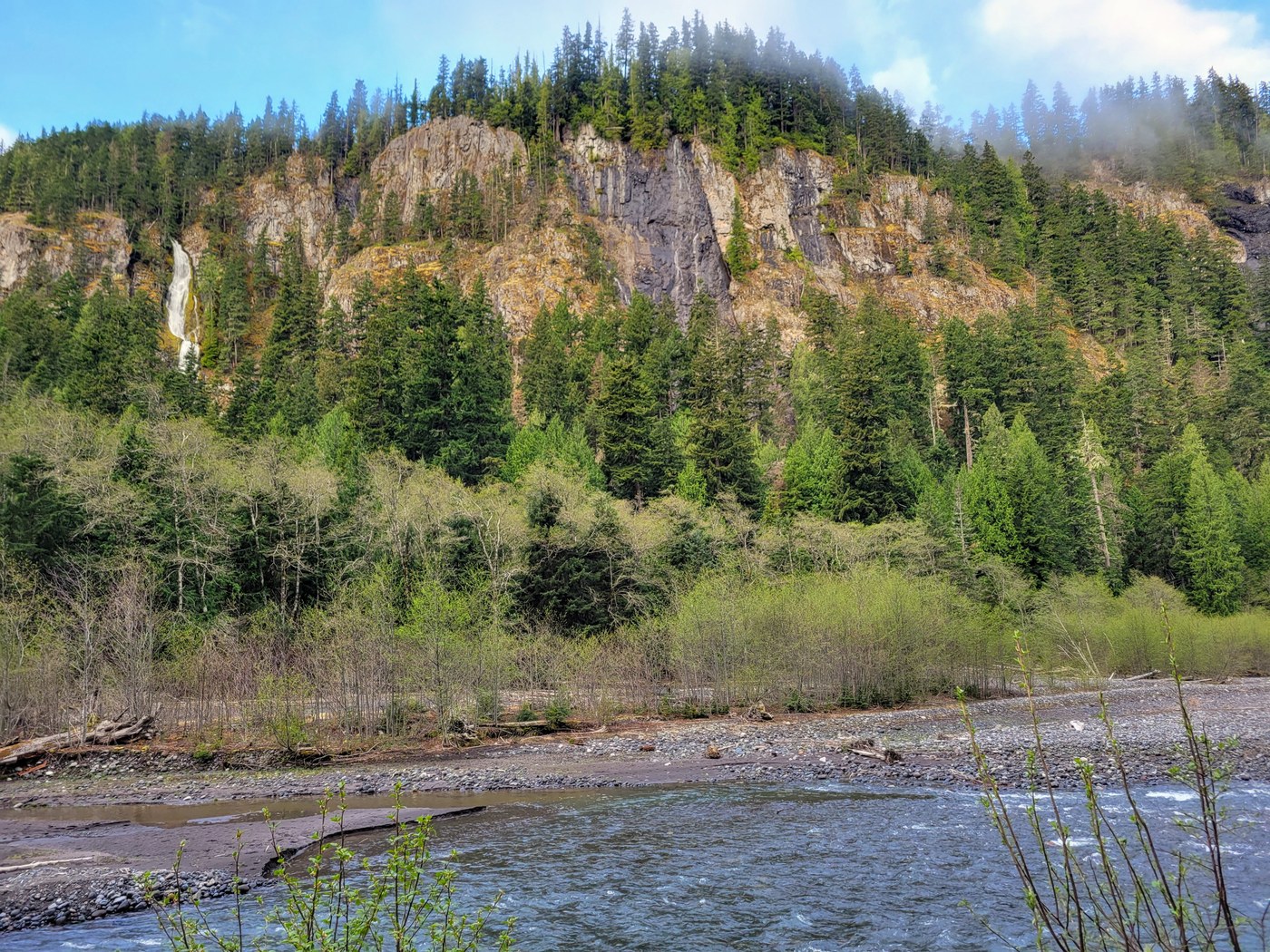
- here you have to walk along 410 for 2/3 mile. Except for 150 feet at the end, the left/east side of the road has a dirt area outside of the paved shoulder. While there were many cars heading south on the other side of the road, only 1 car passed me heading north on the side of the road where I was walking. An added plus, this portion of the road contains the pullout for the Skookum Falls Viewpoint.
- after 2/3 of a mile on 410 you can see the trail sign for The Palisades and White River trails on the east/left, take that
- take the Palisades to the White River, to the Snoquera Falls Loop (up and over and down), to the White River, take the White River trail south until you hit the exit onto 410
- right across 410 is an old road, follow the road for .2 mile, past 2 blowdowns, and it comes out on the Buck Creek Road at the bridge over the White River.
- after you cross the bridge, the Skookum Flats Trail is almost immediately on your right/north, take that back to your car
Comments
Carolyn74 on Snoquera Falls Loop, Skookum Flats, White River
How do I find the attachment? Suitable for an overnight?
Posted by:
Carolyn74 on May 02, 2021 05:22 PM
AlpsDayTripper on Snoquera Falls Loop, Skookum Flats, White River
It's under 'more information for this report'. Except for the campground, which isn't open, I don't think there are good spots along this route. But, I don't backpack, so I don't have a good eye for that.
Posted by:
AlpsDayTripper on May 02, 2021 06:06 PM