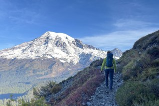
The Skookum Flats Trail parallels the White River with gentle elevation changes. The entire length of the trail is 8.5 miles one way. There is a trailhead at the north end, along Forest Road 73, and another trailhead 6.1 trail miles to the south, along FS 7160. There is road access at 7.5 miles (in a fee area), via Ranger Creek Airstrip Road. This description starts from the north end of the trail, the shortest route to Skookum Falls and back. Length and elevation gain are for only the round trip to the falls and back.
Even though the grade of the trail is gentle, there are rocks, roots, narrow sections and washouts that collectively prevent this trail from being wheelchair-friendly. It is, however, quite popular with trail runners and mountain bikers.
From the north trailhead along FR 73, start out on easy trail through forest. There are varied trees, including Douglas-fir, hemlock, and cedar, with some old growth. Salal is abundant, with ferns, vanilla leaf, thimbleberry — the usual plant life for a western Washington forest at 2000 feet of elevation. Shade is abundant, although it is not dark; the canopy allows plenty of light to come through.
At 2.2 miles, a sign identifies the side trial to Skookum Falls. This is the same waterfall that has a signed viewpoint and pullout along SR 410. From the highway viewpoint, more than 350 feet of waterfall are visible, in two main drops. From this trail, you can see only the bottom portion, which is not visible from the road.
The side trail to the falls is steep but short, only a quarter-mile round trip. Water cascades down a nearly vertical rock face into a plunge pool. By mid-summer, the flow is often reduced to a trickle and you can walk right up close if you like.
After returning to the main trail, continue on through the same type of terrain, forested and shady, but with adequate light and occasional views of the White River.
Mileages from here on do not include the quarter-mile side trip to the falls.
At 3.1 miles is a view across the river valley of the rocky peaks known as The Palisades.
At 4.4 miles, the trail has climbed to 150-200 feet above the river. If you watch for it, you can find where a gigantic mudslide fell away, just a few yards east of the trail. The slide took out the original trail, where switchbacks formerly led down to the Buck Creek connector trail, which crossed the White River on a suspension bridge. Storms obliterated that bridge in the winter of 2006. This portion of the trail was rebuilt on higher ground after the storm damage.
At 5.1 miles, the other end of the original trail (leading to the Buck Creek trail) is still visible, heading downhill and to the west. Bypass this unsigned junction. The old trail might look good, but it has been abandoned and is no longer maintained. As it gets closer to the river, it is overgrown, difficult to follow, and dangerous.
Staying on the high, rerouted trail, continue to within sight of a rock road. The junction at this point features a short trail that leads down to the White River. Cross the road to get to the FS 7160 trailhead. This trailhead has a picnic table and garbage can, but no other amenities.
To complete the trail, leave the south trailhead on the obvious path. In less than 100 yards, veer left on an unmarked trail. It soon leads up to within sight of the Buck Creek campground. The trail stays between the large campground and the White River, which is mostly out of sight. The flatness of the area and the proximity to a campground make for an array of social trails. Just follow along the bluff, which keeps you above the floodplain of the river. To the west, just beyond the campground and road, is the Ranger Creek Airstrip. A windsock and other indications can be seen from the trail.
At 0.9 miles, from the south trailhead, the trail splits in two. One side drops down to the level of the river, then climbs back up to rejoin the high-and-dry trail 0.2 mile later. At 1.4 miles from the south trailhead, the Skookum Creek Trail meets the Ranger Creek Airstrip Road, just south of the airstrip itself. The road is within the pay area for the Buck Creek campground.
The easiest way to continue to the end is to step over a low wall of rocks, toward the river, on a wide path. A network of trails here can be confusing. Look for a route that essentially follows parallel to the White River, just as the previous stretch of trail did. The trail continues south for another 1.0 mile, where signs nailed to trees read, "US Boundary NPS." This is the boundary of Mount Rainier National Park and the abrupt end of the Skookum Flats Trail. Return the way you came.

 Trailhead