
I had my eye on a bigger run this past weekend, but much of the North Cascades are still blanketed in a deep layer of snow preventing efficient travel in the higher elevations. I therefore landed on a low elevation loop run around Ruby Mountain, starting and ending at the Colonial Creek campground. This would take the Thunder Creek trail and head up to Fourth of July Pass. From there, I would descend the Panther Creek Trail until I reached Highway 20. Crossing Highway 20, I could then take the Happy Panther trail to the Ross Lake Dam trail. Finally, I would run a few miles on the highway to get back to Colonial Creek.
The first two or so miles of the Thunder Creek trail were in fantastic shape. Flowy, cool, flat, and well maintained.
I then peeled off at the well-marked sign post and headed up to Fourth of July Pass. This was a steep-ish climb. There were a few downed trees to skip over, but overall, fairly uneventful. There were peek-a-boo views of the Snowfield Peak area and what I believed to be Tricouni Peak if I was oriented correctly.
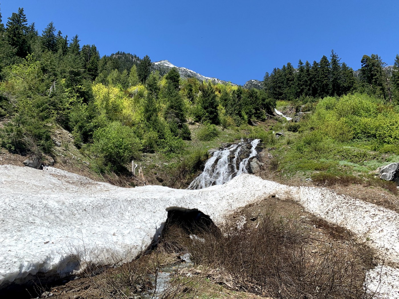
Upon toping out at Fourth of July Pass, I began to encounter some snow. The snow obscured the trail and there wasn’t a clear bootpack. It was super helpful having the area downloaded on Gaia so I could make sure I was staying close to the trail. The snow probably lasted 0.25-0.5 miles, and was never deeper than 2 feet or so.
After crossing the pass, I began to descend on Panther Creek Trail. I could tell this side didn’t get nearly as much love. It was a super skinny trail, very often covered in brush, but overall was an incredibly fun running trail. I don’t know if I would have classified Panther Creek as a Creek, considering it seemed more like a raging river. This area was definitely the highlight of my loop. I came up on a bear about halfway down the trail, but upon calmly making it aware of my presence, it joyfully sauntered off into the deep woods. There was one stream crossing where I had to get my shoes wet. If I had been a bit more patient, I probably could have stacked some rocks to get over dry. Finally, there are remnants of a huge avalanche that crossed the trail at about the halfway point. I was able to climb up the avy debris and walk across it. I would be cautious here as it wasn’t totally clear what might have been a snow bridge.
Reaching Highway 20, I took off on the Happy Panther trail. This was a super fun, flat, runnable trail. I only saw two people on this entire 5mi stretch of trail. There were occasional glimpses of Ruby Creek and then brief views of Ross Lake.
Once I connected with the Ross Dam Trail, the fun was over. It was super packed (to be expected on a MDW Saturday). I finished the last bit of gain and found my way on to the highway for the last 4 or so mi descent back to the Colonial Creek Campground.
Comments