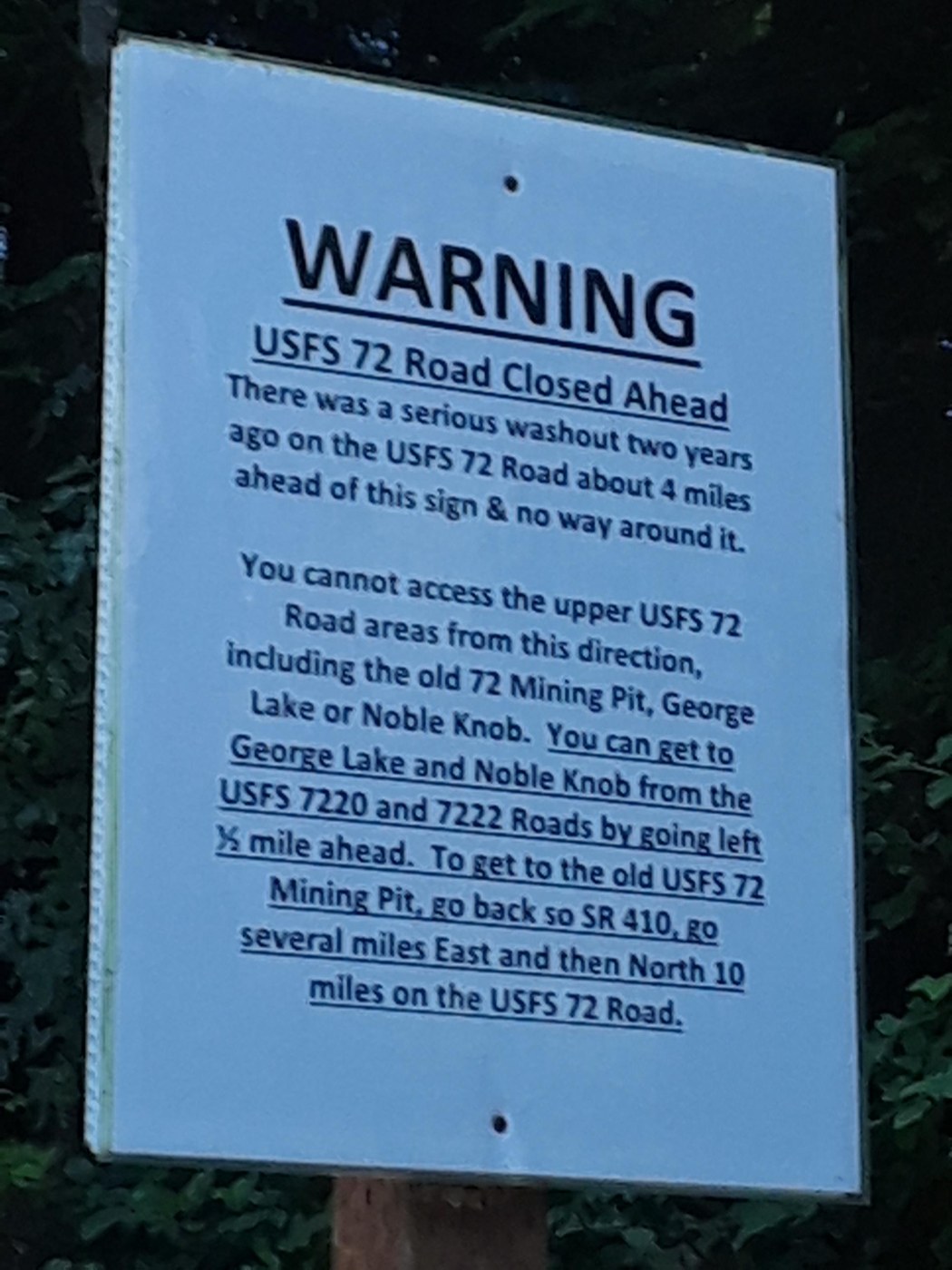
There is a road washout on dirt Road USFS 72 (see photo) so the Dalles Ridge TH is currently inaccessible. Alternate TH coordinates :Lat: 47.066107 Lon: -121.501217 (driving directions below.)
This trail head is unmarked and a little tricky to find. I highly recommend good GPS /garmin to track your current location to navigate how to drive to the TH as there are tons of dirt roads and they are mostly unmarked.
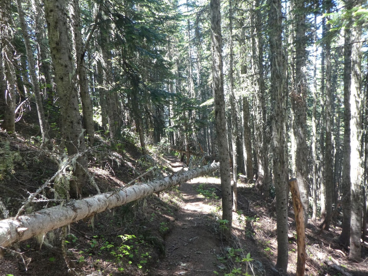
Trail is in fairly good condition except for several blowdowns on lower section in first 1/2 mile from TH. Small diameter trees that are easy enough to skirt around or crawl under. Lots of debris (small twigs and branches) on lower portion of the trail as well made me wish I had brought a small rake with me.
Amazing 360 views from the top of the knob . Surprised at how many folks were out as this is usually a lesser known trail. Gorgeous day and amazing views but the bugs were terrible mosquitos and tons of flies.
Driving Directions to Noble Knob Alternate TH
Heading East from the town of Greenwater turn Left on FS70 ( the first road past the fire station). at 4.6 miles there are toilets at a pull out on the left side of the road but continue 1.1 more miles (5.7 miles from 410) until you pass by the shooting range area then turn right onto a dirt road FS 72. travel .5 miles and turn Left at the spur....in 1 mile at the second spur turn right (this is junction of F110and FS 7220). In .1 mile pass through a metal yellow gate. Stay to the left on the remaining 4 road junctions until you reach the trailhead. When you pass through a log thats been cut on the road the TH is 1.5 miles away/ Look for a freshly fallen tree, some logs and metal culvert debris on the right side of the road to find the unmarked trail. (see photo) It is about 13 miles from the turn off of hiway 410 to the Alternate TH.


Comments
Nice trip report. Following your instructions on Google Earth, it looks like the Alternate TH takes off from NF 7222-1 and travels up the ridge East of Twentyeight Mile Lake. This route appears to be only about 1.4 miles to the Knob with a gain of approx 1100'. Please advise if I am correct about this - will try it on Thursday. Many thanks.
Posted by:
BigButtDon on Jul 06, 2021 09:36 AM
@BigButtDon yes that should work! please report back if I got the turn directions incorrect. I wrote them down on my way out so may have mixed up some turns transposing to go the opposite way. I did make one change in my original report I put it in Bold so you can spot it. Not many roads are labeled up there so its a little tricky.Enjoy your Hike!
Posted by:
Half Zip on Jul 06, 2021 07:03 PM
also my stats came in at around 5.2 miles RT but technology can be fickle :)
Posted by:
Half Zip on Jul 06, 2021 07:05 PM
If you take Forest Service road 72 there is NO road issues and you end up on the Dallas Ridge trail with only ONE blow down. see my trip report https://www.wta.org/go-hiking/trip-reports/trip_report-2021-07-02-7640262997
Posted by:
Elizabeth "Bibbers" on Jul 09, 2021 04:45 PM
If you take Forest Service road 72 there is NO road issues and you end up on the Dallas Ridge trail with only ONE blow down. see my trip report https://www.wta.org/go-hiking/trip-reports/trip_report-2021-07-02-7640262997
Posted by:
Elizabeth "Bibbers" on Jul 09, 2021 04:45 PM
If you take Forest Service road 72 there is NO road issues and you end up on the Dallas Ridge trail with only ONE blow down. see my trip report https://www.wta.org/go-hiking/trip-reports/trip_report-2021-07-02-7640262997
Posted by:
Elizabeth "Bibbers" on Jul 09, 2021 04:46 PM
If you take Forest Service road 72 there is NO road issues and you end up on the Dallas Ridge trail with only ONE blow down. see my trip report https://www.wta.org/go-hiking/trip-reports/trip_report-2021-07-02-7640262997
Posted by:
Elizabeth "Bibbers" on Jul 09, 2021 04:46 PM
Thank you for the information Bibbers! Good to Know that road 72 is open again. Do you know if they will take down the sign that says it is closed? Hoping to get out there for a work party
Posted by:
Half Zip on Jul 11, 2021 06:36 PM
They won’t take the sign down as the road that connects 70 to 72 is washed out. You have to go up highway 410 a little further to get to 72
Posted by:
Elizabeth "Bibbers" on Jul 12, 2021 09:53 PM
Thanks for such an informative trip report!! Curious if the road to the alternate TH requires a high-clearance vehicle? We're usually pretty comfortable on backroads but that little car does have its limitations!
Posted by:
Meghan Elle on Jul 08, 2021 04:55 PM
@meghan Elle High clearance is not required. It is a dirt road and there are some potholes and rough sections but you can usually find somewhere on the road to drive around the rough spots..or just take it slow over the dips. I imagine a regular sedan type car could make it just fine as long as its not one of those kind with the really low bumpers that don't clear the curbs when parking in the city.
Posted by:
Half Zip on Jul 08, 2021 05:40 PM
great, thanks!
Posted by:
Meghan Elle on Jul 08, 2021 08:46 PM
This is a road report if you take FS 72 and do not follow the directions to the Dallas ridge trailhead on WTA. A little extra information regarding Forest Service Road 72, as soon as you turn off of Highway 410 there are two pot holes where the pavement ends and the dirt start. There are some good sized pot holes on the road as well. Right after the second stream crossing that is a rather good sized pot-hole so go slow. The road is in pretty good shape for the most part. Once you turn on to 7250 there are some potholes to dodge. There are some narrow sections of the trail with steep drop offs. For the most part follow the tire tracks to get to the trail head. It took me about 40 minutes to get from the turn off to the trail head, about an hour from Enumclaw if that helps with timing for planning your drive time. The trailhead has plenty of parking on both sides of the road.
Posted by:
Elizabeth "Bibbers" on Jul 12, 2021 09:56 PM
the Dallas Ridge trail head IS accessible using Forest Service Road 72. I and a few others were at this trail head hiking the Dallas Ridge Trail to the Knob on July 1. WTA is working on the Dallas Ridge trail starting this weekend until the end of August.
Driving directions to the Dallas Ridge trailhead which is accessable for all cars (Prius at the trailhead!) is as followed Drive east on State Highway 410 from Enumclaw for about 24 miles through the town of Greenwater to FS 72. FS 72 is 4.5 miles past the Greenwater Fire Station. Turn left on FS 72 and follow for 7.4 miles. Turn right on unsigned FS 7250 and follow for 2.1 miles. Continue straight ahead on 7250-210 for 0.5 miles to trailhead you can also view my trip report at https://www.wta.org/go-hiking/trip-reports/trip_report-2021-07-02-7640262997 with conditions on the other route to this trail head that is very popular.
Posted by:
Elizabeth "Bibbers" on Jul 09, 2021 04:49 PM