
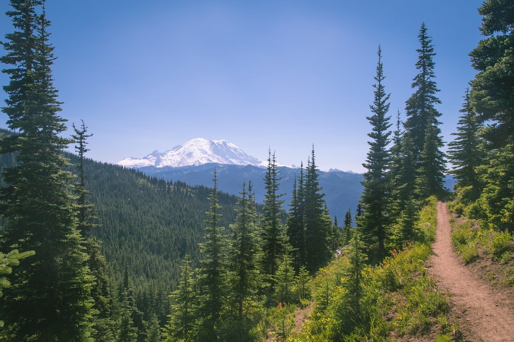

For the minimal elevation gain and quick tromp up to this former fire lookout, the payoff is huge. Gaze out in all directions, to wildflower-studded meadows, alpine lakes and snow-capped peaks. Here, you’ll find some of the best views of Mount Rainier around.
There is a trailhead at either end of the Noble Knob Trail 1184, one from Corral Pass and another off of Twentyeight Mile Road (Forest Road 72). The more popular Corral Pass approach has a more developed trailhead, whereas the Twentyeight Mile Road approach has paved portions that make access a little bit easier on your vehicle.
Dalles Ridge Access
On this route, you'll enjoy a lovely ridgeline hike, since most of the elevation gain occurs on the road to the trailhead. You'll begin hiking through a clearing, follow the ridgeline. A little more than a mile into the hike, you'll arrive at a junction with the Ranger Creek Trail. Here, the trail offers views of Mounts Rainier and Baker, Glacier Peak and the Stuart Range, even the Olympic Mountains on particularly clear days. After the junction, the trail climbs steadily upwards and, just short of 2 miles from the trailhead, you will join the Noble Knob trail.
Head left to take the Noble Knob Trail to the next junction in a tenth of a mile. Here, the trail splits in three directions. Take the middle path straight up to the summit.
The views only improve. Catch glimpses of Lost Lake to the east and Twentyeight Mile Lake to the west. Before you know it, you will have reached the top and its 360-degree panoramas. Mount Rainier seems almost close enough to touch. Look north for your first view of George Lake in the meadow-filled cirque below you. Forested peaks spread out in every direction. Find a good place to settle in and enjoy the views.
Corral Pass Access
The route begins mildly, alternating between roadbed and trail while wandering through meadows and sparse stands of fir and pine. Just a few hundred feet down the trail, it will split off; stay left on the main trail. During the late spring, these areas are bursting with wildflowers, and in the fall, the underbrush is a sea of reds, oranges and yellows.
The first mile or so is more or less flat, quickly transporting you to your first glimpses of snow-covered Mount Rainier. In just under 2 miles, you’ll reach the Deep Creek Trail 1196. Stay to the right, following the ridgeline as you turn north. You will parallel the Norse Peak Wilderness to the west before briefly entering it for a few moments, 2.6 miles from the trailhead.
You’ll know you went through the Wilderness when you encounter the junction with the Dalles Ridge Trail at 3 miles. Head right, staying on the Noble Knob Trail to the next junction in a tenth of a mile. Here, the trail splits in three directions. Take the middle path straight up to the summit.

 Trailhead


