I still felt spry after hiking around Naches Peak Loop, so I aimed for Threeway Peak via the PCT I Section/Sheep Lake approach. The hike was great to Sheep Lake/Sourdough Gap, but the scramble up Threeway Peak was an absolute nightmare: type 3 class 2-5 scramble with free soloing in stretches.
Trail Conditions
The official trail is in solid shape and it's relatively easy to follow, minus some sections around Sheep Lake which are muddled by social trails, etc.
Bugs
Mosquitos are out, but not as bad as they were at Sloan yesterday, thanks to the wind and probably the drier climate.
Water Sources
Your first reliable water is Sheep Lake, and it's unclear how long that will be true given that most of the snow is gone below Chinook Peak, etc.
Be sure to filter and treat the water from the lake though and if possible get it straight from the source, since some folks weren't following LNT and were camping way too close to the lake (<50'). Furthermore, there's no guarantee that someone didn't jump in after spraying themself down with DEET-based bugspray or sunscreen (this is why I don't generally jump in/swim in lakes).
Wildflowers
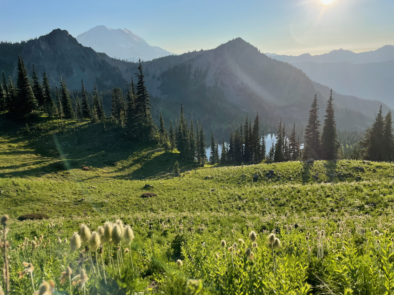
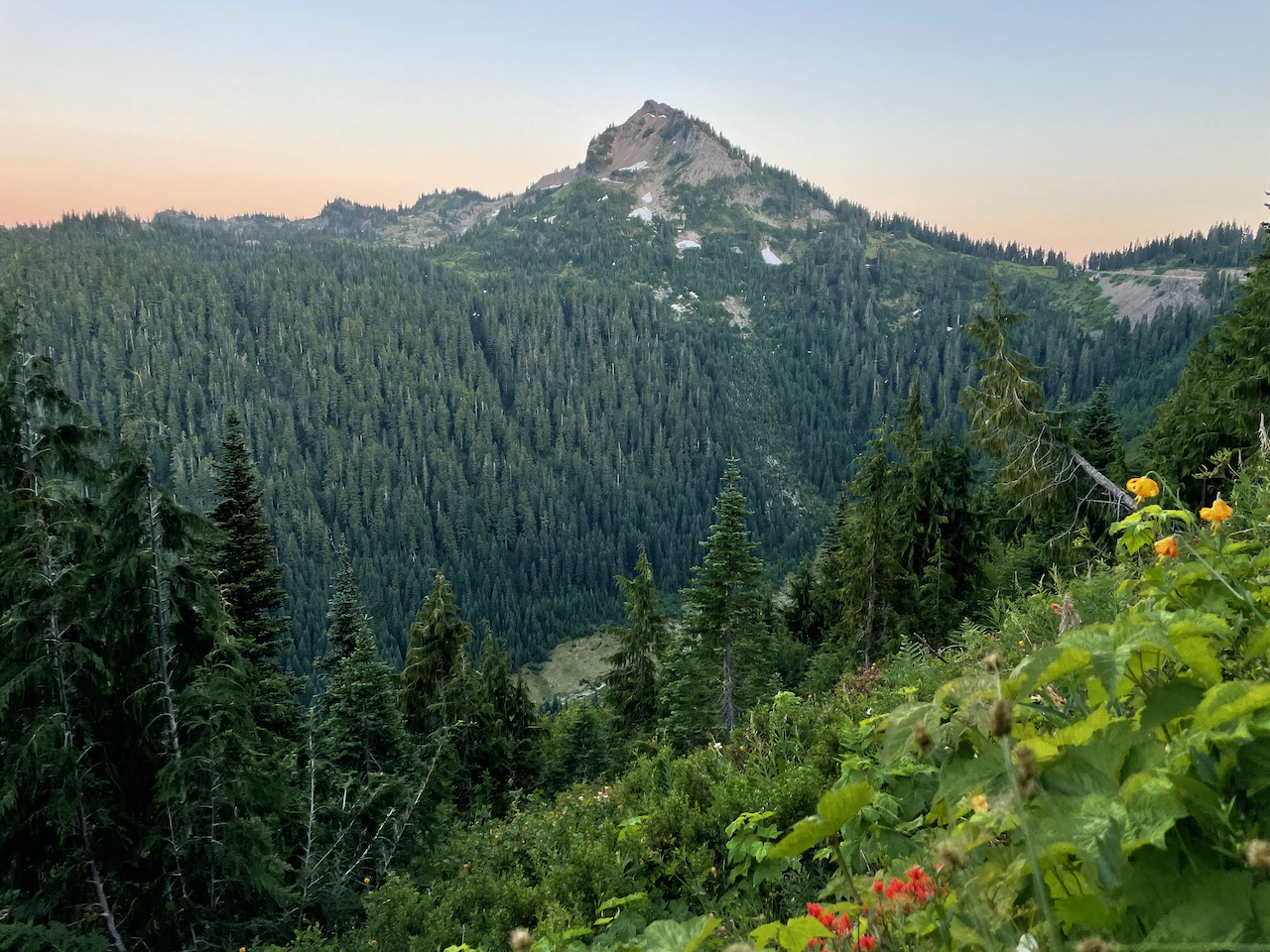
I frankly found more awesome wildflowers over in this stretch than Naches Peak Loop: beargrass (not as spent), pink heather, magenta paintbrush, Sitka Valerian, tiger lilies. Didn’t spot any white avalanche lilies, but they were pretty sad looking.
Reminders about Dogs!
Please keep your dogs on leash and of course out of the park.
One of the forks off this trail (the one that goes over into Crystal Lakes via Sourdough Gap) goes into NPS maintained land. There is a sign that clearly states where the NPS boundaries are and if you consult a map that shows the area by land manager, it should become obvious where dogs are or aren't allowed.
Dogs are allowed on this section of the PCT, which skirts along the border of the Mount Rainier NP, but again, keep your dog leashed (all dogs I saw were off-leash). There are bears, marmots, and goats that wander around the area who will distract or attack your dogs if threatened, resulting in danger to you and/or your dog.
Threeway Peak Scramble
This is the nightmare of this trip: let me go into gory detail.
So, first off... I looked through Summitpost and Beckey's Cascade Climbing Routes - Part I book and both were very sparing on the details about the mountain.
Had I gone through more Peakbagger.com posts or the first trip report for Threeway, or thought critically about what the rock would be like that produces shale scree, I could have maybe deduced it was garbage before committing to a dangerous route up.
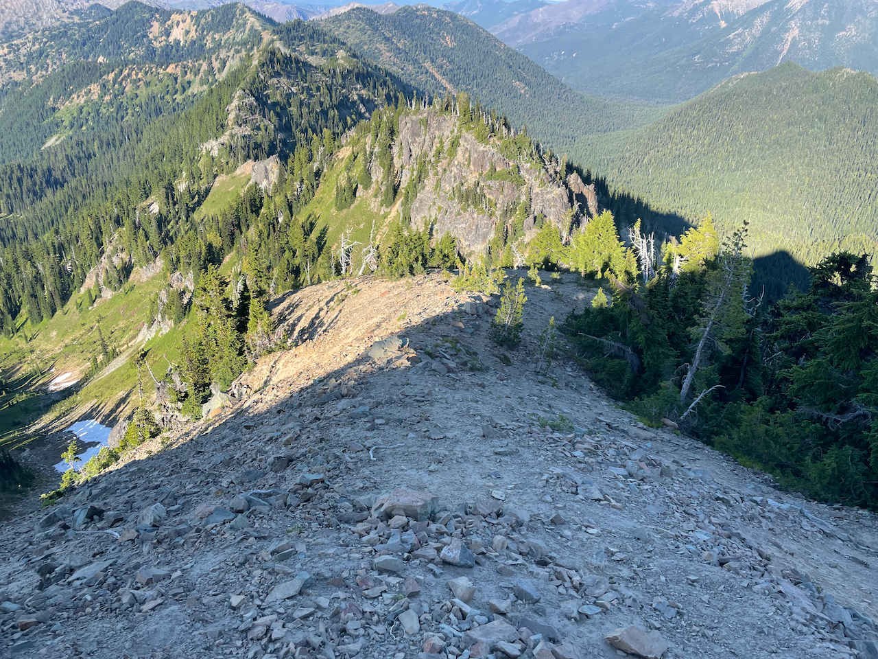
Long story short, I was dealing with a lot of ball-bearing'esque/loose shale scree over boulders which may or may not have been properly anchored in the side of the hill, so trekking poles were useless and I was on my hands and knees a lot. Oh, I failed to mention that the basis for the side of the hill is sand-like, so stability isn't a thing necessarily in all spots, but it is in some areas, so I was scuff stepping my way up the side of the hill (wahhhhht?! Scuff stepping in scree?!) to build platforms so I wasn't completely off-balance.
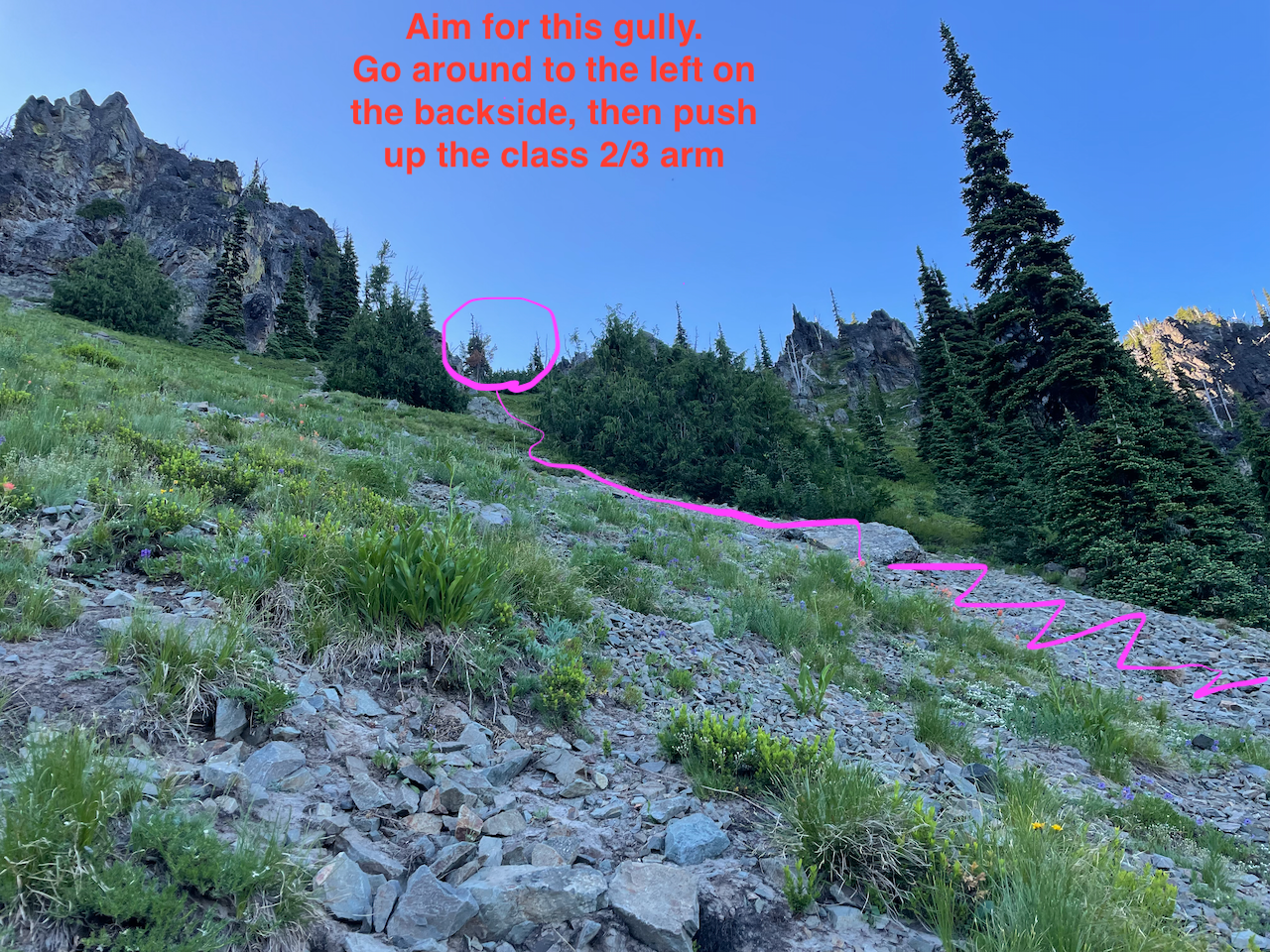
Once I figured out how unstable the rock was (basically, no holds could be trusted), I was already 300' up the climb with 250' remaining. Given that GPS tracks posted illustrated getting down via the E arm and one of the other gullies, I kept on going up and around looking for ways to scramble up the rock wall. I ended up literally veggie belaying up a redcedar tree for about 25', going up the S side, the W side, then the NW side, finding a gully I thought was promising/well-protected, then pushed up towards it.
I was so dang close to slipping or losing my balance and falling down a gully a few hundred feet to the area right above Sourdough Gap, it wasn't funny. I spent a lot of time consternating and talking myself down approaches because the exposure was freaking me the eff out (the other side of the col I had climbed up had a sheer 200'+ drop).
Once I got 30' below the true summit, I had to hop over an rib that was a bit taller than I was comfortable pushing up (why in the hell was I wearing trail runners?!). There was a small gendarme on the other side of the rib with decent-ish holds, so I figured I could leverage it. I was trying to stem and awkwardly paste myself against the larger wall. No dice. Started questioning if this was the right plan, so just to be sure I confirmed that I indeed only had to go <50' by doing some careful class 4 moves on top of the small gendarme. I tried moving a 25+ lb shale boulder to give myself a few extra inches and instead kicked it down several hundred feet and it split into pieces, giving me a great idea of what my body was going to do if I fell. The holds/cracks I thought I could use were super weak: I was breaking them off after applying pressure. On top of that, there was small loose scree I had to dust off of the shelfs. I was so close to calling SAR, but I didn't want to give up, because there was no guarantee SAR would be able to help. I messaged kidzwonthike though so at least someone knew where I was and the serious pickle I had gotten into.
Finally, after 20 minutes and several attempts, I talked myself up and pushed off the smaller gendarme high enough using stemming and walking up the wall to trust grab a shale crack (that thank goodness held!), committed my other hand, did a ~5.5 class free solo move, then mantled my way up finally on to the rib, awkwardly grabbing around as quickly as I could looking for my next hold. Once I got up on the rib, I carefully pushed up the mini-gully to the true summit using airy class 3 moves and decent holds that I tested before fully committing to.
Once I got up to the true summit, I screamed as loud as I could and started laughing nervously. I posted a "WTF was I thinking?!" video to IG so others would know where I was. I got a Peakbagger.com GPS track and confirmed what general way I needed to go down, because I didn't want to rely on my hazy memory of the post I found on NWHikers with a GPS track. Thank goodness for cell reception from Crystal Mountain.
After about 15 minutes I started slowly working my way down the E arm.
This section was super chill; maybe hard class 2 at most or class 3. Then I got to the next mini-gully, hopped over a gendarme to get a better view. "Oof. Cliff. Ok..." I crab walked down the mini-gully, took a right and tried to assess a path down. Went too early and ended up dealing with nasty scree/loose large boulders (!). Nothing quite like putting faith in a child-sized boulder which isn't as static as you think it is.
I finally said, "ok, we're scree skiing this thing", and slalomed my way downhill without my trekking poles, leaning back to avoid falling forward. I finally got down to the trail after having to do approximately 300'~400' of scree skiing. It wasn't fun.
After I got back to the trail, I defeatedly took off my helmet and hat and walked towards the PCT I Section/Sourdough Gap junction. I sat down near Sheep Skull Gap looking at Upper Crystal Lake, Tahoma, Crystal Peak, Silver King, and Chinook Peak, and took a sigh of relief/tried to relax my nerves (they were shot).
After that, I ate some chews, some bars, then pressed on at a reasonable pace towards the PCT I Section/Sheep Lake trailhead. It went by rather quickly, but I just zoned out mentally because I was exhausted from having to manage my emotions and the terrain, while also problem solving for my life.
Gear Used
- Climbing helmet
- Trekking poles
- Work gloves
Gear I Wished I Had
- Rock shoes


Comments
That looks wicked. So glad you got out of there in one piece.
Posted by:
kidz won't hike on Jul 12, 2021 10:02 AM
Me too 😖...
Posted by:
ngie on Jul 12, 2021 11:48 AM
Dog are allowed up at Sourdough Gap and past it as it is the PCT. They are not allowed on the trail that forks off to the left after Sourdough Gap toward Crystal Lakes as that veers into the park and is no longer the PCT.
Posted by:
walksalot on Jul 12, 2021 12:01 PM
I am aware of that (there's a sign that clearly marked the NPS boundary). I'll clarify that point.
Posted by:
ngie on Jul 12, 2021 12:39 PM
Fixed. I hope my pedantic text is now clearer, even though I was technically correct before; I just didn't stay how far off the PCT/Sourdough Gap fork dogs were allowed.
Posted by:
ngie on Jul 12, 2021 12:45 PM
Curious... I see why you made that comment now looking at the map again.
Looking at the map, Sourdough Gap wasn't the gap I was thinking about--it was Sheep Skull Gap--which isn't marked on the USFS map I have access to. It looks like Sheep Skull Gap is the gap that crosses into the park.
Posted by:
ngie on Jul 12, 2021 12:59 PM
no worries, I wasn't trying to be a jerk, just wanted to clarify. out of curiosity, did you see any dogs up there? I feel like I never see dogs out that way but times (crowds) are changing. :)
Posted by:
walksalot on Jul 13, 2021 06:37 AM
No worries! I saw someone take an unleashed dog over Sheep Skull Gap. They were yelling at the dog to stop pestering the agitated marmots, and kept on the USFS side, but they were definitely pushing the envelope with their dog.
Come to think of it, none of the dogs were leashed on the trail... I probably ran into ~10 of them on my way north up the PCT.
Posted by:
ngie on Jul 13, 2021 08:37 AM