
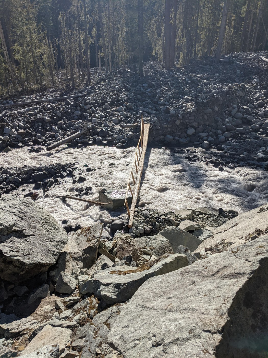
A bit more than a year ago, we did a 5 day bike & hike trip to Ipsut Creek (our previous trip report is here). We loved it so much that we came back. We biked from Seattle to Ipsut Creek on Day 1 (~76 miles). Unlike last year, there was no river crossing en route to Ipsut Creek campground although we had touring bikes (not mountain bikes) so we had to push our bikes where it became rocky (much of the last mile or so). That said, the trail is well maintained and it's not too difficult even with the fully loaded bikes and there was very little walking overall.
We spent two nights at the Ipsut Creek campground. There were definitely many mosquitos at the campsite and plenty of noseeums on the riverbed. Any parts that were not covered well got some itchy bumps by the end of the trip. Bring long pants and shirts and/or bug spray.
On the second day, we hiked the Spray Park loop that we cut short a little bit with a detour up to Mount Pleasant and over to Mowich Lake via Knapsack Pass. We started up across the crossing at the lower Carbon River. The river crossing was so much easier this time, with a solid bridge with a handrail. It's apparently been in-and-out this year but it's in great shape right now. The trail is pretty gentle and easy and we were able to make very good time up until the suspension bridge, where the long climb begins towards Seattle Park. There weren't too many places to easily refill our water bottles until the Seattle Park area but after that, we had no trouble getting water when we needed it (we brought a water filter).
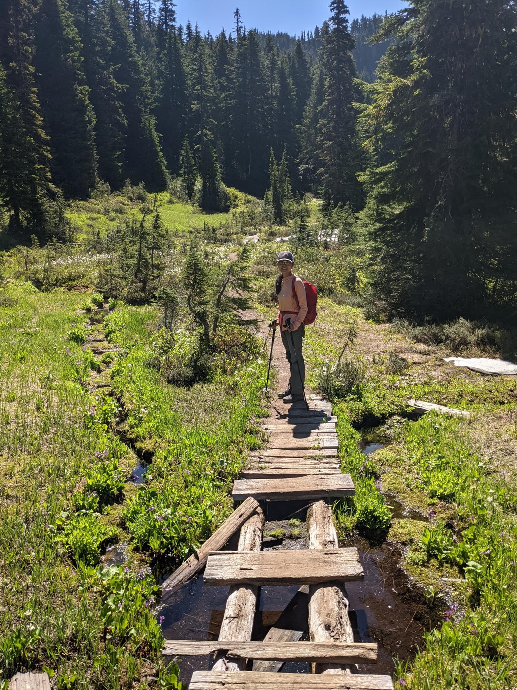
In general, we were awed by how well maintained the trail is. As you enter Seattle Park there there is a small bridge where some of the wooden boards are not nailed down. As we were crossing a frog jumped up from the stream and one of us lost balance on the board that was not nailed down and stepped fully into the water. No injury. Just a funny incident.
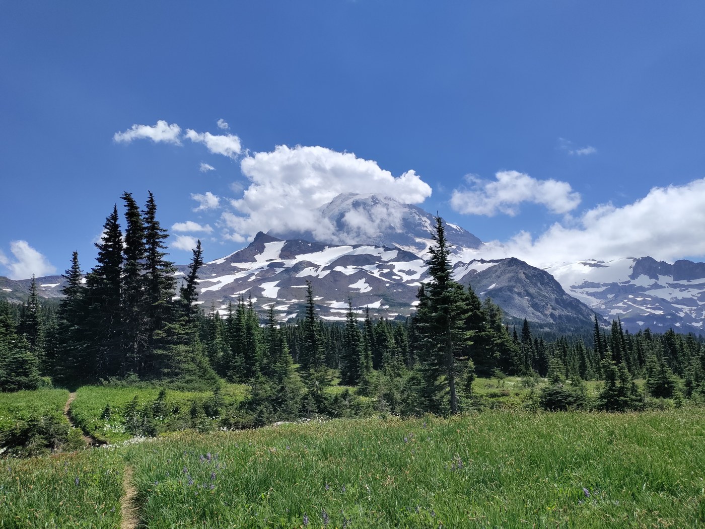
The hike through Seattle Park was priceless. With the summit of Mt. Rainier in the backgound, the slopes were covered in wildflowers, creeks, and snowmelt. As you get up further and begin to cross into Spray Park, there were a number of patches of snow—including the permanent snow field—but we did not need microspikes. We had lunch near the first peak between snow crossings. The stop had to be quick as we were feeding ourselves as well as mosquitos. The mosquito situation is intense. Our clothes were covered in so many mosquitos that we put on our wind shells just to keep the bugs from biting through our sun hoodies.
We got off the main Spray Park loop a little before the Eagle Roost Camp and hiked up to Mt. Plesant on a steep and narrow trail that was covered in wildflowers all the way up. The view of Mt. Rainier from the top was spectacular.
We saw boot tracks on the snowfield below and so scrambled down Mt. Pleasant onto the Knapsack trail. On the way down, we ran into a grouse and her chicks!
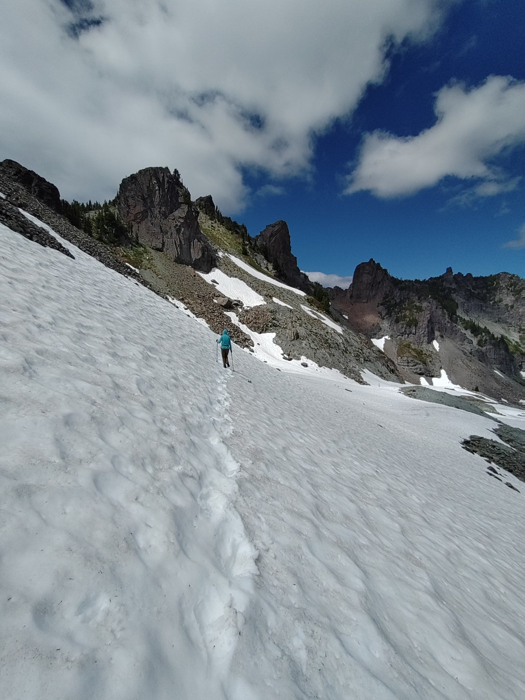
We then followed the bootsteps across the snowfield for a bit up to the top of Knapsack Pass. This was the only place where we could have used microspikes although we able to walk across the field with just the trekking poles and boots with good grip without too much trouble. We saw a mountain goat, who didn't seem to mind us at all.
We then scrambled our way up to Knapsack Pass, a short section of which involved some loose scree. There was about 10-20 meters of loose scree right near the top of the pass that was a little scary. We put our poles away in order to use our hands more effectively and got through it without too much trouble. The pass offered a great view of Mowich Lake below, which was a welcoming sight after these steep climbs. We didn't see any other hikers from the time we left the main Spray Park loop until Mowich Lake. At Mowich Lake, there is a ranger station, where we saw a ranger we had talked to to earlier that day near the suspension bridge. It turned out he done the same loop in opposite direction. There are containers for Wanderland trail users for food swaps there.
The path from Mowich Lake to Ipsut Pass is wide and well-trafficked. From Ipsut Pass, there are reasonably graded switchbacks, followed by an easy trail back to the Ipsut Creek campground. Carbon River is quite silty, so we went back to Ipsut Falls to get water for the evening.
All is all, this was a fantastic hike. Thank you to the staff and volunteers for keeping this park in such a wonderful condition!
Comments
Hey there! I was wondering if you might have a track for the route you took? I'm heading to Ipsut camp next week.
Posted by:
upperleftnative on Jul 29, 2021 11:31 AM
Sure, here's a GPX track of route we did that I recorded on my Garmin watch:
https://mako.cc/outgoing/private/SK1wzSinEZFeLM0V/ipsut_creek_look-20210719.gpx
You'll see that at about the halfway mark (15.2km/9.4mi) we do realize we're on the wrong path and turn back. That took us up Mount Pleasant and then down onto the Knapsack pass trail. I would either (a) turn to the right earlier directly onto the Knapsack Pass trail (on maps you'll see it as a place where Knapsack pass sort of forks into three parts that all connect to the main Spray Park Loop trail) or (b) not have turned back at all and stayed on the Spray Park Loop all the way until Mowich lake.
Option (b) is going to a much easier option with very little additional climbing, no snow, and a generally much more well maintained but much busier trail. Option (a) will probably mean you don't see any people until you get to the ranger cabin at Mowich Lake but will involves several hundred yards of snow, quite a bit more elevation, and a few dozen yards of scrambling over some pretty loose rocks right at the top of Knapsack pass.
Posted by:
makoshark on Jul 29, 2021 05:35 PM
If it's easier, there's a version up on Ride With GPS here: https://ridewithgps.com/trips/71620589
Have fun! It's a really such beautiful and truly incredible spot!
Posted by:
makoshark on Jul 29, 2021 05:40 PM