
I departed Tacoma at 6AM and took a quick pit stop at Dosewallips State Park (I find state parks have pretty good facilities!) I saw a herd of ~40 elk on my drive up Dosewallips River road which was pretty cool to see! I appreciate that elk – unlike deer – do not tend to dart across the road. I was off on my bike at 8AM.
The road is in relatively good shape most of the way. It’s really a shame that this road washed out and never got repaired as it really restricts access to the National Park from the east side of the Olympics. Staircase to the south and Deer Park to the north are the closest drive up options from the east. I’ve read the Forest Service doesn’t want to repair the road just to serve the needs of the National Park…but who knows what the real reason is.
After an hour or so I reached the Dosewallips Campground – what an awesome spot. Plenty of places to camp as it used to be a drive up NP campground before the washout. Now it’s abandoned but with some awesome campsites right along the river. There are very few people in this area from my experience – the 6.5 miles of forest road just to get to the campground/trailhead is really a big deterrent (for good reason). In addition there are multiple trails – up to Anderson Pass (SW) and continuing on to Hayden/Grey/Lost passes (NW). Those that make the trek up the road are rewarded with sparsely populated trails.
I forgot my bike lock key (it’s not the first time and probably won’t be the last) so I ditched my bike behind some trees and removed the thru-axle. If someone wants to steal my bike by lugging it 6.5 miles down a forest road they deserve it.
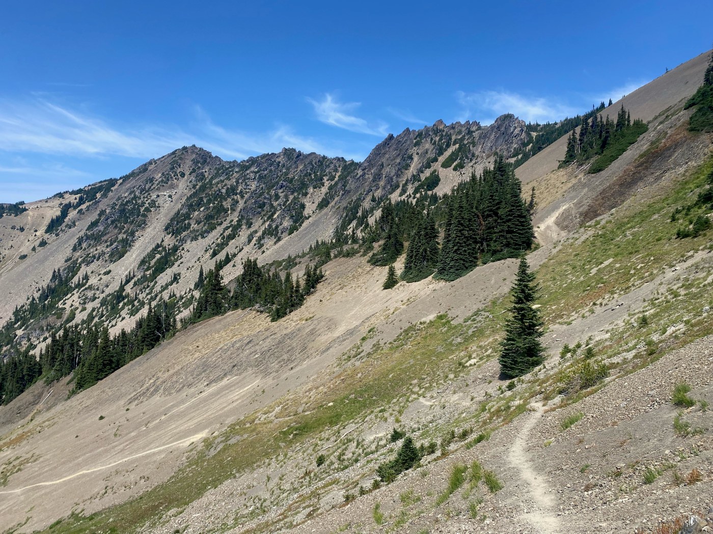
I filled up on water knowing that the climb up to the pass is a long one without water sources. I was off around 930 and jogged the first 2.5 miles until the turn off to save some time. I started the 4+ mile haul up the Constance Pass Trail which is in pretty good shape. There is some overgrowth and blow downs here and there but nothing crazy. I should have brought my hand saw as some of the trees weren’t very big.
I passed two backpacking groups heading down the trail but other than that the only company I had was a horsefly buzzing me most of the way up the trail. The climb is a real beast — especially as it was pretty warm out. There is a water source (Sunnybrook creek I believe) maybe .4 miles before Sunnybrook Campground. I think it’s a spring and was flowing quiet well. There is also a water source (spring) just after the campground but with lesser flow. Springs are pretty amazing – where does all this water come from?!
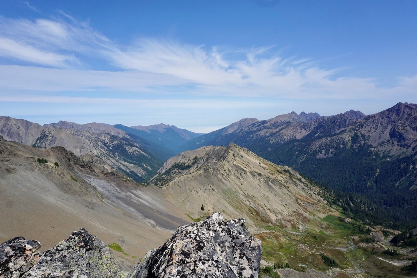
After the campground the trail kicks up again and is exposed all the way to the top. I passed two backpackers right before the top and had a quick chat. They had been out for a few nights and one guy asked me if Trump had been inaugurated yet which I found pretty funny. There was a group posted up at the top (same party as the two guys I passed) and we had a friendly chat. They were some serious ONP park rats – you could tell they had spent many weekends backpacking in the park.
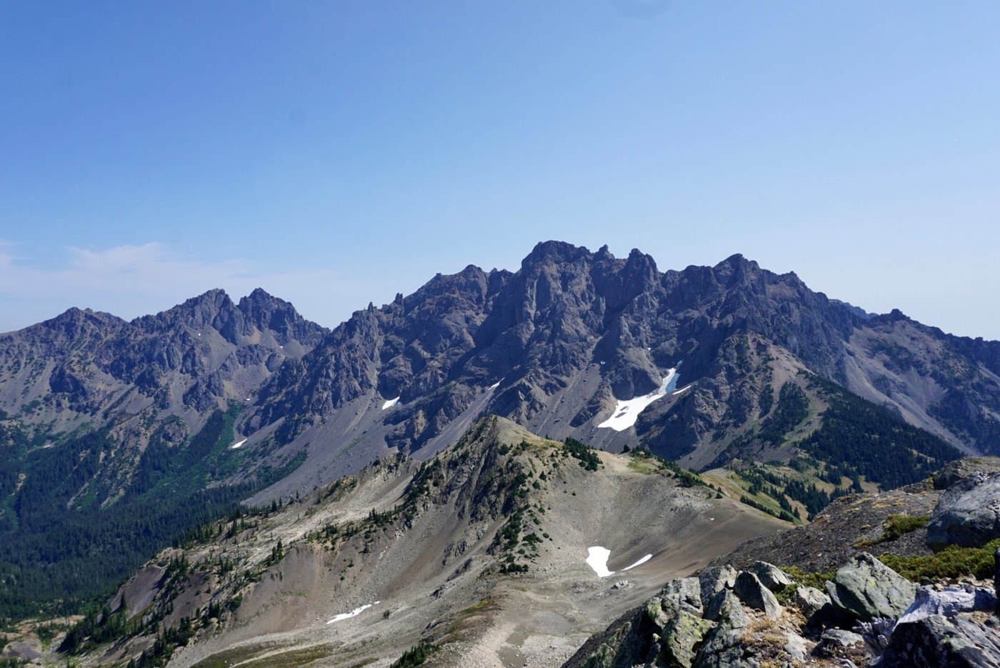
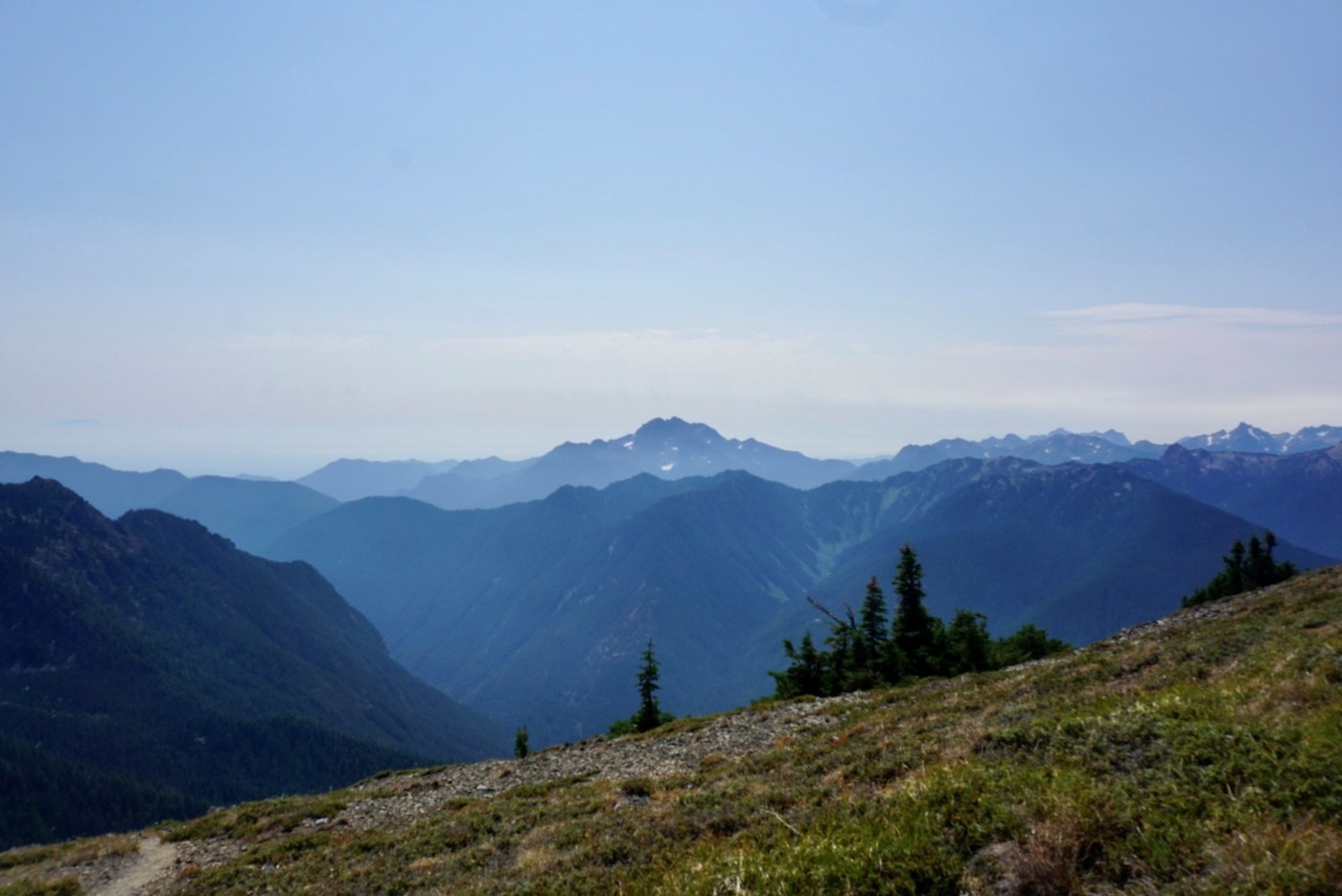
The views from the top are amazing…Brothers, Olympus, Buckhorn Wilderness, and everything in between. The climb is brutal but worth it. I said my goodbyes and headed back down the trail. Stopped for a swim back at the campground and then was off on my bike back to the car. The front brake on my bike was pretty much not working so I had to walk some of the steep sections. Don’t take the road for granted…there is some pretty good exposure in some places (especially at the top by the waterfall).
From Dosewallips Campground to Constance Pass: 13.75 Miles, 5K feet of vertical (based on my Garmin watch)
Bike up to Dosewallips campground: 6.5 miles, 1.1K feet of vertical
Car to car 8 hours. Drank about 8 liters of water.
Comments