

The hike starts by crossing the gravelly stream bed just beyond the parking area and descending to the decommissioned Dose Road. Water may run high early in the season, so use caution when crossing. The Tunnel Creek Trail appears shortly on the right, climbing steeply into the Buckhorn Wilderness.
At mile 1 is the former road washout, where a massive chunk of hillside fell into the river and took the road with it. Hikers may be able to go left along the river if the way is clear and appears safe. Horses and bicycles, however, should follow the switchbacks over the hilltop. This path is wide and graded, although it does add about 100 feet of elevation each way.
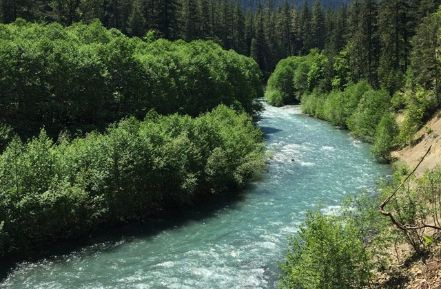
Just beyond the washout, the valley bottom narrows as the sidewalls start to close in. Conditions become noticeably cool and wet. Luxuriant mosses carpet the river rocks and limbs of bigleaf maples. The scene is completed with licorice ferns and vanilla leaf, reminiscent of the Olympics rainforest valleys.
At 2.7 miles is the sign and lefthand turn for Elkhorn Campground, which is now closed to camping. Elk are occasionally seen grazing the nearby understory. Owls add their somber call to the roar of the rushing river in the nighttime canyon.
Beyond the campground, the Dose Road now begins to climb the toe of the valley sidewall. This is the steepest stretch, gaining almost 400 feet over the next mile. The road bed is a nursery for alder, hemlock, and madrona saplings, although the way is generally clear and wide.
At 4 miles, high above the canyon, the river can still be heard thundering below. Soon the canopy opens up and the road enters an area burned by the 2009 Constance fire. Views ahead are dominated by tall, forested ridges and high peaks. Blackened logs lay like spent matchsticks upon the foreground slopes.
The road crosses the boundary of Olympic National Park at 4.9 miles where an old, orange gate stands open. The former welcome sign was destroyed by the fire, but another sign survived.
The roar of Constance Creek can soon be heard as the road swings around the bend of a side canyon. On the western bank of the thunderous torrent is the unsigned Lake Constance trailhead, a route that should be shunned by those with a fear of heights.
Just beyond the Constance Creek side canyon the road reenters old forest and drops to a view of an impressive cataract of the Dose River. After one last uphill slog the road looks onto a now more subdued, meandering river bordered by gravel bars and groves of alder.
Campsites soon appear on the left and a hitching post marks the campground loop, the end of the road, at 6.5 miles. A decommissioned ranger station sits at the main Dosewallips trailhead. The campground makes for a convenient base camp for those interested in day hikes around the area. Campers enjoy the ample room at each site, food lockers for safe and dry storage, and the whispering of the forest crown under a starry night sky.
Access Note
Bikes and dogs are allowed up to the ranger station at Dosewallips Campground, but not beyond (past the wilderness boundary).

 Trailhead


