Short version: My party did a 3-day thru-hike from Third Beach TH to Oil City TH from 8/20-22, camping at Toleak Point and Hoh River.
Getting right off the bat, this is a really phenomenal hike that rewards careful preparation and flexibility. Unique to coastal hiking, you absolutely need to pay careful attention to the trail, tides, and times. You will end up in a bad situation if you don't give the ocean the respect it deserves. Carefully review tide charts, be honest about your party's capabilities, and be willing to change and adapt on the fly.
Day 1, we began at Third Beach TH at around 6:15am, and the trailhead was already completely jammed full with cars. It was very difficult to find suitable parking, and driving through the parking area was a real trick. Once we got on the trail, a straightforward 1.7mi overland spits out at a bluff overlooking Third Beach. The first of many climbs gets you down onto the sand and on your way. Our original plan was to get an early start and catch the tides around Taylor Point, and then make camp at Strawberry Point. By the time my party reached Strawberry point, it was clear we had plenty left in the tank and pushed through to Toleak Point.
Toleak Point is a very popular place to set up camp for out-and-back hikers from Third Beach, as it is a comfortable day hike from the trailhead, and gives a good base camp for day hikes. There are abundant campsites in the woods just off the beach on the north side of the point, giving protection from both winds and tides. On the south side of the point, it is more traditional beach camping on sand. Fresh water was available at Jackson Creek, and the privy on the north side of the point was in excellent shape.
Day 2 turned into a real wildcard for us. Our original plan was to send from Toleak Point to Mosquito Creek, and then hit the 3.5mi overland from Mosquito Creek to Jefferson Cove first thing in the morning on day 3, so that we could catch the low tide crossing for Diamond Rock. Suffice it to say, this was not how the itinerary played out. From Toleak Point to Mosquito Creek, everything was as expected - mild overland terrain and straightforward beach hiking. Once we hit the overland at Mosquito Creek, we were feeling pretty good, and decided to keep hiking since there were campsites along the overland near Hoh Head. We were anticipating that the 3.5mi overland would be similar to the overland sections we had already finished; mostly stable, some up and down elevation, but more or less a straight traverse. This was not the case.
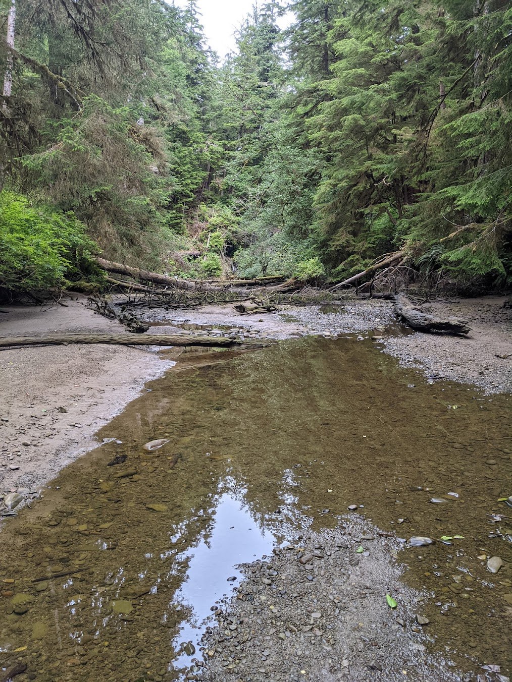
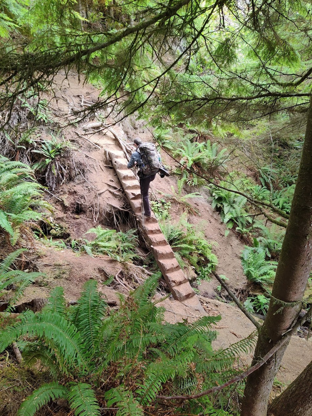
The 3.5mi Hoh Head overland is a different beast from the other overland segments on this hike. There are many downed trees over the trail, frequent and dramatic elevation changes (lots of ravine crossing), and at times the trail was so overgrown, washed out, muddy, or obliterated by landslide that our GPS and map was the only reliable way we had to navigate to the established trail. The Goodman Creek and Falls Creek crossings were very easy and straightforward given the depth of our dry-season; we did not even need to get our feet wet in order to cross, let alone need to ford.
The campsites along this overland trail marked on AllTrails, GaiaGPS, Garmin, et al are unreliable and difficult to find. Only one of the marked sites, located just northwest of the final descent into Jefferson Cove, could be considered a bona fide campsite suitable for more than one tent in dire circumstances. The other sites were barely more than a depression on the trail, or a slightly-wider-than-normal section of clearing. Once my group realized this, we decided to take our chances and push onward to Jefferson Cove, where there was a reliable freshwater source and noted several campsites. The descent into Jefferson Cove is very steep, very technical, and would be very sketchy in poor weather or in darkness.
Jefferson Cove is not a suitable camp area for periods with tides above 7-8ft, let alone the 9+ foot tides we anticipated around midnight on 8/21-22. It looks like there have been some slides and collapses that have narrowed the beach considerably between the start of the cove and Diamond Rock. While a single tent may fit into some of the higher areas on the beach, my group determined that there was no way to safely camp two tents on that beach, and decided to time a hasty crossing of Diamond Rock against the afternoon low-tide of 2.1ft.
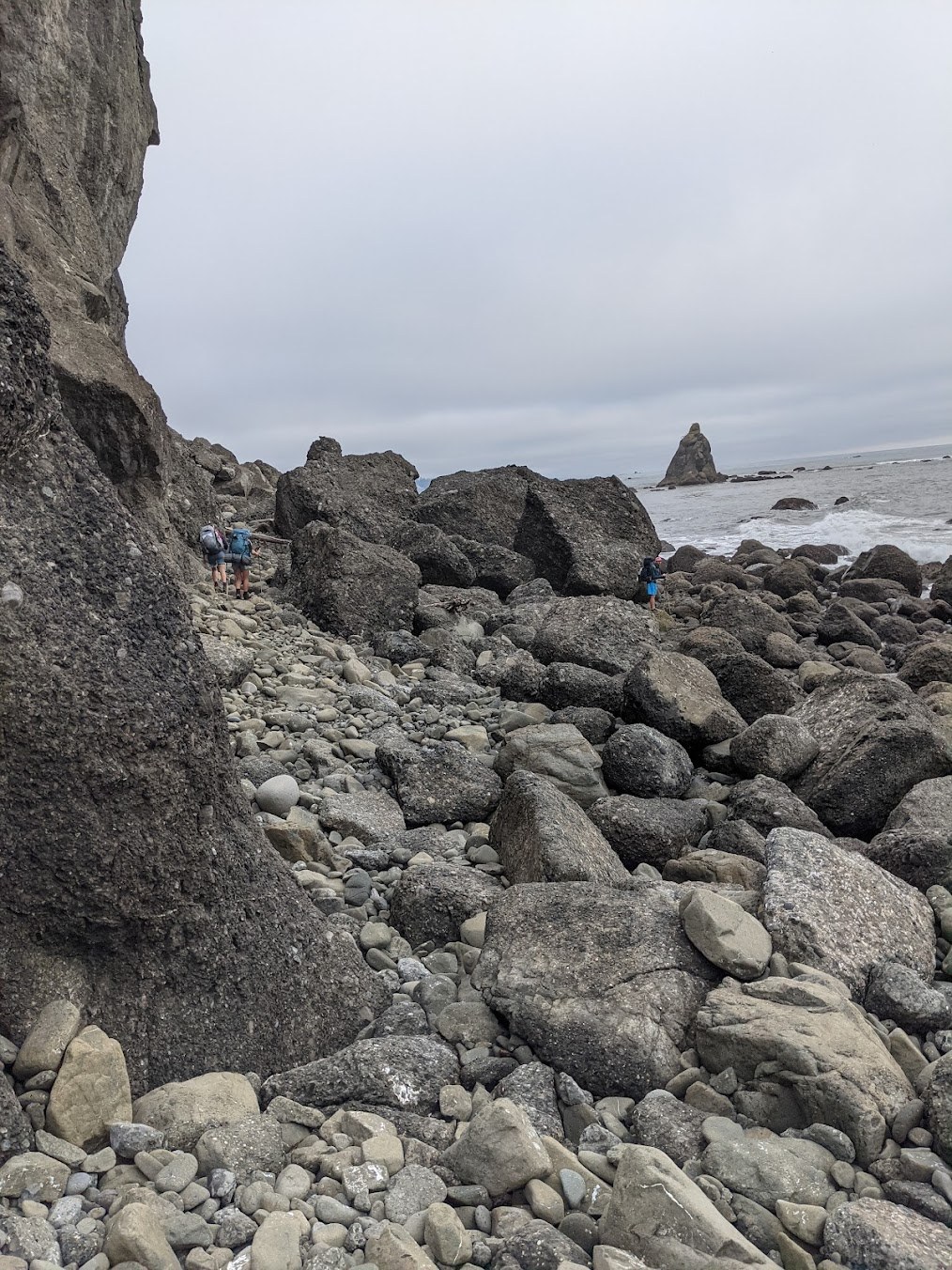
We mistakenly assumed that the crossing of Diamond Rock was a short "round the rock and back on beach" sort of deal. Instead, we found a nearly mile and half long stretch of intense and technical rock-scrambling while the tide lapped at our toes. I would not recommend rushing this crossing, and doing it as close to "fresh" as you can. I would be very uncomfortable crossing this in anything but good weather in good light. The rock field does not relent once you begin the crossing at the south end of Jefferson Cove until you emerge at the mouth of the Hoh River. Once you do reach the Hoh River, there are plenty of excellent campsites on the beach and north bank of the river.
Some things I wish I knew before this hike:
- Beach hiking is faster than I expected, particularly when it's low tide and you can walk on firm sand
- Overland sections are more difficult than I expected, notably the last 3.5mi overland by Hoh Head
- Jefferson Beach is not suitable for camping in high-tide periods. This was not reflected in trip reports, alerts, or the like, and other hikers/campers we spoke to corroborated this experience.
- Maps do not do justice to the difficulty of the Diamond Rock crossing. Give yourself plenty of time and energy to do this crossing.
On the third point, I plan to send this trip report to the National Parks Service, since it could be a legitimate safety issue if campers are counting on a safe site to camp between Jefferson Cove and Hoh River. If they arrive tired, at the end of the day, without an upcoming window to cross out to Hoh River, their only options are to either risk camping on the beach with the tides, or return back UP the ladders to the sites along the overland trail.
All in all, this is a really phenomenal hike, and I would strongly recommend it to anyone interested in coastal hiking. It's a welcome change from my usual pace of high-elevation alpine hikes, and the myriad wildlife make for a very engaging hike.


Comments
cshowalter1 on South Coast Wilderness Trail - Toleak Point, Oil City, Third Beach
Thanks for such a detailed report!
Posted by:
cassy@jaynurse.com on Aug 24, 2021 01:43 PM
Waredo on South Coast Wilderness Trail - Toleak Point, Oil City, Third Beach
Thank you for such a great review! Upcoming father/son trip and this was what I needed to make some final adjustments to our trip plan. I note your comments on how low Falls/Goodman creek crossings were and was wondering if you also hit them at low tide?
Posted by:
Waredo on Aug 27, 2021 12:56 PM
teamster on South Coast Wilderness Trail - Toleak Point, Oil City, Third Beach
Glad it was helpful! I find recent trip reports to be the single most useful part of my planning for a hike.
We did not time our crossings to a low tide - I imagine that in the fall and winter when the water is higher, the tides would therefore have more influence and require more attention to tide times.
Posted by:
teamster on Aug 27, 2021 01:47 PM