
Wow- this thing was incredible - and in different ways than I anticipated before going in.
Rarely have I known so little about a hike before going in, but I knew I wanted to visit both the Sunrise and Paradise sections of Rainier, but unlike Sunrise, where the huge amount of options makes you really do some research as far as what you want to prioritize, its pretty well known that Skyline is the premier trail at Paradise. Most of what I had seen from Paradise had been the of the meadows and flowers, and of course Myrtle Falls. I didn't know just how much I would really see along Skyline that would blow me away- and funnily enough I saw very little of flowers or Myrtle Falls.
This hike was done on a Saturday, though not by design. We had no desire to be doing Rainier on a weekend, and had actually arrived at Paradise bright and early the day before to what was some of the most intense fog and cloud cover imaginable, as well as a constant cold rain. Conditions were supposed to improve somewhat, but they never did. After waiting in the parking area for four hours we hike a bit to Reflection Lakes, Narada Falls, and Ruby Falls, before we left the parking area. The Saturday we did this was our last in Washington, and though it hurt my hear that I might miss the trail, I had another trail I was really excited about, and I wasn't willing to risk our last day in the state with the possibility that the mountain wouldn't be out for the 3rd day in a row.
Oddly enough it was the need for internet that took us to Rainier. Having gotten up early Saturday, we realized we needed internet connection in a few hours to check in for our flight. I knew from the day before that Paradise had good signal, while I doubted the place we were heading to would have. I checked the webcams for the park and there was the mountain. So Paradise it was.
We didn't arrive as early as we would have had we known we were heading here from the get go, but we still got into the parking area around 730, with ample space in the main lot that would soon fill up. The air smelled of smoke more than any other since we'd been in Washington, so we both donned N95 masks to help filter it on our path.
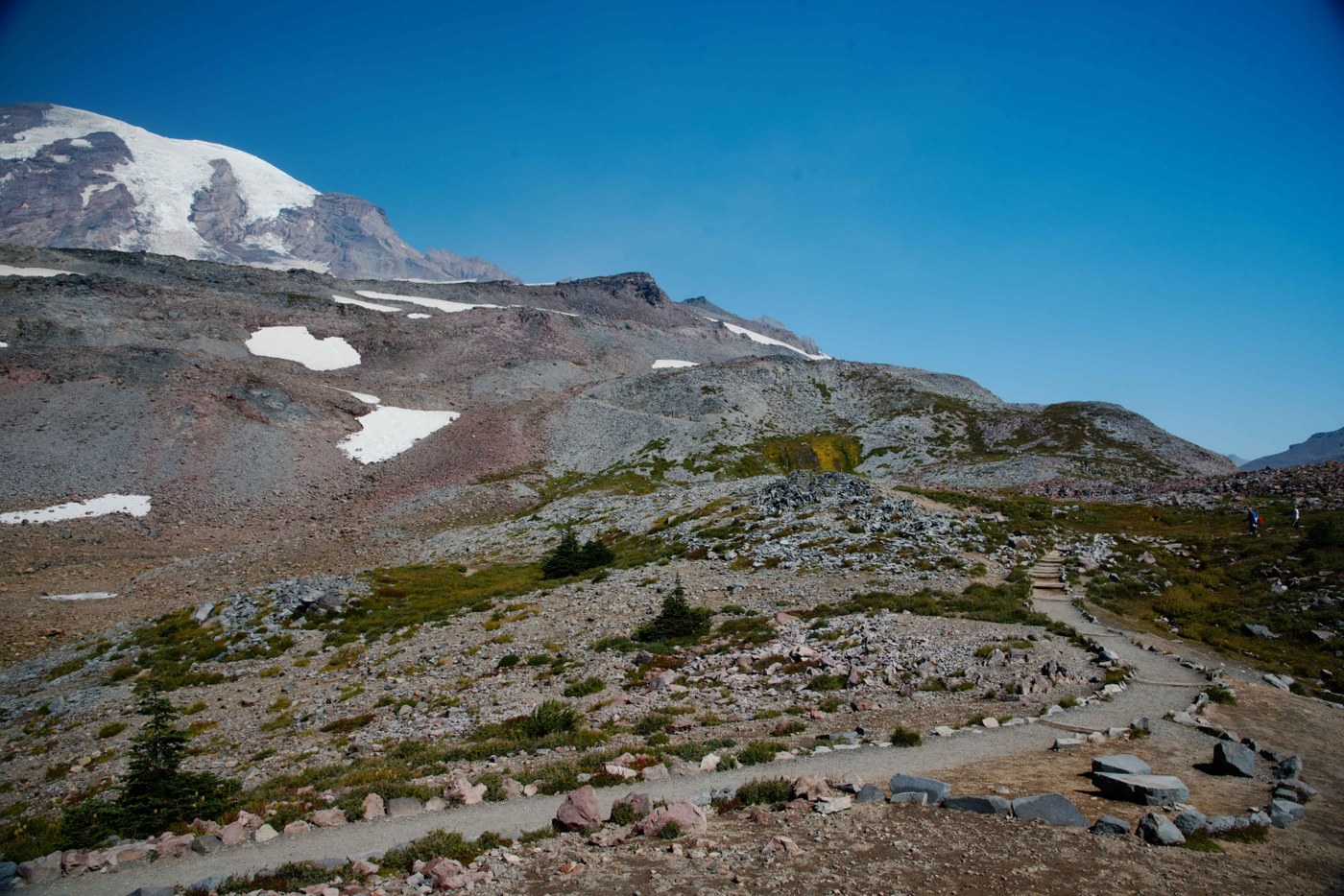
Starting out clockwise, the trail climbed relatively steeply along the paved trail, vaguely heading towards Panorama Point, not that I knew what that really consisted of. We tried to take a side trek along the Moraine Trail, but the trail disappeared far sooner than the map seemed to show, without reaching anything of note. We followed the Deadhorse Creek Trail for a bit, which ran parallel to Skyline in this area but seemed to offer better views than the other trail.
I enviously looked ahead and could see promontories where people were congregated. Ignorantly, I thought that one of these was Panoarama Point. I went left to catch the Glacier Vista Trail where many were going straight, since I wanted to catch a good view back towards that Tatoosh and towards Mount Adams, which was just barely in view to the left. I also could just barely see what I thought was the outline of Mt. St. Helens, and as the haze got ever so slightly less bad throughout the day, I could later see I was right. I wasn't going to be getting any closer to Adams or St. Helens before leaving the state, so I was happy to catch even a fleeting glance of these other peaks.
At this point the mountain was so close I felt like I could reach out and touch it. Sunrise had offered more photogenic frames and a more pleasant north side of the mountain, but this trail was closer - and I had little idea we'd soon practically be on part of the mountain. I mentioned to my wife that I thought we were seeing climbers going up the mountain. She corrected me and said she thought that was the trail, and as it turns out, she was right. We worked our way to another view before following in the path of these "climbers" up a long ascent along the side of another level of the mountain.
This trail section was exciting but not scary, clinging along the rocky edge of the ridge with great views to the south. By the time we reached Panorama Point, we had left the tree line behind a long time ago, and were now in an area where the ground was basically rock - with small pockets of snow still dotting the landscape. But amazingly, Panorama Point was far from the high point on the trail. We still had a lot more to go. But that was just the recurring theme here - everytime we got to a spot I'd been eyeing as a goal along the trail, you soon realized that there was still more to go. To some, that's a bad thing, but aside from the initial ascent from the parking area, none of this ascending was steep, and the excitement of what lied ahead meant it wasn't all that tiring to keep moving forward. We took a break at Panorama Point, and I looked excitedly towards the upcoming section of trail, where the highlight for me wasn't just getting to a higher altitude - it was getting to hike through what we call "moonscape".
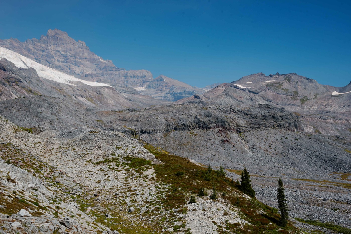
Though this was our 8th day of hiking in Washington, and we had done a really great cross section of hikes in that time, I hadn't yet gotten to hike such a sparse but dramatic landscape, something I really wanted to do (Sunrise offered some vaguely similar stuff, but the terrain around Fremont and Burroughs is still very different from what you see here). Naturally there were even better views above as the trail finally stopped switchbacking and climbing and started to move laterally across the landscape. A big wall of ice and snow lied right along the trail, and I definitely enjoyed indulging in it a bit, seeing as I'm from Florida. Though the spot up here wasn't labeled Panorama Point, it was actually a far better area to stop and take in the view here, with rocks to sit on either facing out, or towards the summit, which was never closer than here.
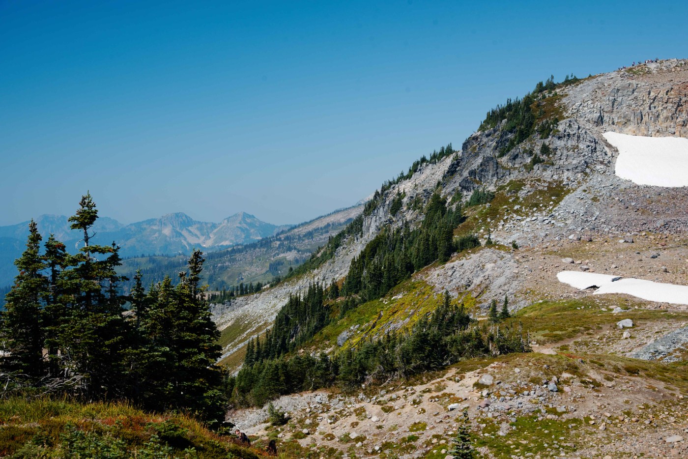
By this point the trail had become quite busy. Every time I stepped out of line to take a picture or something, getting back on the trail was like merging into interstate traffic. We'd soon start navigating switchbacks down on a rocky path, and when the trail finally started to level out it was a mix of rock and grass. The upcoming section of trail was no less interesting than what had come before, as we began to navigate the spine of a ridge that offered nearly continuous good views of the Tatoosh Range ahead. Creeks tumbled over the side to form waterfalls. Still in a mix of moonscape, the trail dipped down into a wide flat area where multiple creeks joined and were bridged, with a great view of Little Tahoma in the distance. This was a special spot along the trail.
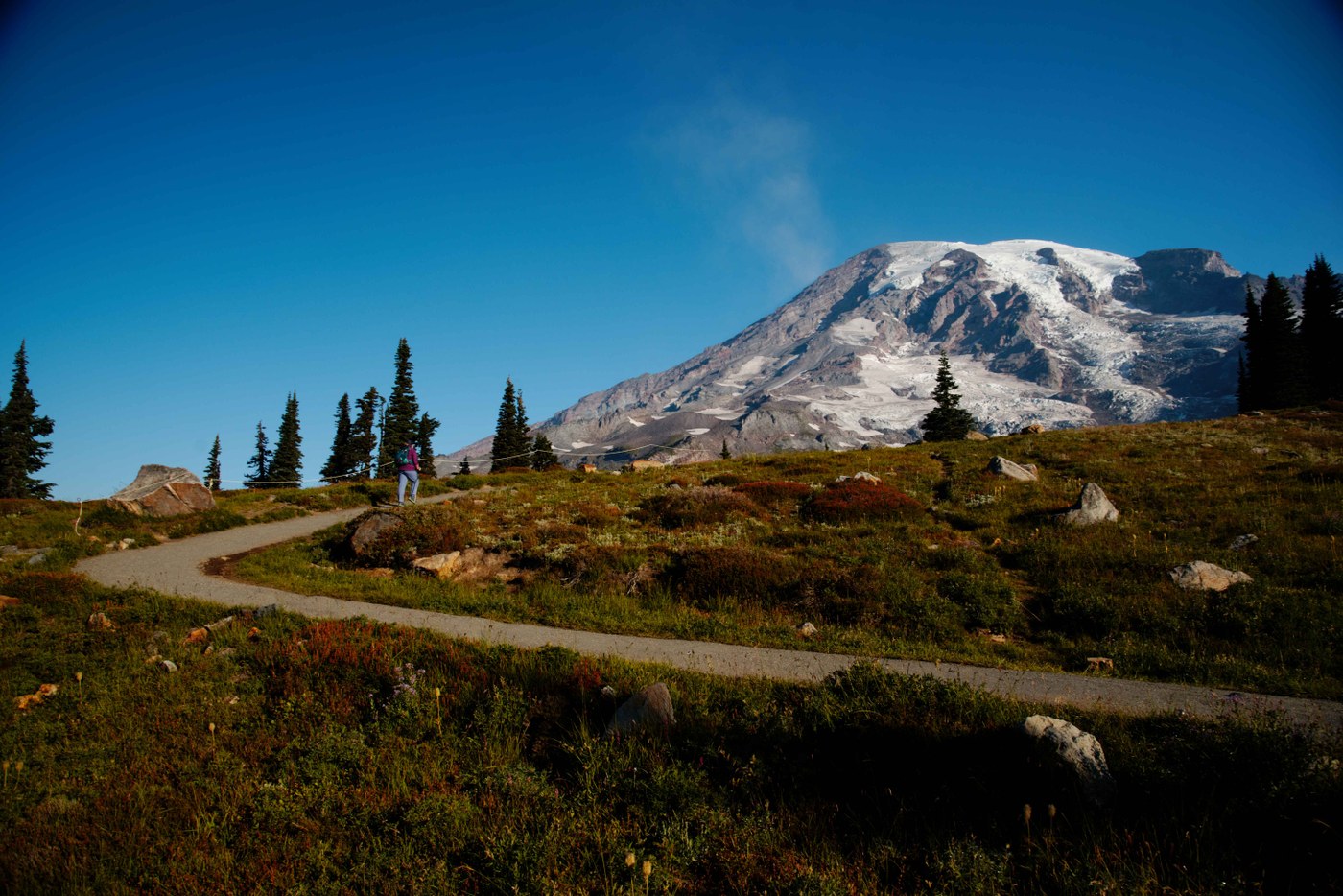
The trail plunged downhill, with great scenes of Rainier in view and occasional waterfalls and creeks. To tell you the truth, by this point there had been so many great sights along the trail that I began to be exhausted by them. As we worked closer to the Myrtle Falls area and the parking area, the crowds became overwhelming. I'd seen lighter crowds at Disney. We ended up not eve doing the Myrtle Falls overlook, only seeing the top from the bridge, as there was a huge crowd and line, and just wanted to get away from the mass of people at this point.
I knew that Skyline would offer some great scenes, I just though it would end up being a lot more sterile feeling, being a partially paved path in a very popular area. Once you got into the trail, it was anything but, and in a good way. I couldn't have imagined that dramatic scenes encountered near the high points of the trail, nor the sheer variety you'd get in just a trail of around 6 miles. This may be the best trail I've done, and if its not, its at least on a very short list.
Comments