One word: WOW. 5 of us from the Mountaineers CHS-2 (Conditioning for Hiking Series 2-3 mph pace group) met at the Snoqualmie Lake trailhead at 6:30 a.m. Traffic at that time is very light, and birds are singing (19 species on the day). The worst part of the road is around Garfield Ledges - just take your time weaving through the potholes. THE ABSOLUTE WORST is immediately after the bridge so SLOW DOWN in order to keep your tires safe.
Portapotty is open and stocked. Northwest Forest Pass (NOT Discover) is required here.
Our fabulous day hike included visiting Big Creek Falls and spending an hour enjoying pristine (and chilly but refreshing) Snoqualmie Lake, returning to the cars around 3:45.
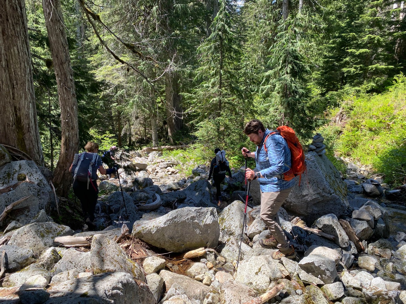
We set a blistering 3.1 mph pace from the trailhead, toning it down to 2.7 by mile 6 where we took an extended snack break to fuel for the gain. Once you leave "the flats" (900 feet gain over the first 6 miles, adding 200' if you pop up to Otter Falls) be prepared for 6-7 over-under blowdowns that have not been cleared. All are passable, they just slow down your pace. So do the talus fields, particularly the last one before Snoqualmie Lake.
Take a moment to check out the side trail to the drainage falls from the lake - utterly beautiful.
Five things worth noting:
1. On one of the talus slopes one of my participants felt his foot shift and suddenly there was a huge gaping hole underneath. I marked it with a pair of sticks so you pay attention to the tread. Simple enough fix but it's a big hole that needs to be filled.
2. Streams are all completely passable for a moderately experienced hiker. The one before Otter Falls continues to be the trickiest, just eyeball the route before you start. The highest stream crossing leading to Snoqualmie Lake with two logs across it is a bit slick, but poles or hand holds on the low log can help with footing. I used one pole on the descent from the lake but otherwise everything is passable.
3. Once you reach the upper outflow, as a previous trip report pointed out, look uphill for obvious cairns showing you the trail just beside the runout. It looks like the trail cuts directly across but I don't know what is on the other side, probably switchbacks or other indicators how to regain - we stuck with the cairns.
4. Make sure you don't have any loose laces or gaiter strings. The roots and branches have arms!! Fortunately any slip-up over most of the trail ends in a soft landing on cushy needles and dirt - no injuries except to egos. There are some muddy and overgrown areas but it kept foot traffic down to only the determined.
5. Somewhere I got 15 miles and 1900' as our totals, but we logged closer to 16.5 and 2200' on AllTrails, go figure. It's a long day hike so be prepared!
Once we got to the lake (average pace for the first 8 miles was 2.2 mph) we were greeted by a pair of American dippers and a red-breasted sapsucker, a sooty grouse I heard once I stepped away from the sound of the running water, and a beautiful, surprisingly large lake. I'd done Otter/Big Creek before but I've never been to Snoqualmie Lake so I gave us an hour to soak our feet, have a snack, filter water and enjoy our hard-won prize.
On my 10-minute scouting trip to check out lake access for future reference, I encountered a trail runner and an overnight backpacker - fellow WTA poster and just-about-to-retire Terry (Hey, we hope your Deer Lake day trip and second overnight turned out well! Drop me a note and we can chat Mountaineers!) but for the most part we only ran into a pair of trail runners and people visiting Otter Falls/Big Creek Falls.
CAMPSITES: As soon as you top out and spot the lake, look left for your first camp sites. If you continue another 2 minutes you'll find a few boot paths that will take you down to a "beach" of rocks near the egress where you can wade and sit for a snack. Not sure what all the yellow was collected in pockets - pollen?
Continue on another few minutes and you'll find your first beachside campsite with a wonderful wade-in spot (where I shot the first of four shared photos). I understand there are more as you continue around the lake toward Deer and beyond, so if the first few are full just keep on walking.
DESCENT: This trail is lovely even in mid-day. I burn easily but chose this for a June/full sun day because I knew most of the trip we'd have forest canopy. Great decision. The boulder fields weren't too hot yet and the cool in the woods with a light breeze felt delightful.
We kept a visit to Otter Falls as optional and decided to save it for another day -- I wanted to scout out the new trail (WOW, thanks whoever hoofed all that way in and did the hard work!) that has been created since I last visited in January but our feet were all feeling it by that point. Our average pace on the day was 2.4 mph. Over that kind of mileage, this early in the season, I was highly impressed with our group's performance.
All in all a totally delightful day with wonderful go-getters all dealing with their own fears and foibles, but the conversation, energy, and camaraderie were magnificent to match the day. "Great confidence booster" one participant shared. So fun I've signed up to lead Nordrum Lake later this summer to see what the "right fork" lake looks like. Middle Fork of the Snoqualmie is a treasure begging to be explored.


Comments