We had a few days of meandering around the Stehekin River (hanging out at Bridge Creek Camp, hiking Goode Ridge, etc.) and had an opportunity to finally take a crack at McGregor. We lugged our packs all the way up to Heaton Camp, which is a lovely and lonely spot perched in a high basin among some larches. It's hard work to get there, but I'm glad we did it.
Just as we were settling into camp, a half-human half-gazelle creature came bounding past camp. A few minutes later he descended at an even faster pace, having presumably turned around above us at trail's end. I don't know who this trail runner was, but I think he was the only person we encountered.
After we settled into camp and ate lunch, we decided to try for an afternoon summit, so we hoofed it up the remaining 0.3 miles of trail to it's end at a talus field. The talus was mildly annoying, but nothing overly treacherous. Starting about halfway up the talus you can *clearly* see the painted arrows that mark the route. These are now safety orange (with occasional faded red visible below) and appear to have been quite recently repainted. They are plentiful and fairly obvious, so if you're not seeing arrows, you are not on route.
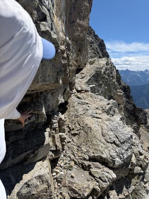
The route itself was a bit more intense than I had expected. I would call it a solid Class 3 with maybe even a couple spots verging into Class 4. There is significant exposure, especially in the first couple hundred feet above the talus field, so it's probably not a good choice for those afraid of heights or who do not feel confident navigating narrow ledges with occasional patches of loose rock. That said, if you are experienced with scrambling or rock climbing, it's all quite straightforward.
The route wanders around a fair bit and it would be challenging to follow without the painting arrows. Note that the correct route goes to a notch that is climber's *left* of the block that sits left/north of the summit. This route is correctly shown on the NPS website and other trip reports (but it is incorrectly labelled on a 2018 trip report by MartinTravles.) Once through the notch, you come out on the eastern side of McGregor right above the Sandalee Glacier. From there it's another 100-150 feet vertical of easy uphill walking to the true summit. We crossed one minor snow patch, but everything else was melted. There are no technical difficulties after the notch. The views from the summit are nothing short of epic -- 360 degrees of mountains and rivers without end, as Gary Snyder might have said.
We carefully made our way back down to the talus, building one cairn where the descent route isn't as clear, for lounging at camp and dinner in the solitude of alpine country. The next morning was cool and breezy, but we enjoyed our descent among the marmots and pikas and two black bears that we spotted in the first mile or so below camp.


Comments