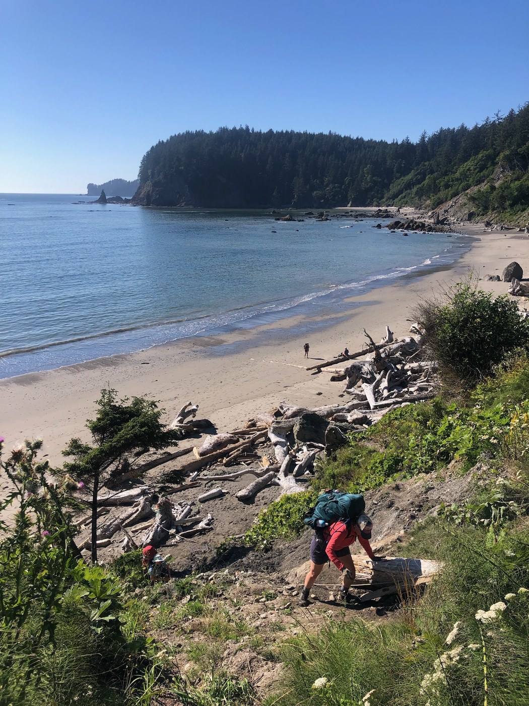
Hiked the South Coast route southbound August 22-August 25. It was warm and beautiful, and as others have noted, pretty hard at times. After a few days of ladders and overland trails and beaches, exactly which part happened where is starting to be a blur but I'm doing my best to remember :).
Day 0: Drove from Seattle and camped at Mora Campground closer to Rialto Beach.
Day 1: Third Beach TH to Strawberry Point. In the morning, set up a shuttle leaving cars at Oil City trailhead and a few of our group waiting at Third Beach Trailhead. Started our hike around 12:30 PM. The hike down to Third Beach is quite easy, a bit steep toward the end down to the beach. Ate lunch there. Then it's about a half mile easy walk on firm beach to the first set of ladders to get up and over Taylor Point. There are several ladders to get up the initial slope, all in great shape and dry. Nevertheless, going up these ladders is hard work. The overland trail is steep in sections with some eroded areas. I remember the way down here being pretty easy though, with some stairs. The beach at the base ended up a little crowded with groups, as we waited a bit for a low enough tide (sub-4.5', though it was still a wading situation at that level). Then, around to the next beach. At the end of that beach, we took the route up and over Scotts Bluff. The rope up wasn't super memorable, but I think a rope here again and steep. Maybe less steep than other rope sections. This section I also remember the way back down, southbound, to be easier with some stairs. We met some people at Scott Creek who indicated accessing fresh water there was difficult, but we found a stream that was more accessible just a bit further south on the way to Strawberry Point. We camped south of the point itself in a lovely spot. No privy here!
Day 2: We hiked from Strawberry Point to Mosquito Creek. The initial hike from Strawberry to Toleak was beautiful, firm beach walking. Some of our group used the privy here in the morning as it's not too far from Strawberry Point. Then walked about a mile south of Toleak. At the south end of this beach we came to the next rope climb up toward Goodman Creek. This section of overland trail felt interminably long and we came across multiple other big groups and that made it feel kinda crowded compared to big beach areas where other people just feel more spread out. We ate lunch at Falls Creek by a lovely waterfall. There was a big log here that some of our group walked across; I forded it in sandals which ended in a ton of mud. I put my boots back on and then it's just about .2 miles to the ford of the slightly bigger Goodman Creek, where I did another shoe change to sandals. There wasn't a way not to ford here, and the water was up to a bit past my knees (I'm 5'9"). Then more overland walking with some fallen trees to navigate over or under, and some mud. The way back down was more ropes, some of which were pretty muddy and steep. Then more beach walking to Mosquito Creek. At Mosquito Creek we forded the river though this part might have had spots where rock hopping was possible. We hiked up the steep trail to the campsites on the bluff which were empty, spacious, and beautiful with views of the ocean.
Day 3: Grateful to already be up on the bluff, we headed out at 6:30 AM to make the tidal restriction at Diamond Rock. The low tide (-1.5 or something) was at 8 am but we weren't going to make that. The expected 2' tide was at 10 am. The trail across Hoh Head has lots of ups and downs, trees to navigate over or under, etc. Pretty slow hiking. I think we did this section which is about 4 miles, in about three hours. The way back down to the back has some very steep ladders, but they are in great condition and felt reasonably solid. There's a bit of sandy beach to walk on before reaching Diamond Rock. We got to Diamond Rock a bit before 10 am and had to go over the boulders. I'm just learning from another report that maybe if the tide is really low you can avoid these. But, for me it was very slow going to navigate all the boulders and I got kind of chewed up by barnacles. Most of my friends wore pants, which I'd recommend, and probably gloves. Past the Diamond Rock area is more rocky bouldery walking but that was the hardest part. I couldn't really tell where the official trail intersects the beach from the little east-west section along the Hoh River, but we exited the beach and then walked along a bit of beach along the Hoh before finding a bit of a gap and getting on the woodsy trail back to the cars at Oil City. It looks like this trail continued further west from where we got on it. Day 3 for us felt very hard hiking compared to the other sections of this hike. I understand why people might do an out and back to Toleak from Third Beach, for sure.
This is a really special hike, remote, and beautiful. Having also done the North Coast Route, this one is easier than that! Takes a lot to get to the coast from Seattle but worth it. Not for the faint of heart!


Comments