
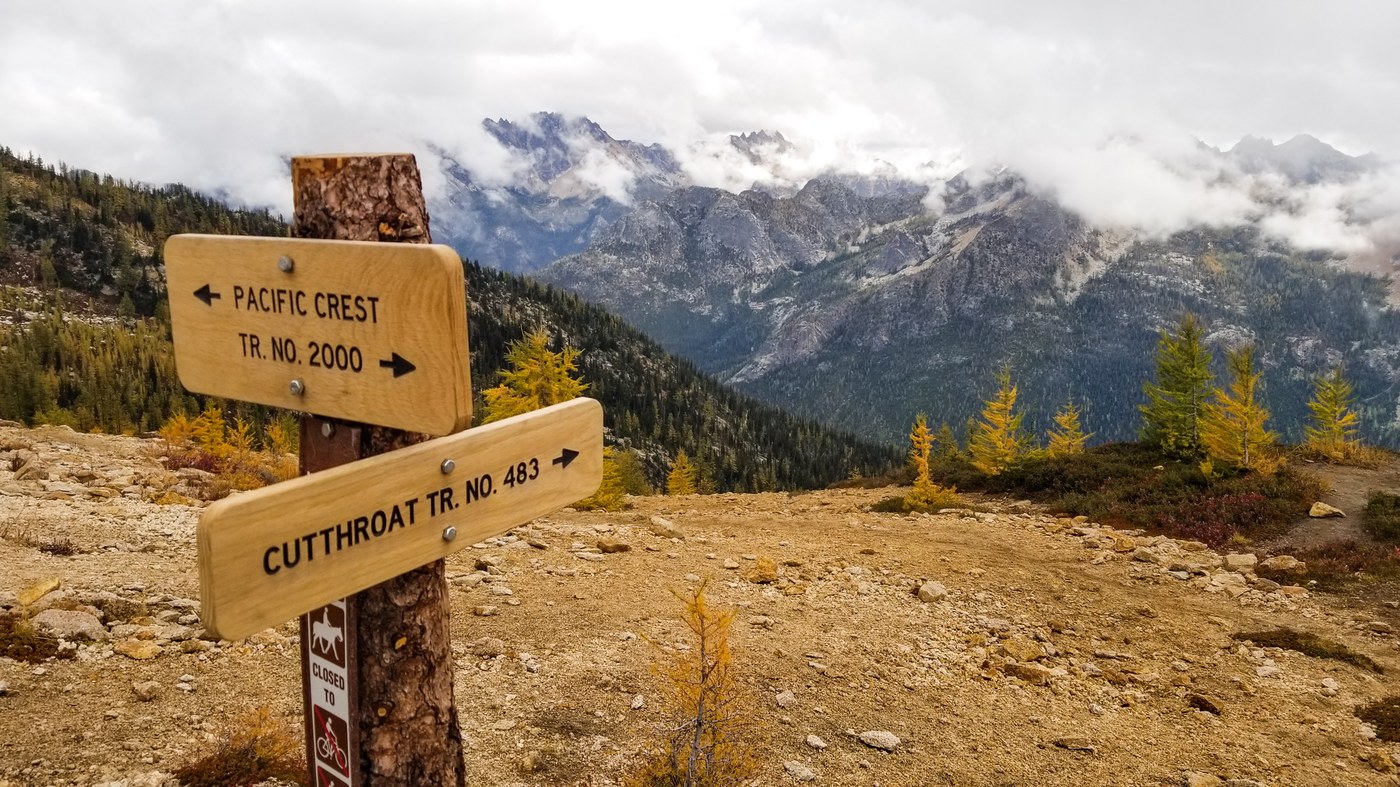
We had hiked up to Cutthroat Pass via the PCT the day before and now wanted to compare it with the route from the other side. While I had hiked the Maple Pass Loop and the Blue Lake Trail several times, it was my first time on either of the Cutthroat Pass Trails. How would they differ, and which one might we prefer?
The road to the trailhead is around a mile and a half of seriously degraded pavement with potholes. Repaving is long overdue. We arrived at the trailhead lot as the sixth vehicle in the small lot around 9:30 am. The weather was still overcast with a chance of rain, the subalpine larch not yet in its prime time, and this trail is more distant from the western cities, is longer, with more elevation gain, and less popular than the one that accesses the pass via the PCT. Hence, fewer hikers.
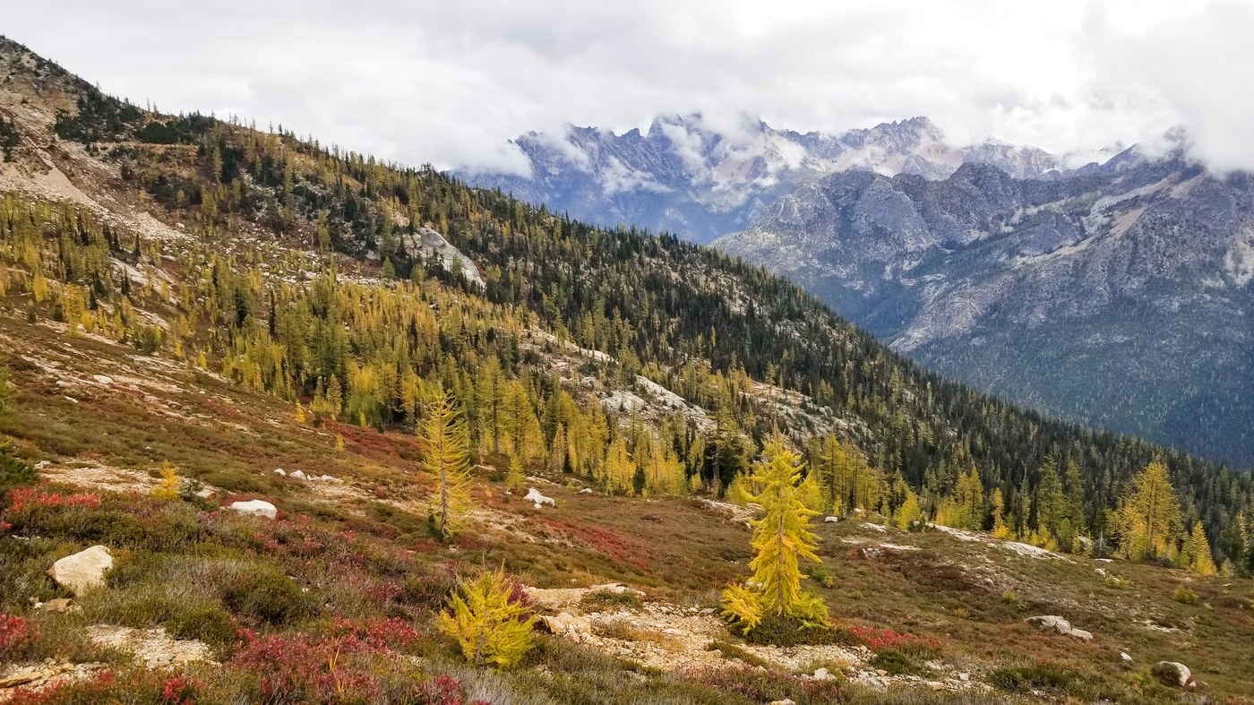
So, what’s the verdict? The first two miles to the Cutthroat Lake Trail gain only 500 feet. The trail is easy, and the woodland on the eastern side is more open, lending a spacious quality to the first miles. The breakout to more expansive vistas begins after the lake trail intersection and the subsequent ascent of the twenty switchbacks to the pass. Whereas the PCT trail starts with a 3.5-mile trail through more dense forest before breaking out to bigger views. Like the PCT route, the higher sections traverse through increasingly robust stands of larch. One advantage of the 20 switchbacks is that your point of view makes more frequent 180-degree shifts. And the views are amazing.
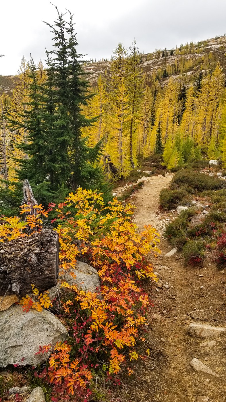
The larch needles, while not yet fully gold, varied from a subtle lime green to soft yellow. We found it even more interesting to be among them in this transitional stage than at their peak. The whole scene seemed to me to be pure magic.
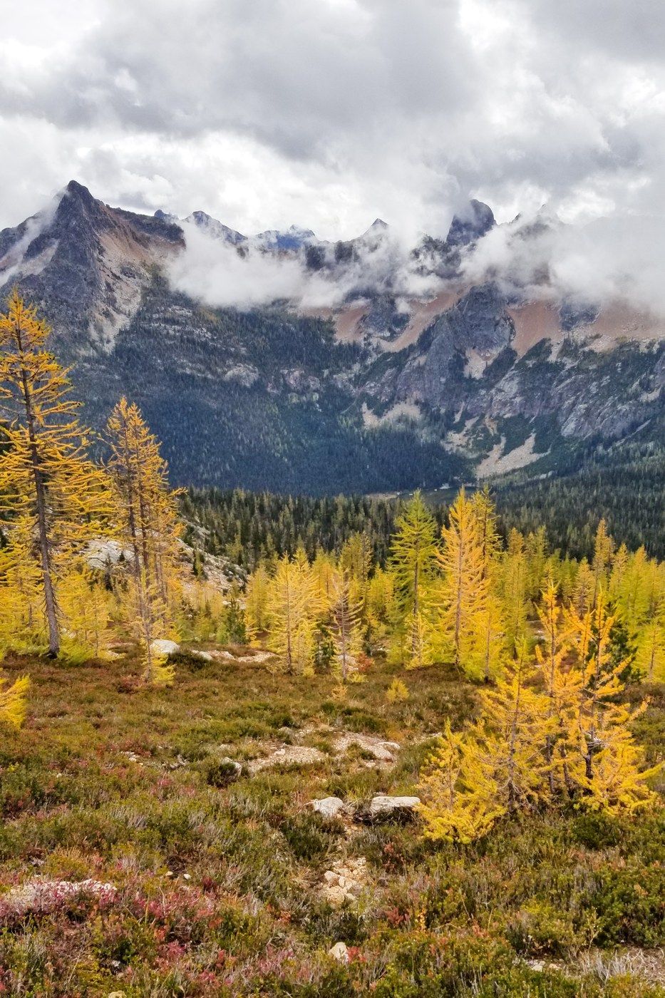
As we crested the pass, we experienced a ‘wow!’ moment as we suddenly encountered a panoramic view of jagged peaks that populated the western skyline. As we paused to look around, we noticed dramatic gray clouds drifting above, alternately revealing and then obscuring the nearby summits. The pass was mostly rocky and barren, with few trees, but broad and expansive enough to host many hikers. Today we saw only a few others. Yesterday, we encountered five horse packers slowly moving across the pass. We had seen extensive horse poop on both trails.
The drama and the dynamic of the ominously dark drifting clouds provided a photographic opportunity that clear blue skies do not. So, yesterday I had set up my tripod and shot enough frames to assemble one spherical panorama at the pass and called it good. Again, it was damn cold up there, and I wanted to feel warm again. So, after a snack, we reluctantly left the pass, said goodbye as we passed the magnificent larch of the switchbacks, and finally ambled the easy last two miles to the trailhead. GAIA GPS stats: 11.4 miles round trip, 2,335 ft, gain.
So, the verdict? Both are great larch hikes, but of the two, I prefer the Cutthroat Lake route. However, the upper larch cirque on the PCT side is blessed with more larch trees and is spectacular as well. The optimal approach would be to park a car at the Cutthroat Lake Trailhead, shuttle to the PCT Trailhead to be dropped off, and make the hike, end to end, beginning at the Rainy Pass side and finishing at the Cutthroat Lake Trailhead.
The link to the panorama from the pass is posted below. For the most immersive viewing experience, select the full-screen mode and scroll around.
Note: This trip report is a bit late, as we stayed in the area all week, doing three hikes, Tuesday through Thursday, and then visiting Winthrop before our return.
Comments