Since the DNR was finished with their logging operation on Middle Tiger Mtn., I wanted to hike up to the summit and check out the view. The last time I was up there was in 2018. I tuned off Highway 18 at Tiger Summit and had to park at the mud pond parking area just of the highway as the gate for the West Side Road was closed. I hiked up the road to the main DNR parking lot for the trailhead for the Iverson Railroad and Connector Trails. The old gravel parking lot with the wooden restroom is now gone. DNR has built a new larger paved parking lot to take its place with a brand new two door restroom. At the trailhead for the Iverson and the Connector Trails is a cement concrete patio area with bollards so you cannot park on it. Across the West Side Road from this parking lot the DNR built a second huge parking lot with another restroom. There are 170 parking stalls for the two parking lots. Both are paved and white paint stripes for the parking stalls.
I then started up the Iverson RR Grade Trail. After getting up to the trail next to the DNR clear-cut area that was logged off several years ago I found two new blown down trees across the trail. One you can get around through its limbs, and the other was a duck under. When I got to the junction with the Side Hustle Trail, I took it to get to the TMT near the Holder Creek train wreck site. After crossing the East Fork of Holder Creek on the long steel girder bridge I turned off left on to the TMT Connector Trail. One of the small steel deck bridges on this trail has had a Red Cedar tree fall over it, since cut out. I continued on the TMT Connector Trail crossing a DNR spur road before getting to the bridge over the West Fork of Holder Creek. After passing by the train wreck site from over 100 years ago (a Wood & Iverson log train derailed here on Feb. 23, 1925. The remains of the Clyde track laying machine, some wheels and car parts are still here. Their sawmill was down in Hobart.).
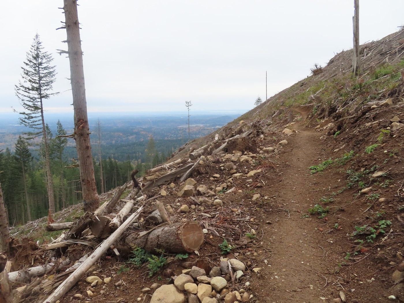
I then got to the junction with the main TMT and started hiking up it. A ways up the trail while going through the conifer forest I came to an area of about 20 acres with lots of blown down trees from the Nov. 2024 windstorm. Some had come over the trail that you can walk under and while others had been cut out. Further on I crossed a DNR spur road that goes up to where the DNR logging operation on Middle Tiger Mtn. took place. I then got to the trail junction for the Middle Tiger Trail at Millan's Crossing. I hiked up the TMT a short distance to where it crosses over the new clearcut on the side of Middle Tiger Mtn. You now have a big viewing area to the southeast, south and southwest since the tall conifer trees are now gone.
I hiked back to the junction and headed up the Middle Tiger Trail. It looked like this was a new section of trail that came out onto the DNR spur road. I crossed the road and continued up the trail that came to the old trail that I had hike in the past. This old trail has some steep sections with a grade of 12-14%. After getting up where the trail goes along a ridge top, I came to a new unsigned trail junction. The Middle Tiger Trail goes to the left and the new trail to the right going downhill. I had one more steep section of trail before getting to the summit in the DNR clear cut which now has a grand view. There is a small wooden bench at the end of the trail at 2,607' elevation. Before the DNR logging operation there was no view at all.
I ate lunch while enjoying the view. Lots of colored trees to see in the Maple Valley area down below. Cloudy today so no Mt. Rainier or the Olympics in sight. I could see the skyscrapers in Bellevue too. There was a cold wind blowing at the summit like it was Winter, so I put on a second jacket, fleece hat and gloves. Remember the Boy Scout matto, "Be Prepared". I was in the Scouts back in the 1960's. After lunch I headed back down the trail the way I had come. I did not see any other hikers or mtn. bikers on my trip. Saw bike tracks on the Iverson RR Trail. Some of the trails I hiked need brushing. When I got back down to the new DNR parking lot two guys came by heading down the West Side Road riding Onewheel electric powered skateboards. You need good balance to ride one. They cost between $1,900 and $3,500.
Starting from the West Side Road gate at the mud hole parking area off Highway 18 my hike was 8.5 miles round trip. It will be a little less once the new DNR parking lot is open. The parking lot project is supposed to be complete on Oct. 31st. It looks like it is completed. So, the ribbon cutting ceremony should be happening soon.
Keep on hikin', George


Comments
wafflesnfalafel on Middle Tiger, Iverson Railroad Trail, Tiger Mountain Trail, Side Hustle, Tiger Mountain Connector
wow - that new parking lot sure is nice and big!
Posted by:
wafflesnfalafel on Oct 29, 2025 03:34 PM