Trip Report
White Pass - Pilot Ridge Loop — Tuesday, Aug. 20, 2013
 North Cascades > Mountain Loop Highway
Type of Hike
Overnight
We settled on this loop to retrace part of a trip that two members of our party made 30-some years ago. We had planned to go clockwise but, when we reached the junction for the Pilot Ridge trail, decided to go the opposite way so we could complete the substantial climb earlier in the day -- and in the shade. So we went up and up – and then up some more. Not sure this was easier than the clockwise route, but it was less exposed, and therefore cooler.
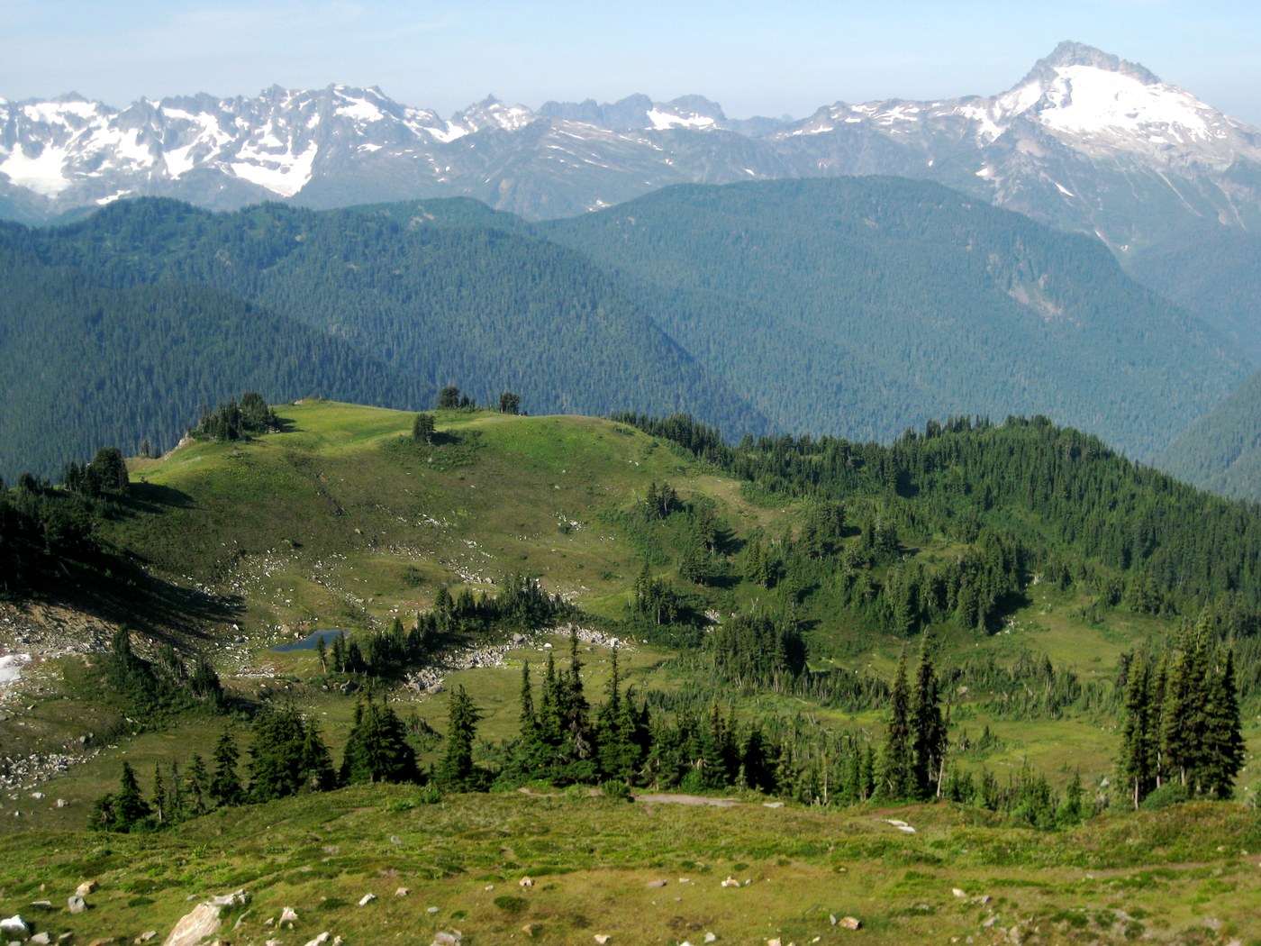
We enjoyed the views that started at the top of the ridge and into the meadows beyond. Given the relatively slow uphill pace for this group of 50- and 60-somethings, we set down our packs at upper Blue Lake with just enough time to eat, pitch tents and hang food before dark. (No water before the lakes – so that had to be our destination.)
Early the next morning, we decided to once again tackle the steepest part of the trail early in the day, and took the high route out of the basin, which rewarded us with a wonderful view at the top. We then headed down to the junction with the Pacific Crest Trail, where our friends hiked all those years ago.
After the initial climb, the rest of this day’s trail had a gentler grade and wide, heart-filling views of mountains and meadows all the way to White Pass. We arrived at the campsites below White Pass with plenty of time to goof off before dinner, and to enjoy a blazing orange-and-red sunset. (We were happy to have bug netting, however – flies out in force.)
The next morning, we hiked without packs to Red Pass, which is where, after nearly a week of hiking in the rain decades ago, the clouds finally lifted and our two companions, then in their 20s, literally jumped for joy. Then we continued down into Glacier Peak Meadows, rounding a curve for the full-on view of Glacier Peak. Some of our group climbed the Cinder Cone -- the reddish-orange pile of volcanic debris nearby.
That evening, also spent at the campsite below White Pass, brought another beautiful sunset. We oohed and ahhed and then simply watched in silence as the glowing red sun sunk and spread its light across the horizon.
We awoke the next morning to the sound of rain but it soon stopped and we suspended our hurried packing to eat a hot breakfast after all. On the way back down, we stopped often to graze on plentiful, sweet blueberries.
After we turned off the PCT onto the North Fork Sauk Trail, our knees benefitted from the relatively soft trail on the nearly three-mile descent, and then we cruised through the final six-mile forest walk.
Years ago, the mother of one member of our group seriously questioned whether her daughter could complete the earlier, longer PCT trip. Our friend had no problem. This time, her grown children expressed some doubts about whether she or her husband could make it up to White Pass with full packs. We joyously report: No problem.

Comments
How long was trip?
Looking to do loop in August. Is there camp spot within 4 miles of TH if you go CC?
Posted by:
"skagithiker" on Jul 05, 2014 10:10 PM