Trip Report
Standup Creek, Navaho Peak & Navaho Pass — Sunday, Jul. 3, 2016
 Snoqualmie Region > Salmon La Sac/Teanaway
Type of Hike
OvernightTrail Conditions
Obstacles on trail:Muddy or wet trail,
Overgrown in places.
Road
Road recommended for high clearance onlyBugs
Bugs were an annoyanceSnow
Snow free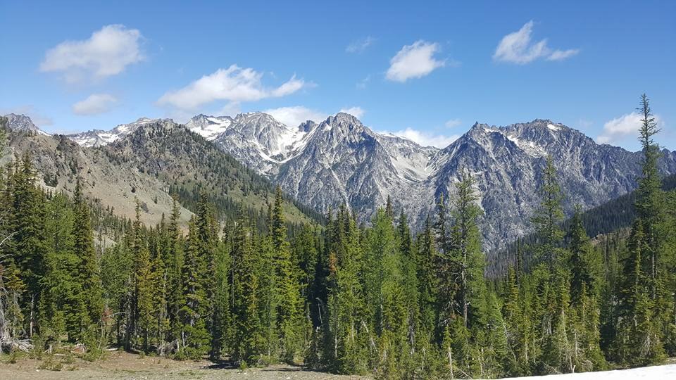
Three friends and I enjoyed two challenging days in the Teanaway over the 4th of July weekend. We started our ~20 mile loop at the Standup Creek trailhead because it is less crowded than Stafford Creek.
The road to Standup is *rough* though. We were in a Subaru and had to park about a quarter mile down the road and walk the rest of the way because the ruts were too deep for low-clearance vehicles. A couple in a Jeep drove past us on our walk, though, so high-clearance vehicles should be fine.
Once we got to the trail, we pretty immediately stopped to apply insect repellent. The first two miles are buggy and incredibly overgrown. The trail is still visible, just be prepared to bushwhack and conduct a thorough tick check afterwards. We decided to describe our experience of this section as "brushtration."
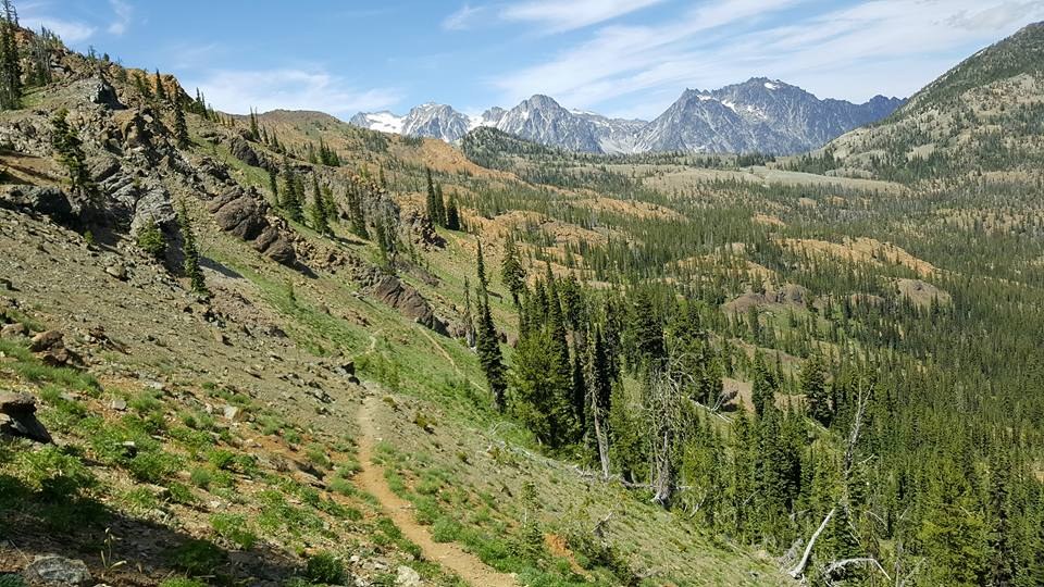
After the first couple miles, the trail opens up and we began to ascend in earnest. It was challenging and had quite a few false summits. Also, if you're planning to make this an overnight, be mindful that the first two campsites marked on this trail on Green Trails map #209 appear not to exist. We didn't see any flat ground for camping until we reached the highest point of the Standup Creek trail about 7 miles in. It was a glorious campsite, too, but we were in need of more water, so we descended into the valley below where the landscape changes from semi-dry ponderosa forest to lush river valley.
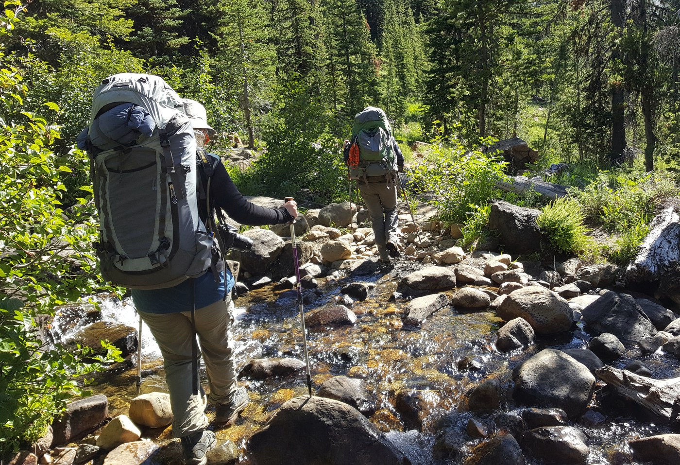
Water and wildflowers abound here, a little paradise ringed by mountains. We only came across one patch of snow on the trail in the valley and it was only about three feet wide, but there were many muddy sections.
We found a nice campsite about half a mile from the junction with the Stafford Creek Trail just big enough for two tents. There was a fire ring there that looked recently used, but please remember there is currently a burn ban in effect.
The next morning, we packed up and hiked to the Stafford junction and dropped our overnight packs for a quick jaunt up to Navaho Peak. On the way to Navaho, there is a perfect alpine meadow with many great campsites. There were quite a few groups there, but everyone seemed to have their privacy. We kind of wish we would have pushed onward and camped here.
On the saddle just before you really start to climb toward Navaho, you get your first panoramic view of the Enchantments. They were somewhat visible from the ridge on Standup Creek, but holy cow, this view was something else. The mountains are just right there in your face.
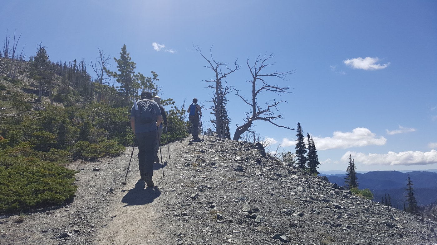
After catching our breath, we continued up to the peak. Be warned though that this is little more than a climbers' path and it is incredibly steep in sections and traction is limited. Lots of loose rocks and sandy soil here. It's gorgeous, but step carefully. I am a little afraid of heights and didn't make it to the peak because the increasing steepness and crosswinds freaked me out. I waited for my friends about a third of a mile below the peak (I know, I know) and then we faced the challenge of descending. We all slipped and fell at least once. Trekking poles were incredibly helpful here.
After we got back to the junction, we filtered more water, picked up our packs and continued along. We had planned to camp at one of the marked campsites on the way down the Stafford Creek Trail, but by the time we reached the last one, it was only 2:30 in the afternoon, so we just decided to finish the remaining two miles of the trail.
The trail was all downhill at this point, a welcome change from the day before. We completed the loop with a road walk back to the car and spent the night at the nearby 29 Pines Campground, which I highly recommend. On a holiday weekend, fewer than half the spots were occupied.
Comments