
What an exciting hike!
We got a later start... we parked around 1 pm.
One 1/2 mile before TH there has been yet another small washout. There is a "ROAD CLOSED" sandwich board sign just before the small washout. There is limited parking located there. One car did still choose to pass the washout park a 1/2 mile up where the overgrown road then narrows and becomes more like a trail. This spot is what passes for the current "trailhead".
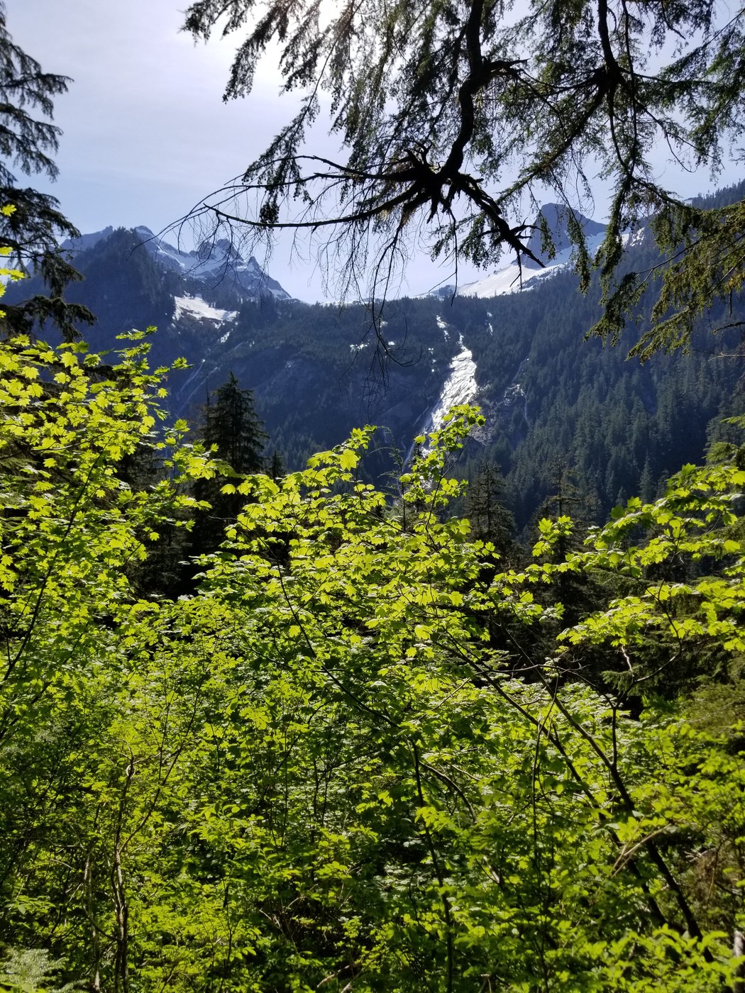
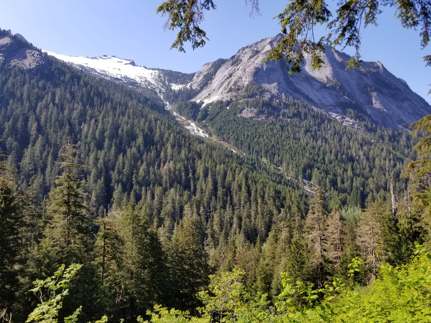
From the very beginning you can see the trail entering the valley and how the mountains opposite squire creek on the other side of the valley pop out larger than life as if super imposed upon the horizon. The crags are dramatic, the waterfalls awesome, and the overall views are majestic and rewarding.
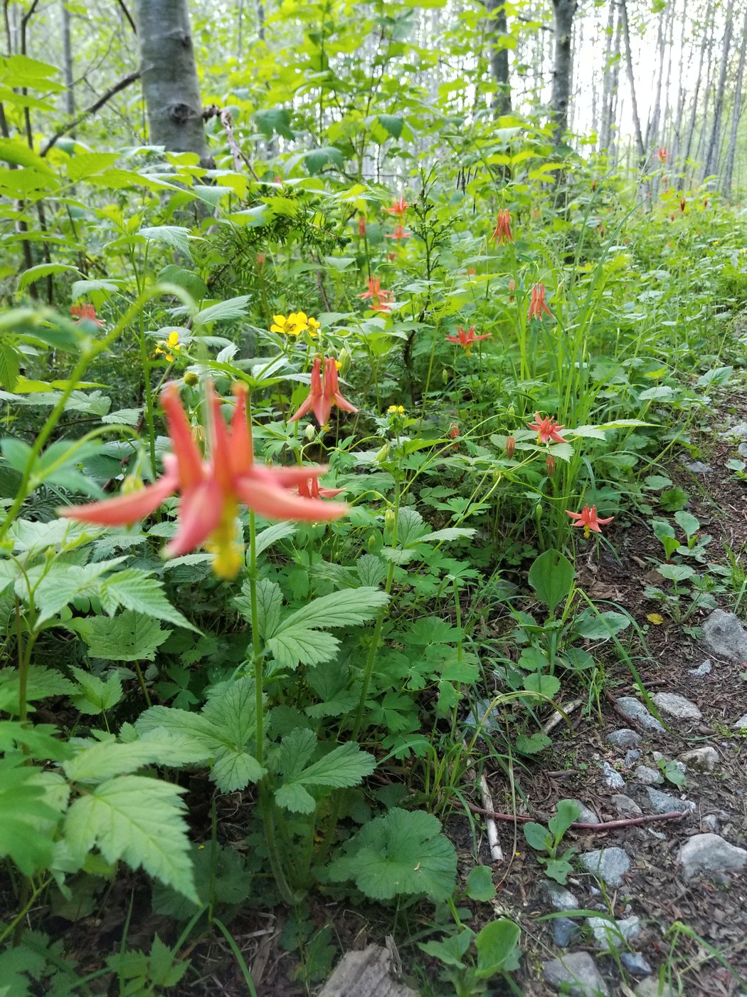
After warming up and getting a good sweat walking up the hot valley, up mostly old, overgrown logging roads surrounded in walls of greenery, trees and flowers ( glacier lily and trillium in abundance, among others) we encountered a sign in box and a trailhead. I signed us in and saw that people have been visiting this trail daily or at least weekly. (That explains the trail and roads great condition despite being un maintained.)
After this things get trickier...
After this there are several creek crossings, that progressively become larger and more complex to cross. The flowers and greenery surrounding the trail become thicker to pass through.
The most epic creek blowout took us a good 30 minutes on the way in, and still took fifteen to twenty on the way back due to how swollen the snow melt flows were coming down and due to the sheer size of this blowout. It really is epic.
The secret is to turn right and head downstream. There is some faint though present boot tracks through the woods to the north of the river if you look carefully. Then you must actually ford the many pools actually hike through rushing water and pristine pools, and along logs and rocks. Rock hopping wont be enough to get you out of this one. You will start to notice brush or branches placed by other hikers in strategic spots... These are usually indicators of the trail so look carefully when deciding where to cross and you will make out some trail. There were even some fallen trees that provided a type of hand rail at one particular ford. Luckily we learned the white, rushing water wasn't quite as dangerous as we had expected, so we learned to adapt and carry on hiking through water!
Immediately after this blowout of epic proportions, we arrive at the original TH. It had taken a couple hours to get here, I felt covered in spiders.
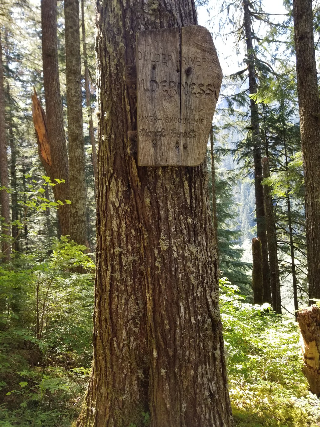
From here, the way becomes a true trail. The trail turns into creek a few more times too (seriously you have to actually hike up creek, wading and hopping through pools and boulders). This part is exciting moving through highly scenic forests with moss and flowers and majestic views! We made it to the "Boulder River Wilderness" boundary sign which is also in disrepair. We ran into some gorgeous old growth trees here, there are two especially impressive ones located directly next to the trail. They are easy to admire and readily available to hug should you wish. Look up and gaze upon their stunning height and shape!
Finally we got to one of the original blowouts that I can remember reading about in very old trip reports from the early 2000s .... With the help of my GPS I realized this was the 2100' point labeled on my "GREEN TRAILS MAPS NO 111SX" officially indicating that we had arrived at the final 2.3 miles with a 2000' gain to squire pass. There was pink tape on the other side of the creek indicating trail, and it was not too difficult to spot.
At this point it was already 3:45 pm and we had not really stopped at all to rest after all the exciting navigation through water, heat and new terrain. We decided shortly (after running into more awesome views of the three fingers) that we were content and ready to turn back.
So we sat and enjoyed some food and some rest for fifteen minutes and turned back. And I am glad that we did turn back because it took us just as many hours to get back thanks to the water crossings. With the water this deep and strong it is slow going (though highly fun). We got back to the car around 7.
Conclusion: This hike is a gem!!! It is especially great if you are looking for seclusion we only ran into one other pair of hikers all day (Memorial day). Bring water shoes. We encountered no snow. There are tons of flowers and butterflies surrounding the trail. I highly recommend this one to experienced hikers with navigation experience.
I will be back another time, or at least I will check out the eight mile creek approach. If you intend to reach Squire Pass via Squire Creek, you will need to begin early.
This trail could use some clipping and trimming. Otherwise surprisingly easy to follow besides the many creeks and blowouts. The final two miles that we did not hike involves a 2000 foot gain and I hear it is also overgrown and underwater, so this hike is definitely a piece of work.
I was inspired to check out the area thanks to "101 hikes in the north cascades" by Ira Spring and Harvey Manning, the second edition, published in the 70s.
I will be back when I am in the mood for more punishment I mean adventure :D
Comments