We are the Mountain Goats, Nathan (14) and Terrence (12) and this weekend we brothers climbed The Brothers.
We got to the Lena Lake parking area at around noon Saturday, and it was completely full - we had to park quite a ways down the road. Please note that this trailhead requires a Northwest Forest Pass since it's federal land, NOT a Discover Pass. We saw many cars getting ticketed for the wrong pass.
We left at 12:30 in overcast weather, but that was nice for carrying heavy packs. The trail to Lena Lake is well maintained, fairly flat, and easy to follow. It was a nice leisurely way to start our adventure. Lots of people out, and at the lake there were tons of people setting up camp. The creek crossing on the north side of the lake really isn't that bad despite what some reports say. After the lake we entered the Valley of Silent Men which truly reflected its name. There was so much moss and it's so green with huge trees, devils club and lots of blow downs and obstacles. It was so beautiful and we felt like we were in a Lord of the Rings movie! At this point it's easy to get off the trail - GPS helped a great deal. There is one very difficult creek crossing where the log is at an angle and we ended up crawling across.
At 4:30 we arrived at Climbers Camp which is 6 1/4 miles in at 3,000 feet. We got a really cool camp spot right where the creeks come together next to another couple, Julie and Brian, who were very nice and who we saw for most of the rest of our trip. They helped us start a great campfire, which you can do here because it's below 3,500 feet. We had great white noise from the raging creek and slept pretty well. There are several camp sites hidden up and around this area, and there were two or three other small groups.
The next morning we got up with the sun, had a big breakfast and hit the trail at 6:30. Navigation is tricky at the point as we headed west, following the creek over and under many fallen trees. The occasional cairn and tape blaze helped, as well as our GPS, which was critical on this trip. After a mile or so, you emerge from the trees into a huge avalanche/burn out slope that gets steep and more difficult to follow. There were a couple small parties heading up at the same time, so between us we were able to pretty much stay on the trail.
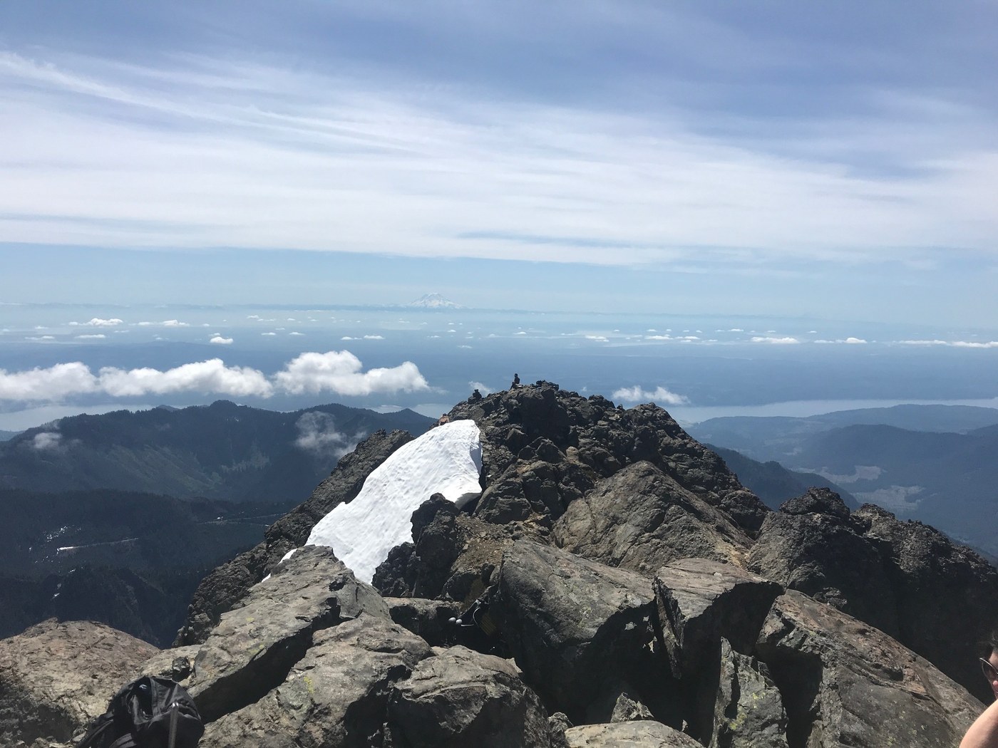
At about 4,200 feet the real fun began! Straight up south to north up a long snow slope up to the first rock band where we went left instead of right, which meant some extra dicey scrambling. We got back on the path and the snow and continued up steeper and steeper, through the hour glass and towards the summit block. Luckily the snow wasn't too hard, because the angle hear is quite steep (50-55 degrees) and so we didn't need to use crampons. We did however, have our ice axes out and ready just in case. As we headed up, there was a search and rescue helicopter that was hovering and going back and forth very low right above us. Eventually we got off of the snow and onto rock for the last 400 vertical feet or so. Again, we ended up going the "hard way", taking a left after the snow and wrapping around towards the summit block. There were some dicey, exposed moves as we went up and over a big rock outcropping before descending a bit and picking up the faint, and relatively easy remaining class 3 moves to the summit at 10:30.
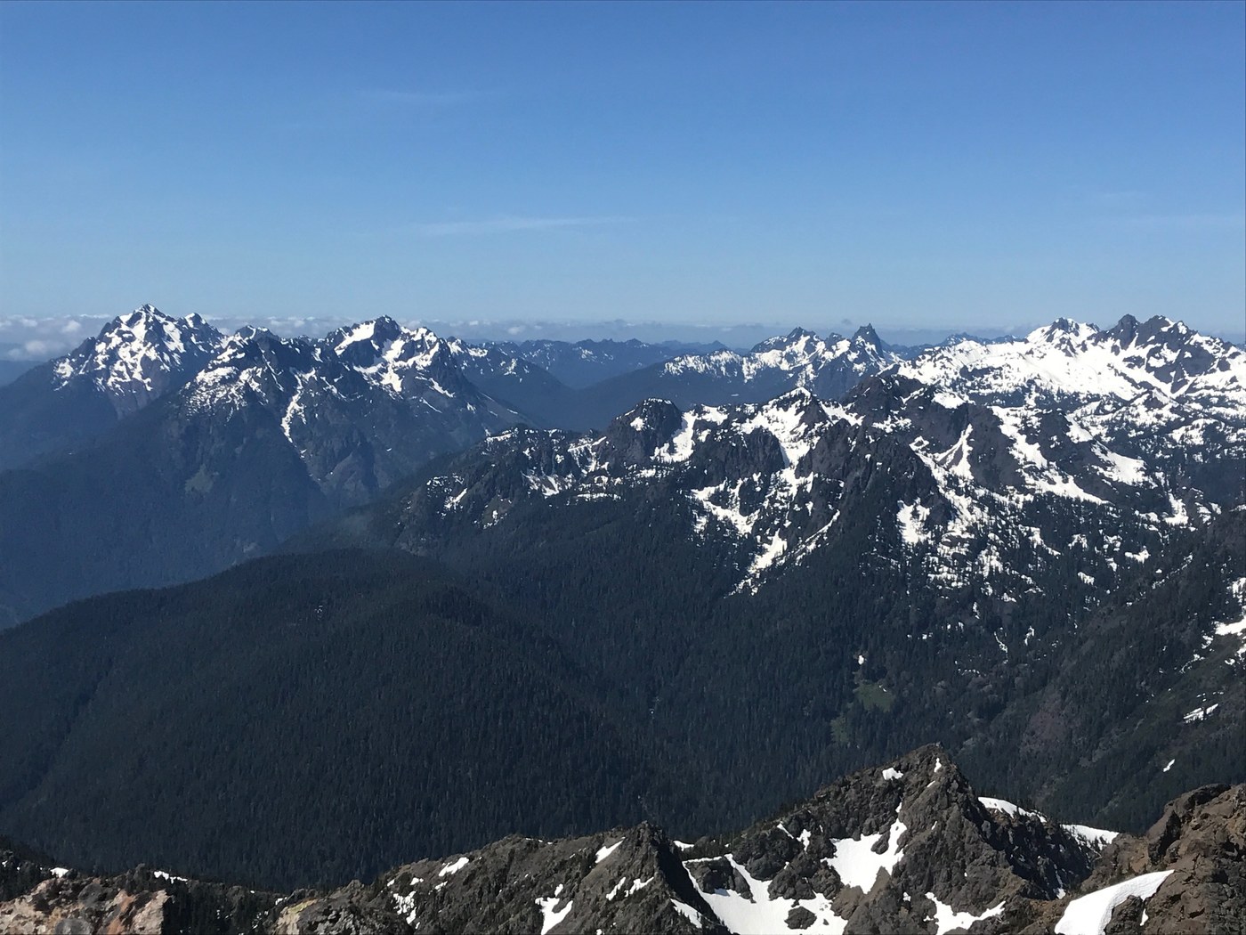
The summit was incredibly cool! The views were stellar, and we were so lucky to be up there with clear skies. We could see all the big mountains everywhere, up to Canada and down into Oregon. The views into the Olympics were insane. Mount Washington and Mount Elinor in one direction, Constance and Warrior in the other, and countless mountains in the interior. Just as we got to the top, search and rescue had left. They had rescued someone who fell on the North Brother. It was a bit windy, but the rocks were warm so we sat and lied down, eating our food, resting, and savoring the effort, slightly worried about the trip down.
Coming down the rock was actually a bit easier than we thought - slippery in some spots, but we found an easier way down and picked up the snow. There was still some good, safe glissading on the mountain, especially one last part where it was a good 1,000 foot continuous glissade. Back off the snow, it was an incredibly tiring, long trip out. We pick our way through the gully and the woods, broke down camp, soaked out sore feet in the creek, and headed out for the last 6.25 miles to the trailhead. Summit to camp was about 3 hours 20 minutes and camp to trailhead was 3 hours 30 minutes. We were so tired we could only go so fast. Sore legs, aching feet, and tired shoulders. Hungry and tired we got to the car at 7:40.
Unfortunately, everything was closed in Hoodsport, and since we're kids, the Lucky Dog Casino denied us entry to the restaurant, so we had to go all the way to the Little Creek Casino outside of Shelton. It was a long drive, but we had some great food at one of the restaurants there!
Not sure why some descriptions say this is 13 miles. The Brothers is just under 18 miles round trip. We were kind of surprised at first that there weren't more people, but actually this hike is so long and difficult and a little dangerous in spots, it's not surprising that there weren't a lot of people. This is a really tough one, but so worth it with the unique rain forest, beautiful mountain and amazing news! Thanks for readying and happy hiking!


Comments
Just incredible...great report and photos
Posted by:
seattlenativemike on May 28, 2018 12:35 PM
Thank you!
Posted by:
Mountain Goats on May 28, 2018 03:35 PM
Is ‘climbers camp’ still snow covered?
Posted by:
TimsToursNW on May 31, 2018 10:59 PM
Hi - No snow at all at climbers camp and plenty of running water. No snow until after the burn area and you start up the slope.
Posted by:
Mountain Goats on Jun 01, 2018 01:12 PM
Great description! This is Julie....it was a pleasure meeting you and the boys! I registered just so i could comment and say hello! I'm confused about the distance too. Seemed longer than described but i didnt track it so that could be my fatigue talking. Definitely a challenging hike! Looks like your boys are going to be quite the climbers!
Posted by:
Friedle on Jun 01, 2018 07:11 AM
Hi Julie! thanks for commenting. We really enjoyed meeting you and also being able to go up together. Our dad's GPS said just under 18 miles and it's usually pretty accurate. Thank you for your support and maybe we will see you again in the mountains some day.
Posted by:
Mountain Goats on Jun 01, 2018 01:17 PM
So, after arriving to the base camp which direction do you hike? I can't find any maps of the trail beyond the base camp. In your description you said it was difficult to see. Is it easy enough to find for someone who has never done the hike? I'm planning on going this weekend. Getting up there Friday night, and hiking to the summit Saturday (Jun 15-16, weather permitting) if you are interested in doing it again.
Posted by:
MolokoMan on Jun 11, 2018 03:31 PM
Hello. We attached the link to the GAIA track that we created. We couldn't figure out how to to upload it to All Trails. We never did the hike before and we were able to manage OK since we did some research before. You should check the Summit Post description (we attached it below). In that description is a really good GPS record by Gabriel Deal. Our dad copied that track on his phone and it really helped. One suggestion - after we set up camp, our dad went exploring to find the trail for the next day. You head northwest up along the creek that goes to your left. He went up about 1/2 mile and so the next morning we at least knew where we were going. If you camp where the two creeks come together, you'll see what we mean. Hope this helps and good luck!!
Our track
https://www.gaiagps.com/datasummary/track/90402c5f966f4d1d43bf6f8630403ff8/?layer=openhikingmapHD
Summit Post - this is very helpful and the GPS track we mentioned is there.
https://www.summitpost.org/the-brothers/517714
Posted by:
Mountain Goats on Jun 11, 2018 08:46 PM
Another comment, sorry. Are you able to upload your GPS info to AllTrails.com? Then you can map it for everyone else and that would be amazing!
Posted by:
MolokoMan on Jun 11, 2018 03:32 PM
Also, if you download the GAIA app to your phone you can upload tracks that other people have uploaded to the site
https://help.gaiagps.com/hc/en-us/articles/115003526307-Add-Public-Tracks-to-your-Account
Posted by:
Mountain Goats on Jun 13, 2018 10:23 AM
That's great, thank you. I have never used this app before. Exactly what I was looking for!
Posted by:
MolokoMan on Jun 13, 2018 04:11 PM
Great review, thanks!
Posted by:
SECO on Jun 14, 2018 01:31 PM
Thank you for reading!
Posted by:
Mountain Goats on Jun 15, 2018 08:50 PM
Fantastic report!! I'm mostly a hiker and do a little scrambling, I have always wondered how much of this would I want to hike. Your report gave some great details which answered that question. All of the details were put in context, you equated your abilities and comfort level with the challenge.
Posted by:
AlpsDayTripper on Jul 27, 2018 01:21 PM
Thanks a lot for the nice words, and thanks for reading! Have a great summer.
Posted by:
Mountain Goats on Aug 03, 2018 04:54 PM