Two days of continuous larch views. Many people had flocked to Carne Mountain to see the larches, with probably 50-100 cars in the parking lot. Once past Carne mountain, however, saw few people, and the Ice Lakes themselves don't seem to be too popular, but are quite spectacular.
Itinerary: Day 1: Phelps Creek TH, Phelps Creek Trail -> Carne Mountain Trail -> Carne High Traverse. Where Carne High Traverse diverges from the Mt Maude bootpath went right up the ridge to the saddle above Upper Ice Lake. ~2/3 up Maude from the Upper Lake for sunset. 11.2 miles, 6859 ft gain, 3085 ft loss.
Day 2: Explored around the lower lake and upper lake. Rejoined the Carne High Traverse. Went about halfway up Seven Fingered Jack before turning around with mountain being socked in. Leroy Basin Trail -> left on Phelps Creek Trail. 15.5 miles, 2821 ft gain, 7328 ft loss.
The larch trees are incredible once you hit about 6k ft on the Carne Mountain Trail and don't stop until you begin descending back towards Phelps Creek many miles later.


The trail disappears a few times between Carne Mountain and Mt Maude, so it's useful to have a map or GPS device. There was a light dusting of snow in places, up to 6in deep coming down the saddle above upper Ice Lake. For sunset we made our way ~2/3 up Maude, but the sun set a little earlier than expected, so we didn't continue all the way to the top, but there were some nice views of Glacier Peak, Rainier, and Buck, among many others from the ridge up Maude.

Got quite cold at night, probably low 20s or high teens.
The next morning we explored the lakes further. Looking east towards the Spectacle buttes provides great sunrise views:

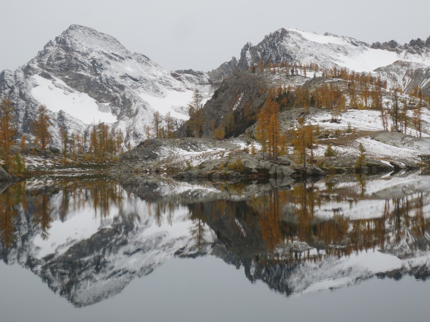
The lower Ice Lake offered perfect reflections of the surrounding larches and snow-dusted mountains.


Then we scrambled back up above the Upper lake and descended to its northeastern shore. The area around both lakes is covered in pumice. The upper lake also had spectacular reflections:


Still plenty of larches going along the Carne High Traverse towards Seven Fingered Jack:

We started about halfway up 7 fingered jack on the way out but we were running out of time and the clouds were moving in, so we decided to skip the summit.
Road: The road is about as bad as it's hyped up to be. We parked our low clearance car about two miles short of the Phelps Creek TH, where the road splits from the one towards Trinity. Easily able to hitch a ride on the way up, hiked the way back out. Even the SUV we rode with on the way up bottomed out on a large rock. And some people we talked to said last year they tore off some of the underside of their car. Lots of several foot deep ruts and protruding rocks.


Comments
bertman4 on Ice Creek - Ice Lakes, Leroy Creek High Route, Carne Mountain, Carne Mountain High Route
Thanks for the trip report. It helped me out quite a bit. I went Oct 13-14, staying at Ice Lake. I was pretty beat so did not explore the lakes but headed straight out.
Posted by:
bertman4 on Oct 16, 2018 10:28 PM
CascadesAndCoffee on Ice Creek - Ice Lakes, Leroy Creek High Route, Carne Mountain, Carne Mountain High Route
Glad it was helpful!
Posted by:
CascadesAndCoffee on Oct 16, 2018 11:13 PM