

A work crew is using explosives near this route (White Mountain area) from the 9-15 August, but the trail is not closed. Possible noise and delays. However, the 7 mile final section of road going to this trailhead will be closed Aug 19-30. Call 360-436-1155 for info.
I started my clockwise 3 day version of this hike at 2:15 pm on a Tuesday. If you're doing 3 days as well I recommend this time as it puts you above the tree line with late afternoon sun behind you at a pleasant angle for nice temps, no glare, and good coloration of the landscape. If you're doing two days consider an 11:00 am start for some of this benefit but with enough time to reach Blue Lakes camp before dark.
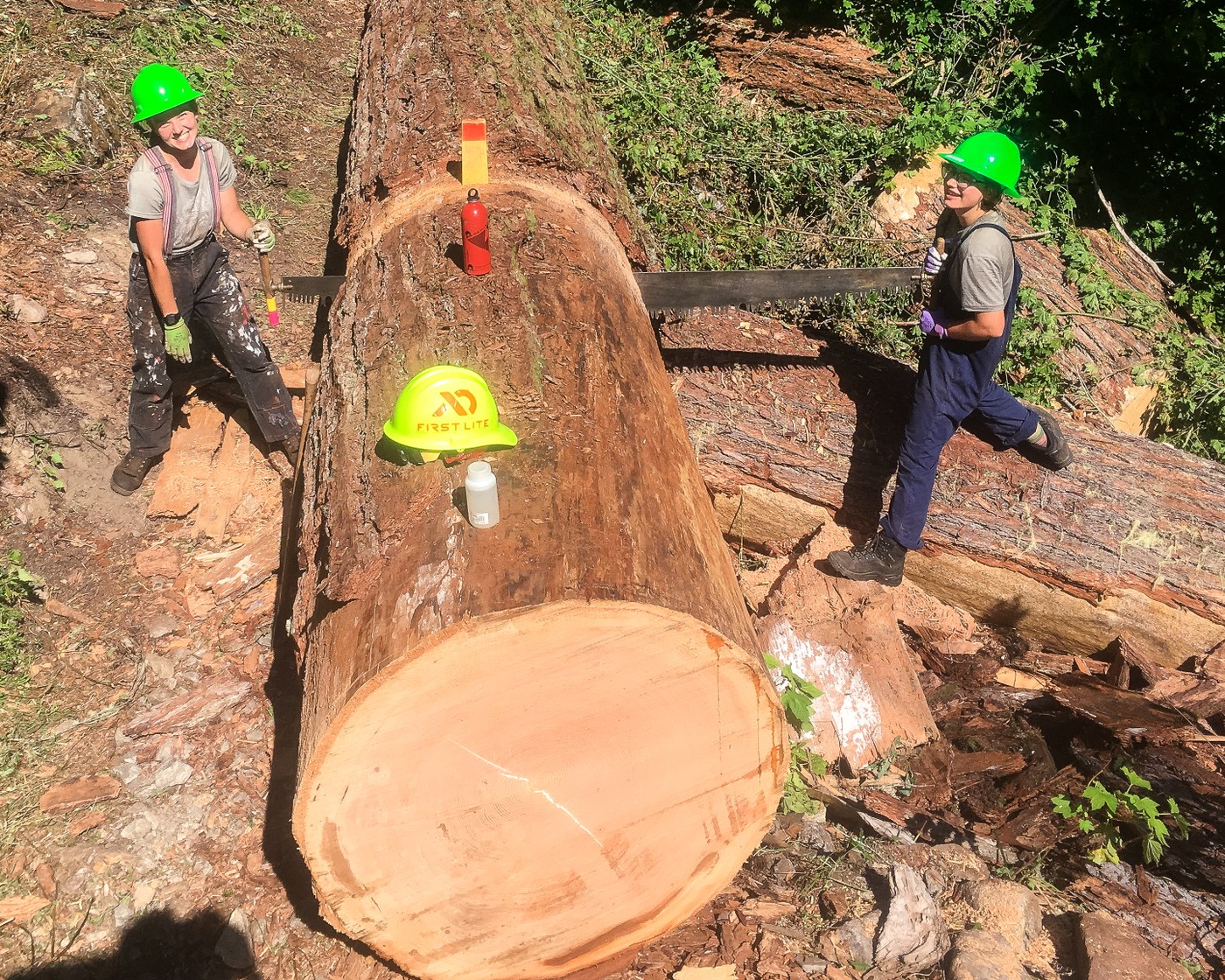
The 1st 1.9 miles of the trail are old growth with smooth, manicured tread, and the sounds of the North Fork Sauk River running nearby. It was within this section that I lucked upon two unlikely looking trail workers. Juli & Kal Cia ...all combined 200lbs (: of them, wielding a huge hand saw to cut through a 16' diameter(?) newly fallen tree. Thanks girls, you seriously rock!
At the Pilot Ridge trail junction, go straight/left and continue until you get to a "shelter" on your right. Actually, a pile of wood rubble. Go to the river and fill up if you don't have at least 32oz of h2o or you'll regret it. You're about to turn UP into a 3 mile 3k' section section of trail that, thankfully, passes among the sporadic shelter of trees 2/3 of the way, but it's still steep and hot. Emerging eventually into a hillside meadow with views and a good supply of blueberries (at the time of this writing). From this point until half way between Blue lakes and the trailhead, many miles ahead, views abound and there's no shade so I was happy for the cover of my hat.
After camping just below White Pass I rose early and enjoyed jaw dropping views and a relatively short hike to Blue Lakes. In the middle-ish taking a side trip up a peak (name?) for a coffee and brunch break with incredible views. At Dishpan Gap I hung a right, as per the trail description, and took the high route up and over the ridge above Blue lakes. This is .5 miles and 700 ft gain. Beautiful without any serious exposure on the upside. Once over the ridge it's similar with two notes. I would personally not consider doing this if there was snow! Second, the notes mention scree fields and footing. I estimate the slippery section to be only 20' wide and near to the bottom. Easy. I don't use them, but surely many may find comfort in the use of poles on the upper route do to the narrowness and steepness of the trail.
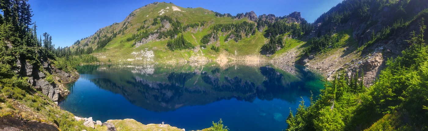
The lakes are gorgeous and incredibly clear. Swimmable temp by alpine lake standards. So blue. Trout, fishing birds of prey, and an amazing hillside backdrop to ponder through a long day of snacking, reading (audiobook actually), and quiet contemplation.
On day three the trail was easily obtained by reading the trail description. I didn't venture up Johnson Mountain as the view seemed likely to be similar to the one I got on my side trip the previous day albeit from a slightly different angle and somewhat greater elevation. I'm glad I didn't because this was a strenuous day by the end. The views are superb right up until the last third when you again regain the welcome shade of trees, and that's also when you encounter a lot of up and down elevation. Much of it with the now familiar 1k' per mile theme. Lots of mushrooms, marmots, flowers and chipmunks. One of my favorite hikes.
The biting flies and mosquitos were plentiful and at times, annoying, but my deet-free repellent kept them from biting me. Mostly.

Comments