

Wow, what an amazing hike! Everything went right from the weather to the lack of bugs and people to all the black morels! Paper maps of the area were hard to come by so we wound up using Gaia as our main source of navigation, which worked pretty well though there's a few things to be aware of that I'll detail below. There were LOTS of blowdowns and some washouts, but nothing too hard to deal with.
We started at the Panjab trailhead, which was easily accessible from any vehicle. On the first day we hiked the Turkey Creek trail to the TeePee trailhead. There were a few creek crossings but nothing major. We spotted a few morels along the trail, and a couple bear's heads too (my personal favorite). There was one campsite along the creek, but I suspect all the others were washed out. The TeePee campsite was fantastic though, with a toilet, picnic benches, a spring, and a great view! The spring was a little bit hard to find, especially without GPS, but it's directly down the gully below the firepit behind the bathroom. You'll know it when you find it though, there's a hose and a trough.
The second day we hiked to trusty Oregon Butte spring, dropped our packs, then went up to the fire lookout where the watch lady had just returned to duty for the season. She was extremely friendly and knowledgeable -- she's been keeping watch there for 17 years! We then took the trail towards Danger Point but turned back about half-way because we weren't feelin' it. We rejoined our packs and set off along the Mount Misery Trail towards Indian Corral. We *didn't* refill our water at the Oregon Butte spring before we left, which was a mistake. We couldn't find Emergency Spring or Tablecamp Spring, but we pushed on anyway and were very relieved to find Dunlap Spring flowing nicely when we got there with empty canteens.
Indian Corral was a lovely place to spend a couple nights, with several good campsites scattered around the area to choose from. We wound up camping at Dunlap Spring since it had the nicest site and easy access to water. If you come to a National Forest sign pointing towards Third Fork, that's the way to Dunlap spring. The next day we left our packs at camp and did a day hike along the Mount Misery Trail to Squaw Spring. We stopped for a snack at Bear Wallow though we didn't find the spring (we also didn't look very hard), then pushed past Clover Spring -- which was flowing nicely -- to Squaw Spring, which was also flowing nicely and had a very established camp site at it, though perhaps too established since that's the only place on the trip where the flies were bad. Otherwise there were no mosquitoes or ticks, and the flies generally left us alone.
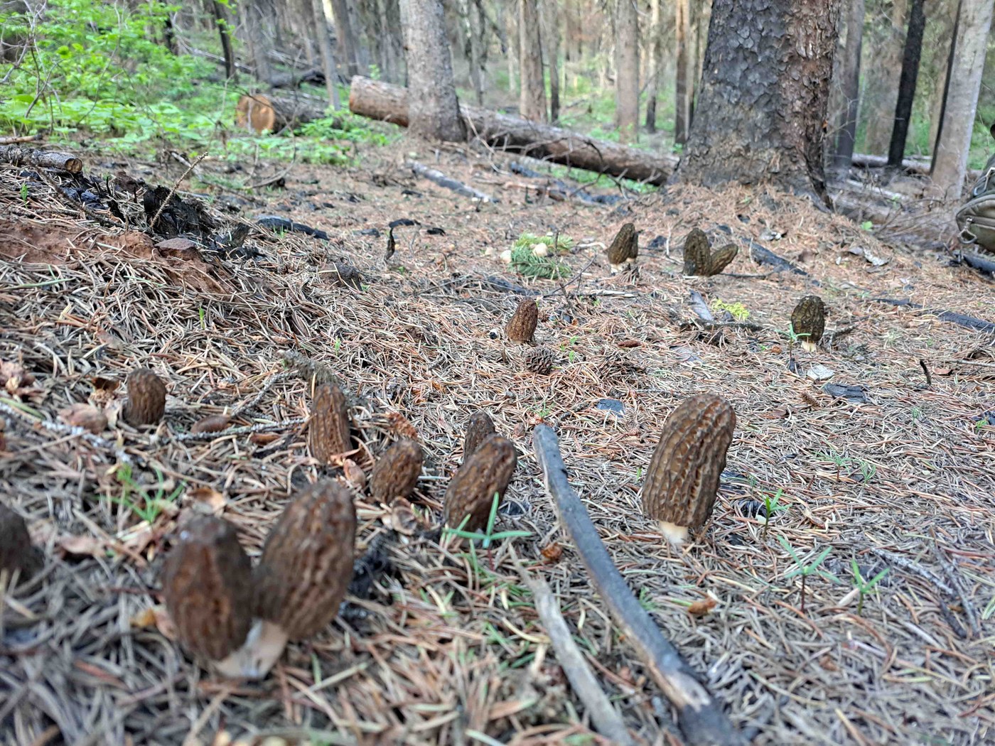
We had lunch at Squaw Spring then went back to camp and spent a little while hanging by the creek and hunting morels which were littering the forest floor. For almost the entire hike anytime we were in a pine forest if we stopped walking we would certainly find a morel, but most of them were old. We found a spot full of prime morels though, and easily cut our fill. The fourth day we took the Panjab trail back to the car. After the first day almost all of the hiking was on exposed ridges and through burned forest, so good sun protection is a must! On the first day and the last day, down by the creeks, there was undergrowth which occasionally included stinging nettles (the Danger Point trail had some too) and a few muddy/boggy spots. The Panjab trail had a few decent washouts which I'm guessing would be easier to navigate going up than going down. The Grizzly Bear Ridge and Crooked Creek Trail no longer exist for what it's worth.
The landscape was spectacular and there were still tons of wildflowers, though I suspect we missed the peak. We saw a buck, a snake, and we're pretty sure lots of signs of mountain lions. If you're an experienced backpacker with reasonable route finding skills you shouldn't have much trouble with these trails, though do be mindful of water and the sun.


Comments