
Another disappointing hike due to people/Instagramers who have no respect and/or understanding of leave no trace principles (LNT). I lost count, but there were multiple wads of toilet paper laying RIGHT next trail :( Including one wad left within a short walking distance of the toilet at Summerland camp. Please stay home and stop ruining the outdoors or pack it out!!!
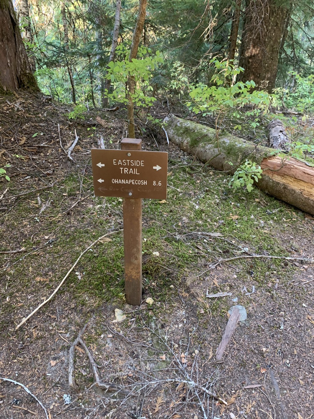
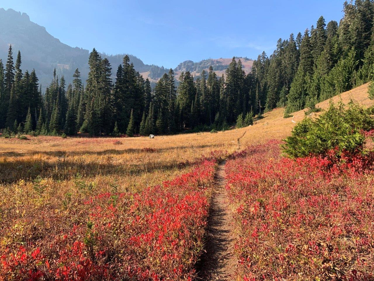
After picking up self-issue permit, decided to start at Owyhigh Lakes, off Hwy 123. Started Saturday afternoon ~11:30 am. There were 3 other cars at "TH"/pull out along the side of road that may fit ~7 cars. Hiked Eastern Loop clockwise. The Eastside trail from Deer Creek camp to Grove of the Patriarchs/Stevens Canyon entrance is pretty flat, cruiser trailer, except for the multiple down trees you have to go over or around (nothing difficult). The foot/log bridges have all seen better days (i.e., they are slanted, some more so then others). They were dry, so no problem crossing any of them. I averaged ~2.7 miles/hour on this section. I could hear cars along parts of this stretch. There is some water access along the trail. The side trail to Grove of the Patriarchs was roped off and said it was closed due to bridge being out. From Grove of the Patriarchs, I headed right along road to access Cowlitz Divide TH instead of staying on Eastside trail. Trail gains elevation, but overall trail is in good condition. Olallie Creek camp has a toilet and the camps are tucked among the trees. There is water here. At Wonderland junction, took a right. ~5500' there are great 360 views, including Rainer, Adams (although viability was limited due to Goat Rocks fire), etc. Met a nice guy who started running the entire Wonderland Trail the day before and was ~70 miles in. From here start dropping down to Indian Bar. Enjoyed the views at Indian Bar and filled up water. I met a volunteer with https://www.cascadescarnivore.org/ who was on her way to check cameras in the area and put out some tasty treats for the carnivores. The hike from Indian Bar to Panhandle Gap seemed very slow going between elevation gain and regular stops to enjoy the beauty and catch my breath (averaged ~1.6 miles/hour). There is water along the trail before and after Pandhandle Gap. No snow. After Panhandle Gap on saw 5 goats on the hillside to the left and a heard of ~11 on far hillside to the right. The last of the day hikers were leaving as I arrived Summerland on Sunday night. 2 other groups camped at Summerland Sunday night. 3 deer (buck, mama, & doe) were grazing through camp Monday morning. Trail down to Fryingpan Creek TH is in good condition. To complete the Eastern Loop, I walked along road until I arrived at Owyhigh Lakes TH. Trail gains elevation and is primarily in the trees/shade. Some down trees. Again, nothing overly complicated to go over or around. Tamanos Creek camp is in the woods and ~.5 miles from Owyhigh Lakes were the views opened up. Beautiful fall colors. I thought about getting water from lakes, but the water didn't look that nice and I still had a little left. But if you need water, get it here, since the next water source is closer to Deer Creek. Trail back to Deer Creek camp/TH is primarily in the trees and a semi-cruiser trail as the trail descends. Some more down trees and foot bridges that have seen better days. Arrived back at car Monday evening. No other cars. Smoke really rolled in Sunday night/Monday. I'm not a trail runner, but the Eastside trail and Owyhigh Lakes trail would be good trails to do so. Passed another trail runner coming down Owyhigh Lakes trail.
Happy Trails!


Comments