
Summary: strenuous uphill, expansive views start at 0.7 miles and do not disappoint, tons of tree blow downs especially on the downhill side.
There are two car camping campsites, across the highway from the Goat Peak trail head parking lot. They both have vault toilets, and were supplied before and after the hike with toilet paper.
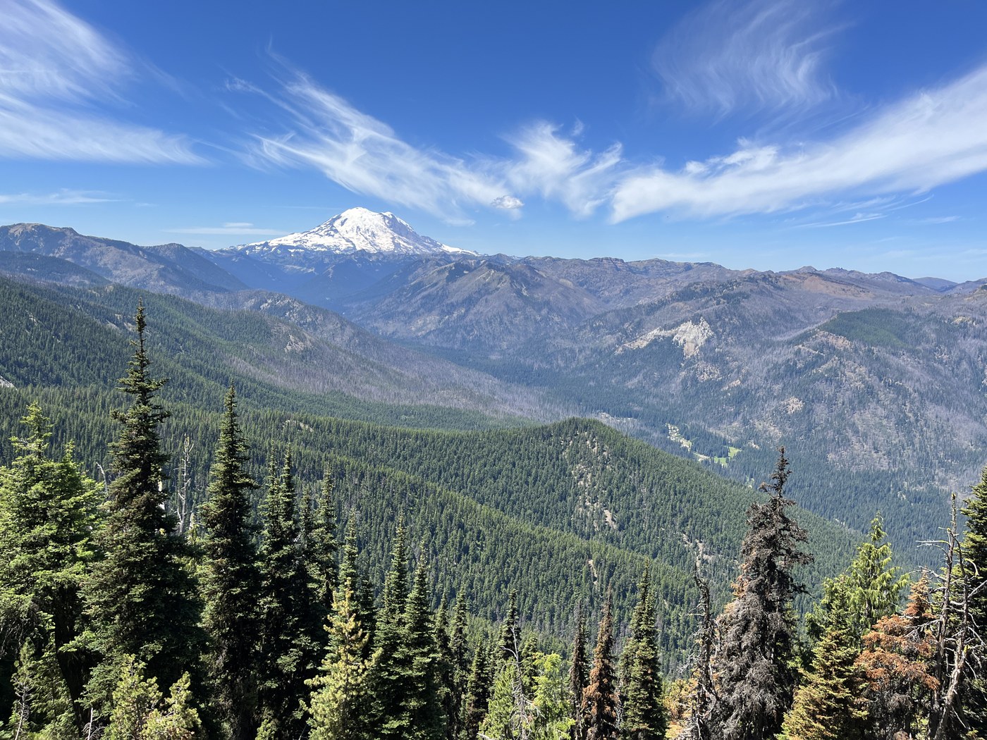
We traversed to Goat Peak Loop clockwise starting with the big climb. The initial part of the trail was in full shade and kept close to a creek. There were half a dozen three blood downs in the first half mile. By 0.7 miles the trees stand out enough to give expansive views of the mountains to the north. For the next mile, the trail darted in and out of tree cover giving views to the north and east. At 1.5 miles the trail cut to the other side of the ridge line and you get your first views of Mount Rainier. It is a steep and strenuous hike so we were grateful that the tree cover continued periodically, but we were also grateful for the continued magnificent views to the north east and west where Mount Rainier is. We took it very slow and steady and made the 3200 feet ascent in about three hours. Well worth it; the 360 views on a nearly cloudless day were spectacular! Right at the very very top it was super buggy. So we moved down just a little bit and had our lunch in the little bit of shade, still with great views.
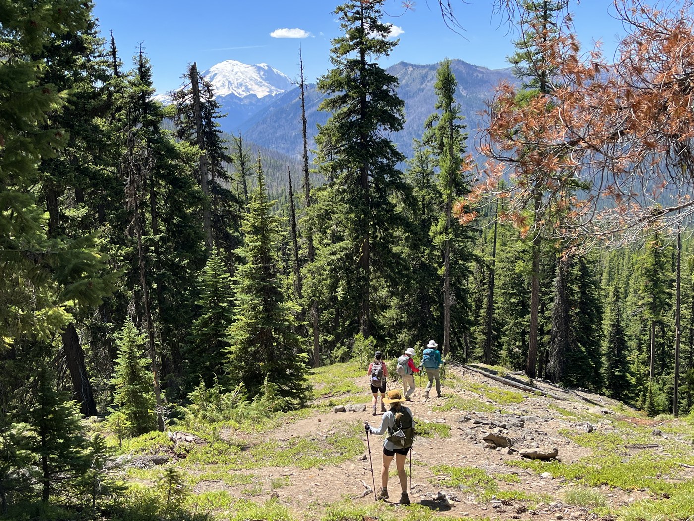
We started our descent. It was still quite deep, descending 3000 feet in ~4 miles. We were on the American Ridge Trail for 1.1 miles and then took the Pleasant Valley Lake Trail. There were several blow downs on the trail up to Goat Peak, but the number of blow downs on the way down was incredible. I don’t think it’s an exaggeration to say that we had to climb over, under, or go around at least 100 downed trees. This definitely slowed our pace. A large part of the trail is through a burned area where about half of the trees were burned. Many of them are still standing and dead, but many of them have also fallen across the trail. Because of the century canopy, there was a lot of sun during the hottest part of the afternoon. But it also allowed us to have continued views of Mount Rainier.
At 6.8 miles we reached the Pleasant Valley Loop trail, which followed that picturesque American River. I wish we had built in a little extra time to go down to the river and wade in and cool off. I’ll definitely put that on the list for next time. This section of the trail was completely flat so we were able to make good time for our last 2.2 miles back to the trail head. The car thermometer said 82 degrees. I drank about 3 L of water during the day. We did not pass any water sources on the uphill or downhill parts of the trail after 0.5 miles until the trail got near the American River.


Comments