
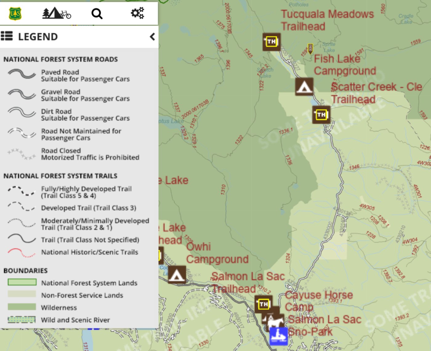
This is not a report of the Report "titles" Trails (off NF 4330), but of the Road Condition of NF 4330 (~15 miles between Tacquala Meadows and Cayuse Horse Campground).
In the Forest Service Interactive Visitor Map, NF 4330 is shown as "Dirt Road Suitable for Passenger Cars". However, during my 19oct2023 drive, i found it to be - generally, "Gravel Road Suitable for Passenger Cars".
Link to my "movie" of Driving NF 4330 (from Tacquala Meadows towards Cayuse Horse Campground) >> https://photos.app.goo.gl/sCh3xtxmARXbbwM48
imho, the ~3+ miles between Tacquala Meadows TH and the Scatter Creek "water-crossing" was much better driving and road condition. It was mostly 2_Lane with a few spots (at/near the road bends) where it "narrowed" to ~1.5_Lane.
The ~12+ miles from Scatter Creek "water-crossing" to Cayuse Horse Camp was "fair" driving and road condition; washboardings, some potholes, and the occasional road shoulder "steep" drops.
i am no expert Off-Roading, but driving on Gravel could be iffy .. especially, when driving on/near the road shoulder - which may be un-compacted Gravel; and so there's the risk of "sinking", "dropping", and/or "sliding" off the road. Also, do drive at a safe s-l-o-w speed - brakes doesn't work (well) on Gravel 😅
Anyway, imho - NF 4330 is a pretty good Forest Service road .. Thank y'all NF for your difficult and hard work maintaining the FS roads.
It took me ~1.5 hrs driving the ~15 miles (Tacquala Meadows TH to Cayuse Horse Camp), including the many stops i made to safely shoot the photos (for the "Movie") .. 🙃
Be safe and happy driving 🙂
Comments