Fall Hikes for Families
The beauty of fall colors is a beautiful reason to get out on trail. The days are shorter, but those pests — the mosquitoes and flies that bothered kids during summer — are gone. The light is beautiful and you may get to enjoy to beautiful moodiness of a foggy day and fall colors.
Do be aware that hunting season will be starting and plan around it. If the sound of distant guns would bother you or your kids, consider hiking in national parks and on beaches and shorelines during the season. Remember too, that weather is changeable. Bring layers of clothing, rain gear and treats to keep the kids warm and fed. Consider bringing a thermos full of hot chocolate or soup for chilly days.
We've collected hikes that provide excellent opportunities for exploration and discovery in the fall. Make a plan now to get out with your kids this October and November — and you may find that autumn becomes your favorite season for hiking in Washington.
North Cascades
Point Whitehorn
Location: About 30 miles from Bellingham
Length: 4 miles, roundtrip
Elevation gain: minimal

Explore both the forest and shoreline at Point Whitehorn. Photo by Tiger Hiking.
Explore both wetland and sea shore along the Point Whitehorn trail. During the fall season, cottonwood and maple trees can been found in vibrant colors. Keep an eye out for wildlife in the sky and the water along the 2+ miles of public beach. Wheel strollers and wheelchairs can be used through the wetland and forest for the first 0.75 miles of the trail, however reaching the beach requires descending a steep bluff and stairs.
> Plan your trip to Point Whitehorn using WTA's Hiking Guide
Bagley Lakes
Location: Mount Baker Area
Length: 2 miles, roundtrip
Elevation gain: 150 feet

This hike around Bagley Lakes at Heather Meadows is fun for all ages. Photo by geezerhiker.
Two lovely alpine lakes lie in the Heather Meadows recreation area at Mount Baker. The first is a man-made reservoir, the second lies in a deep cirque under Table Mountain. When the trail is open and the snow is gone, it is easy walking for children, with a dam to walk across, two lakes to throw rocks into, berries to pick, ice cold water to put toes into, and a year round snow slope to play on. Fall color can turn entire hillsides scarlet and crimson.
Look for the Herman Saddle-Bagley Lakes trailhead opposite the ski lift. The trail descends sharply for 60 feet, crosses the dam, and with some ups and downs, traverses the first lake to the second. You can stop at a small beach there to enjoy water games. Even in fall you can expect wet sections. To return, you can connect to the various loops, which saves backtracking.
> Plan your trip to Bagley Lakes using WTA's Hiking Guide
Old Sauk River Trail
Location: Darrington area
Length: 6 miles, roundtrip
Elevation gain: 150 feet

Enjoy a leisurely stroll along the Old Sauk River Trail. Liz M.
While this nearly flat river ramble is nice any time of year, it's particularly lovely in the fall when you'll find glowing fall colors and probably plenty of mushrooms to admire. The trail is lush and green, and you can hear the river as you walk. There are a few places to access the river edge, and you should watch out for wildlife, including eagles and other birds. This hike includes an ADA accessible loop. If you'd like to hike only that section, it has its own trailhead.
> Plan your trip to Old Sauk River Trail using WTA's Hiking Guide
Sauk Mountain
Location: Highway 20
Length: 4.2 miles, roundtrip
Elevation gain: 1,190 feet

Take in the abundant plant life at Sauk Mountain. Photo by dannyfratella.
Sauk Mountain in the North Cascades is unique for several reasons. Families start hiking in alpine meadows, and even the views from the trailhead parking lot are sweeping vistas of the meandering Sauk, Skagit, and Cascade Rivers, alongside major peaks. The whole trail is a steep alpine meadow. Twenty-eight switchbacks lead you up through grasses, blueberries, fireweed, paintbrush, heather and a few clumps of trees. This trail is not for toddlers because it gains 1,600 feet in 2½ miles, but it's great for older kids. Watch for marmots and you hike. And on the earlier end of fall, you can find berries. At the top, you can see Mount Baker, Mount Shuksan and Whitehorse Mountain. You can see why there once was a lookout posted on this high and lovely spot. Note that, because this hike is so high, it's likely to get snow early. Check conditions before you go.
> Plan your trip to Sauk Mountain using WTA's Hiking Guide
Puget Sound and Islands
Washington Park arboretum
Location: About 5 miles from Seattle
Length: 5 miles, roundtrip
Elevation gain: 50 feet

View the changing leaves at the Washington Park Arboretum. Photo by Hiking Nerds.
The Washington Park Arboretum is only a short trip from Seattle and has so much to do, your family can visit again and again to find new adventures. See all the colors of fall at the Park’s variety of themed gardens like the Woodland and Japanese Gardens. There are plenty of paved hikes through the trees perfect for leisurely strolls. Dogs on leashes are allowed, so pack a picnic and spend the day with the whole family.
> Plan your trip to Washington Park Arboretum using WTA's Hiking Guide
Iceberg Point
Location: Lopez Island
Length: 3 miles, roundtrip
Elevation gain: 50 feet
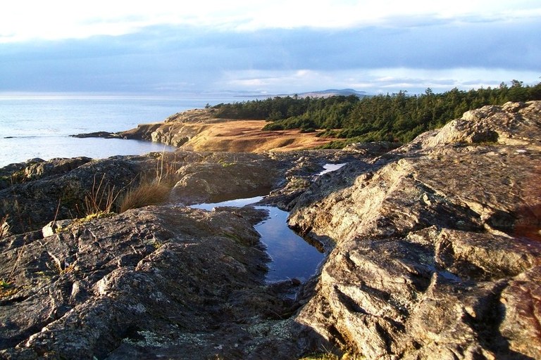
Bring your family to discover the beauty of the San Juan Islands at Iceberg Point. Photo by tess.
Kids and grown ups will be thrilled with the rocky reefs, sweeping overlooks of the south end of the island, and glimpses of seals and spouting orcas. The trail is short, though it passes through an easement on private land — be respectful and stay on trail. Yellow grasses and rose hips are fall accompaniments here. After only half a mile or so, come out of the trees to a long reef of glacially carved rock, windswept trees, and at the highest point, a stone monument dated 1906. Even on a windy day, this is an exciting place. Kids can walk trails at water level as well as high above it.Views are of Vancouver Island, the Olympics, and Cattle Point on San Juan Island.
> Plan your trip to Iceberg Point using WTA's Hiking Guide
Central Cascades
Tonga Ridge
Location: Stevens Pass — West
Length: 6 miles, roundtrip
Elevation gain: 1,200 feet

View vibrant colors on the Tonga Ridge trail. Photo by Soosh.
Tonga Ridge is one of the best trails for dazzling fall color and ripe berries in the fall. Don’t expect to be alone, however, and don’t expect to be the only berry picker. Half a mile in, enter the Alpine Lakes Wilderness, and after another half mile, find yourselves in the midst of huckleberries and heather meadows. Carry water, as the trail is dry. Continue on gentle switchbacks as far as Mount Sawyer or as far as your kids wish, watching for deer and gorgeous views into the Cascades. If your family is feeling ambitious — wanting more berries and views — climb up the obvious but unsigned trail to Mount Sawyer. Each step upward reveals more of the surrounding mountains to the north. Kids will delight in seeing Mount Rainier slowing unveiling itself on a clear day, and might even forget that the trail is quite steep.
> Plan your trip to Tonga Ridge using WTA's Hiking Guide
Tronsen Ridge
Location: Blewett Pass
Length: 8 miles, roundtrip
Elevation gain: 1,000 feet
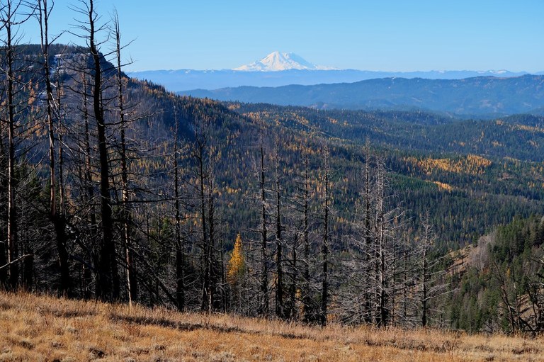
Tronsen Ridge provides mountain views and fall colors for the whole family. Photo by LuBlair.
Tronsen Ridge is an easy place to see golden larches. Is this something your kids would enjoy? You are the best judge of that. But our deciduous conifers have a mythical quality that some hikers are addicted to, for the brief period in mid-October before their needles drop. Whole hillsides are covered with golden trees during that time, and some folks plan a “Larch March” just to see them. A bonus is the chance for kids to continue their explorations in the nearby nineteenth-century mining town of Liberty, where old artifacts and mine tailings are on display. Begin in ponderosa pine forest, following Naneum Creek on an old jeep road for about a mile. Kids can create their own fantasy worlds from the strangely shaped basalt rock outcroppings and tree snags. At one mile look for the first view west to Mount Stuart and Glacier Peak. Larches begin to appear all around you from this point on. You may choose to continue your wandering through rock outcrops and shimmering trees for as many miles as you have time for.
> Plan your trip to Blewett Pass using WTA's Hiking Guide
Olympic Peninsula
gold Mountain
Location: About 20 miles from Bremerton
Length: 4 miles, roundtrip
Elevation gain: 1,087 feet
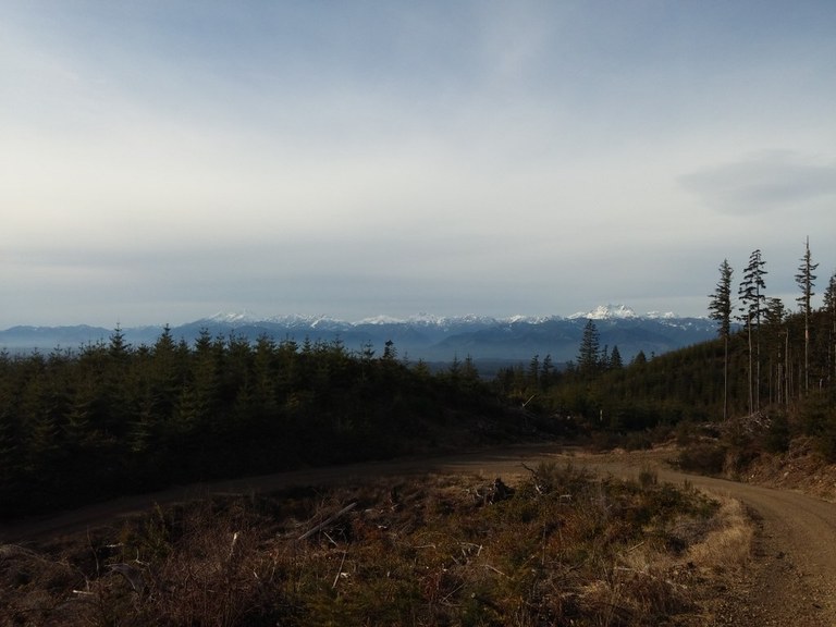
Take in the mountain views of Gold Mountain. Photo by Drew B.
Find spectacular mountain views at Gold Mountain. Mount Rainier, the Cascades and the Olympics can all be spotted along this forested trail. For a beautiful view a little closer to your feet, be sure to keep a look out for mushrooms during the autumn season. The furrier members of the family can join in on the fun too, as leashed dogs are more than welcome on this trail.
> Plan your trip to Gold Mountain using WTA's Hiking Guide
Spruce Railroad Trail
Location: On Lake Crescent
Length: Up to 10 miles, roundtrip
Elevation gain: 250 feet
![]()
Spruce Railroad Trail has plenty of maples and is nice as a short or long walk. Photo by PixelsAndPassport.
This old section of railroad trail has been turned into a lovely walking and biking path. It's great year round, but in the fall you can enjoy the color from plenty of maples. The trail is smooth and mostly flat, although there are a few sections of elevation change. Kids will enjoy the old tunnel that's about a mile in. It's not very long, so the center doesn't get too dark and scary. If your group is up for a bit of uneven trail, you can also take a side trip to the extremely photogenic Devils Punchbowl.
> Plan your trip to Spruce Railroad Trail using WTA's Hiking Guide
Hurricane Hill
Location: Near Port Angeles
Length: 3 miles, roundtrip
Elevation gain: 950 feet
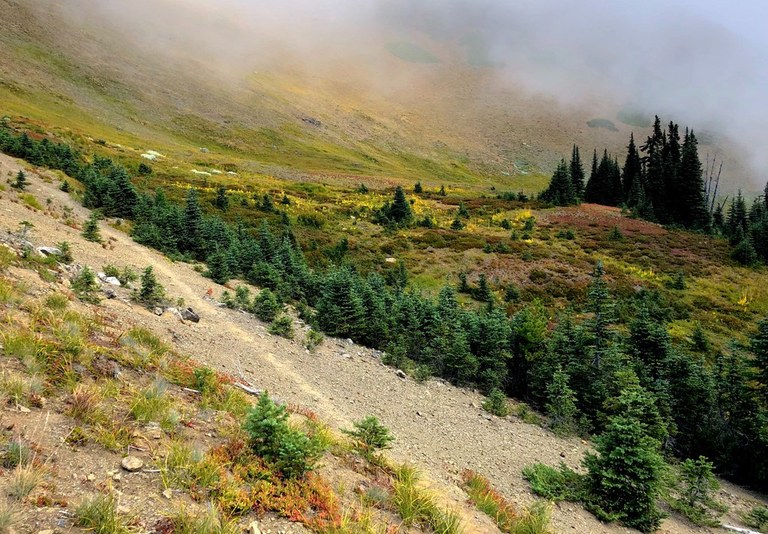
Wildflowers and changing colors can be found at Hurricane Hill. Photo by bzimmer.
Update, fall 2023: The Hurricane Ridge area is closed until December 2023 to install toilets and finish clearing debris from a fired that destroyed the lodge. But it will be open for winter sports.
Rather than requiring young kids to climb to gain elevation, the trail to Hurricane Hill in Olympic National Park begins in alpine meadows and only gains a few hundred feet. Marmots and deer are likely to share the meadows and berries with you. The paved trail for the first mile and a half means that very little kids can enjoy this scenic place. Below are Port Angeles and the Strait of Juan de Fuca. Beyond is Vancouver Island, and to the east are the San Juan Islands and Mount Baker. To the south is the heart of the Olympics, wrapped in green forests and fall colors of flaming red and orange. The kids won’t care about the views if there are deer and marmots grazing on berry bushes around them. Be prepared for the weather; storms can come in quickly here and there is no longer a visitor center after the fire in 2023.
> Plan your trip to Hurricane Hill using WTA's Hiking Guide
Third Beach
Location: Pacific Coast
Length: 3.6 miles, roundtrip
Elevation gain: 280 feet
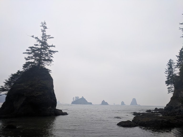
Enjoy the coastal views and wildlife at Third Beach. Photo by emeraldyellow.
This wilderness-feeling beach offers a wide sand beach along a crescent shaped shore and tree-studded offshore islands. Even in mid-winter this hike is enjoyable. Try it during a storm when your children can watch the big waves. (Just be safe — stay back from waves and warn kids about the dangers of logs rolling in waves.) The mostly level 1½ mile trail to Third Beach travels through old forest and then abruptly plunges off the plateau in a series of switchbacks before arriving at the long, curving beach of Strawberry Bay. Walk the beach ½ mile south for a closer view of the waterfall plummeting down the sea cliffs of Taylor Point into the surf. This beach offers wonderful play possibilities, including tide pools. Gray whales are often observed and throughout the year, eagles perch on snags.
> Plan your trip to Third Beach using WTA's Hiking Guide
South Cascades
Summit Lake
Location: Mount Rainier Area
Length: 5 miles
Elevation gain: 1,200 feet

Summit Lake is a great destination for the family at any time of the year. Photo by gnortsdc.
Superb Summit Lake is set on a ridge just outside Mount Rainier National Park with a knockout view of the mountain’s north side. Kids will enjoy the gradual trail, after an eroded beginning section, into old growth trees of the Clearwater Wilderness. At one mile it crosses a bridge over the outlet of little Twin Lake, which seems to have lost its twin. Both blueberries and huckleberries grow along the way and at the lake. The view of Mount Rainier flanked by foothills flaming with color is stunning. Lead the kids around the lakeshore on the right and up to a high ridge for the best views south. Or stay at the shoreline for water play and fishing.
> Plan your trip to Summit Lake using WTA's Hiking Guide
Norway Pass
Location: Mount St. Helens Area
Length: 4.5 miles, roundtrip
Elevation gain: 300 feet

Keep an eye out for huckleberries along Norway Pass. Photo by Jon Lee.
Norway Pass in the Mount St. Helens National Volcanic Monument is spectacular in the fall. Berries are ripe in early fall, and their leaves and those of vine maples and mountain ash are bright red and orange in later fall. They are just the backdrop for this spectacular viewpoint of the disaster area. You and the kids can look across Spirit Lake to the crater and steaming dome, clothed by now in the first snowfall. One third of the lake is still covered by a log raft of trees blown in by the 1980 eruption and washed into the lake. This is a 4.5-mile round trip hike, so be sure to carry water.
> Plan your trip to Norway Pass using WTA's Hiking Guide
Eastern Washington
Mckenzie Conservation Area
Location: About 30 miles from Spokane
Length: 3.3 miles of trails
Elevation gain: 436 feet

Look out for wildlife and fall colors at the McKenzie Conservation Area. Photo by TrailKat.
The McKenzie Conservation Area is a great place to teach your kids the importance of conservation. Funding from Conservation Futures made protecting important wildlife habitats in the area possible. Walk along the picturesque Newman Lake shoreline to see gorgeous fall foliage and native wildlife.
> Plan your trip to McKenzie Conservation area using WTA's Hiking Guide
Kettle Crest South
Location: Near Republic
Length: 5 miles, roundtrip
Elevation gain: 900 feet
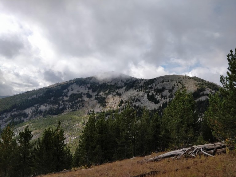
Take in the beauty of eastern Washington along the Kettle Crest South trail. Photo by ponderosa.
Sherman Pass and the Kettle Crest Trail South offers families views into the Colville National Forest, gentle switchbacks, and bright color on crisp fall days. The trail heads south from Sherman Pass, winding around the east side of Sherman Peak. Wildlife is abundant, including deer, coyotes, grouse, black bears and songbirds, with signs of the elusive lynx. Camping is available at the Pass and along the way, but you will need to carry water.
> Plan your trip to the Kettle Crest using WTA's Hiking Guide
Southwest Washington
LAcamas Park — Lacamas Creek
Location: About 30 miles from Vancouver
Length: 4.5 miles, roundtrip
Elevation gain: 350 feet
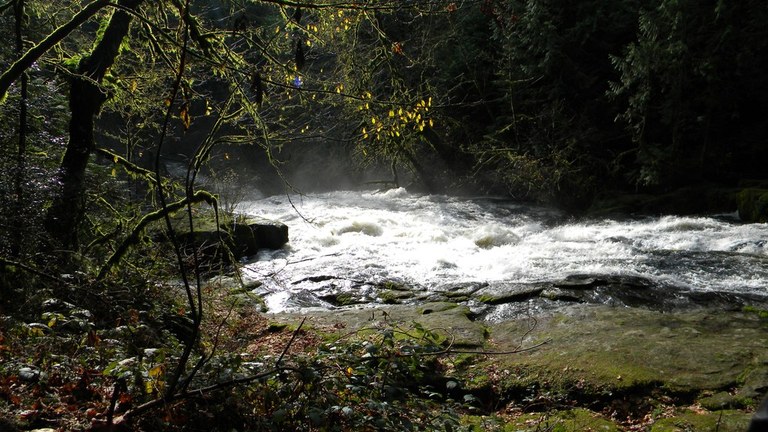
Lacamas Park provides the beauty of nature close to the city. Photo by Luis O.
Located about 20 miles from Vancouver, Washington, Lacamas Park is a great place to bring the family without having to spend too much time traveling. There are a variety of trails to choose from such as the Lacamas Creek trail. This trail along the river has waterfalls, changing leaves and even some local wildlife. The main entrance even has a playground and picnic area, so there is plenty of ways to fill up the day or the weekend.

