10 Local Loops: Spring Hikes Near Seattle
Everywhere you look, spring is in the air. Until you look at snowbound trip reports in the high country, that is. That's why these local loops well within reach of Puget Sound will keep your nature cravings satisfied until high summer. Plus, they're close enough to tackle before or after work, leaving your weekends free for brunch, chores or...more hiking!
Whether you're looking to walk around a lake, take some new hikers for a stroll or find the perfect training route, everyone loves a loop. When you never have to return from the way you came, every step forward feels like an adventure.
So while you save your big summertime loops in your My Backpack for later, you can explore some of these lower-elevation loops now.
Tips for SMART AND SAFE SPRING hikes
- It's still shoulder season.Check the forecast before you head out.
- Brush up on basics: You'll be sharing some of the trails below with other users, so refresh your trail right of way guidelines.
- Pack it in, pack it out. On every hike, practice Leave No Trace ethics. Or go beyond, and pick up trash along one of your favorite routes.
Lord Hill Loop
Location: Puget Sound and Islands -- Snohomish County Parks
Mileage: up to 10 miles
Elevation Gain: 200 feet
")
A spring view of one of the main Lord Hill trails. Others, narrower trails wind and twist throughout the park. Photo by Jon Lee.
The beauty of Lord Hill is the infinite options. It can be a maze, which means you can splice together short or longer hikes that take advantage of the 11 miles of trails running through this wild urban treasure.
You can wind your way through woods (particularly lush and green in spring) and to pocket views, but there are enough crossing trails that you'll want to take a map with you. Also, brush up on your etiquette for encountering horses (step aside and say hello to horse and rider), as you may run into a few equestrians enjoying the park along with you.
> Plan your visit to Lord Hill using WTA's Hiking Guide
Boulder Garden Loop
Location: Snoqualmie Pass - North Bend
Roundtrip: 2.5 miles
Elevation Gain: 800 feet

The trail winds by giant boulders. Photo by ccondi24.
Sitting at the foot of Mount Si, this popular loop winds through a forest littered with giant, moss-covered boulders. While it may only be 2.5 miles long, this loop gains 800 feet, which is challenge enough for plenty of hikers. Better yet, it often escapes the snow-cover of Mount Si's higher elevation.
> Plan your visit to Boulder Garden using WTA's Hiking Guide
Phantom Lake Loop
Location: Puget Sound and Islands - Seattle/Tacoma
Mileage: 3.2 miles
Elevation Gain: 130 feet

View across Phantom Lake. Photo by Ups n Downs.
Hike all the way around the Phantom Lake area, nestled in between Bellevue's Weowna Park and the main section of Lake Hills Greenbelt Park. Much of the shore is taken up by homes, but you can enjoy expansive views across the lake from both the western end and eastern end. And much of the paved hiking path is bordered by trees that give the illusion of a more rural setting.
> Plan your visit to Phantom Lake using WTA's Hiking Guide.
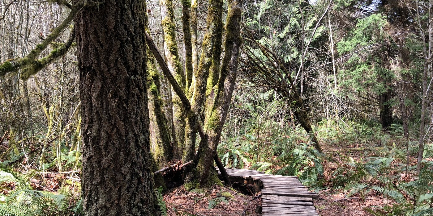
SILENT SWAMP LOOP
Location: Issaquah Alps - Tiger Mountain
Mileage: 8.8 miles
Elevation Gain: 600 feet

Silent Swamp trail. Photo by trip reporters George & Sally.
If you like the idea of hiking through shades of spring moss and green green while occasionally saying hi to fellow trail users rolling by on mountain bikes, find your way to this loop. It's a longer local loop (with options to connect to much, much more) on one of Tiger Mountain's "internal" trails.
> Plan your visit to Silent Swamp using WTA's Hiking Guide.
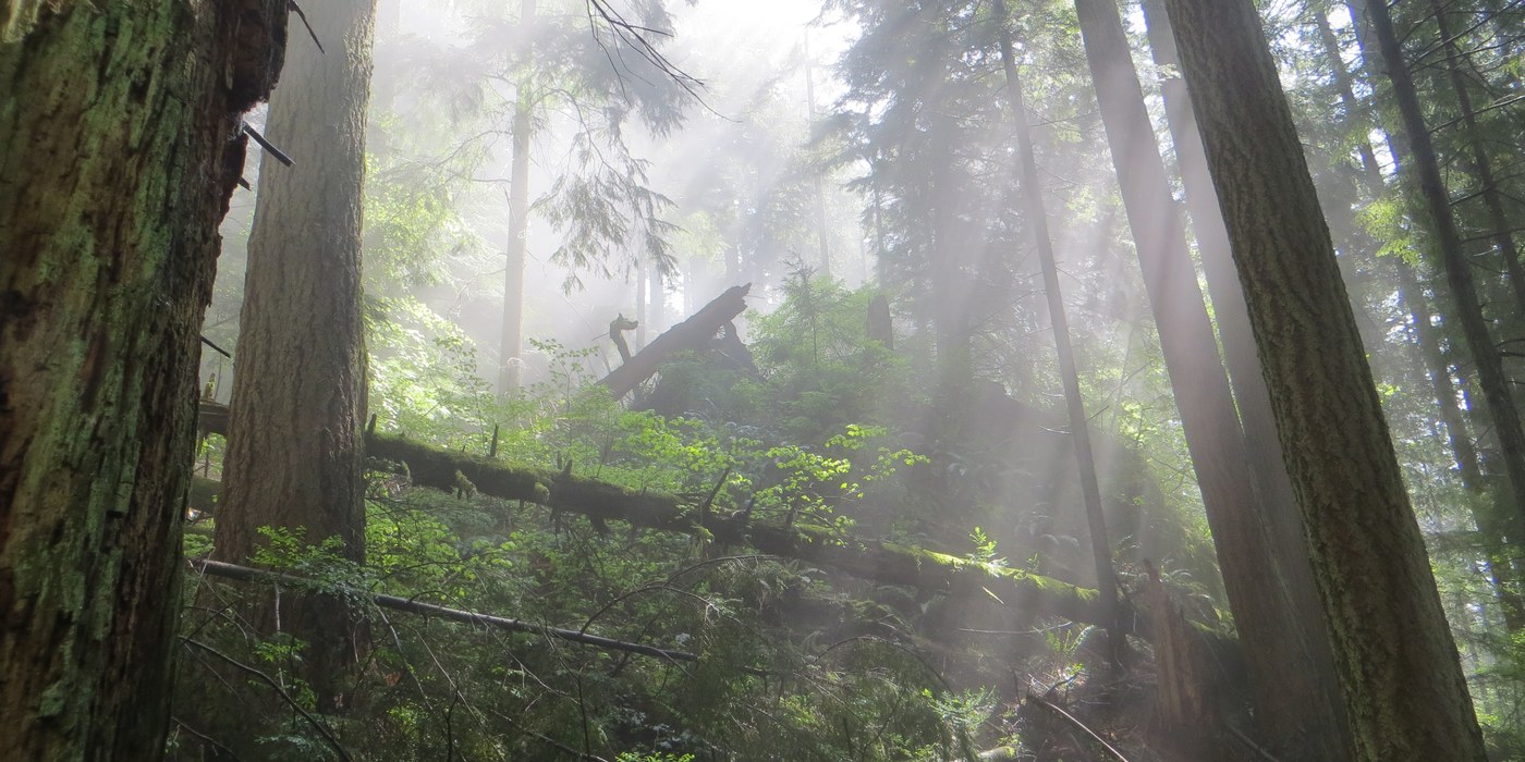
SOARING EAGLE REGIONAL PARK
Location: Issaquah Alps
Mileage: 12 miles of trails
Elevation Gain: Varies

A view of one of Soaring Eagle's trails later in the season. Photo by Pribbs.
Like many of our local regional parks, a series of trails shared by hikers, runners and mountain bikers winds through this lovely park. It's like a wilderness in miniature, with each little offshoot offering it's own unique flavor. You can make a grand loop around the outside, or little butterfly wing loops off the central trail.
> Plan your visit to Soaring Eagle using WTA's Hiking Guide.
2 DISCOVERY PARK LOOPs
Location: Puget Sound and Islands - Seattle/Tacoma
Mileage: 2.8 miles / 5.1 miles
Elevation Gain: 140 feet / 380 feet
The Discovery Park Loop Trail has it all. Photo by Cory C.
Two for the price of one! This bus-accessible park in the Magnolia neighborhood of Seattle has two terrific loop hikes to explore. And do they both pack a lot into their length, from stunning beach views to forested trails where you'd never know you were in the middle of a major city.
> Plan your visit to the Discovery Park Beach and Highlands Loop using WTA's Hiking Guide
> Plan your visit on the the shorter, classic Discover Park Loop using WTA's Hiking Guide.
DASH POINT STATE PARK
Location: Puget Sound and Islands - Seattle/Tacoma
Mileage: 11 miles of hiking trails
Elevation Gain: Varies

With trails that lead through woods and loop down to the beach, it's a great destination for families. Photo by allifam.
This shoreside state park between might be best known as a summertime camping or fishing destination, but with 11 miles of hiking trails (and more bike trails), it has a little something for everyone: bird watching platforms, woodsy walks among ferns and streams, sandy beaches and plenty of places to picnic. You can even plan a loop with a stop at the playground, if you're hiking with kids.
> Plan your visit to Dash Point using WTA's Hiking Guide.
PARADISE VALLEY CONSERVATION AREA
Location: Puget Sound and Islands - Seattle/Tacoma
Mileage: 5 miles of trails
Elevation Gain: 150 feet
From thick vegetation to rolling boardwalks, you'll find a variety of trails at Paradise Valley. Photo by Jennekehikes.
Once again, you've got your choice of loop hikes on this former working farm and homestead-turned conservation area outside Woodinville. The trails (with loops aplenty) here are well-signed, and plan to share them with horses and bikers. One of the best reasons to visit in spring? Spotting the showy salmonberry flowers alongside the trail.
> Plan your visit to Paradise Valley using WTA's Hiking Guide.
ECHO MOUNTAIN & Spring Lake – Lake Desire Park
Location: Puget Sound and Islands - Seattle/Tacoma
Mileage: 4 miles
Elevation Gain: 400 feet

One of the trails climbing to/from Echo Mountain. Photo by Erwin Buske.
You'll see this King County Park described as Echo Mountain or by one of the two lakes on either side of it. But whatever you want to call it, this gem between Renton and Maple Valley provides plenty of lollipop loop options. Be sure to take a map, so you can wind your way around the high points, or bounce back and forth between the lakes to your heart's content.
Want to make it an all-day muscle-powered adventure? The Cedar River Trail runs within 2.5 miles of the park, so you can work it into a bike ride or long training run, depending on where you hop on.
> Plan your visit to Echo Mountain using WTA's Hiking Guide
Chybinski Loop
Location: Issaquah Alps - Squak Mountain
Mileage: 7.7 miles
Elevation Gain: 2100 feet
Mid-may sunlight filtering down on the trails around Squak. Look for trillium and other woodland wildflowers. Photo by hellpops.
Located in the Cougar/Squak Mountain Corridor, this trail is your go-to for some reliable elevation gain. Experience the area’s extensive trail system and discover new experience each time you return. There are many ways to enjoy the fabulous Chybinski Loop Trail. A lovely option is to start and end at the Margaret’s Way trailhead. But the options are plenty, so take a lap of your own making.
> Plan your visit to Chybinski Loop using WTA's Hiking Guide.