13 Winter Backpacking Destinations
Winter may feel like the time to hang up your backpack and retire your tent for the season, but there are still plenty of opportunities to spend a night outside even when the temperatures are low. These low-elevation backpacking destinations can be accessible in every season and will help maintain your backpacking spirit all year long.
Depending on the year, these hikes may have anywhere from a foot of snow, to none at all. Before you embark on your adventure, read up on recent trip reports or call the local ranger station to check conditions in the area
TIPS FOR PLANNING A winter BACKPACKING TRIP
- Planning. Learn about choosing and planning your trip.
- Basics. Backpacking 101: Tips on equipment, food, setting up your camp and more. Snow Camping: Depending on the year, you may encounter low-level snow on any of these trails. Read up on our practical advice for setting up camp on snow. Winter Safety Tips: Hikers need to do plenty of advanced planning and take every precaution before hitting a trail in winter months. We have some tips for safer backcountry exploration in winter.
- People. To lessen your impact, keep your group size small. In official Wilderness areas, the general rule is 12 heartbeats (people, dogs, horses, etc.) or fewer in a group.
- Permits. If you are staying overnight, you will need to fill out a self-issued wilderness permit at the trailhead. Some areas, like national parks, may require an additional permit for backcountry camping. It's always a good idea to check with the land manager while planning your trip.
- Pack it in, pack it out. Whenever you head outside, practice Leave No Trace ethics.
Olympic Peninsula
Lower Big Quilcene river
Location: Hood Canal
Mileage: 10.2 miles, roundtrip
Elevation Gain: 800 feet
 A light dusting of snow on the bridge crossing the Big Quilcene River. Photo by Blazen.
The river ramble may be one of the best low-elevation hikes on the east side of the Olympics. Endless greenery and a bubbling river keep you company for the majority of this 10 mile trek. After crossing the Big Quilcene River on the oft-photographed bridge 2.7 miles in from the trailhead, you'll arrive at Bark Shanty Camp. If you're not ready to call it quits for the day, head another 2.4 miles down the river until you arrive at your second camping option, Camp Jolley.
> Plan your visit to Lower Big Quilcene River using WTA's Hiking Guide
Lower South Fork Skokomish river
Location: Hood Canal
Mileage: 8.5 miles, roundtrip
Elevation Gain: 800 feet
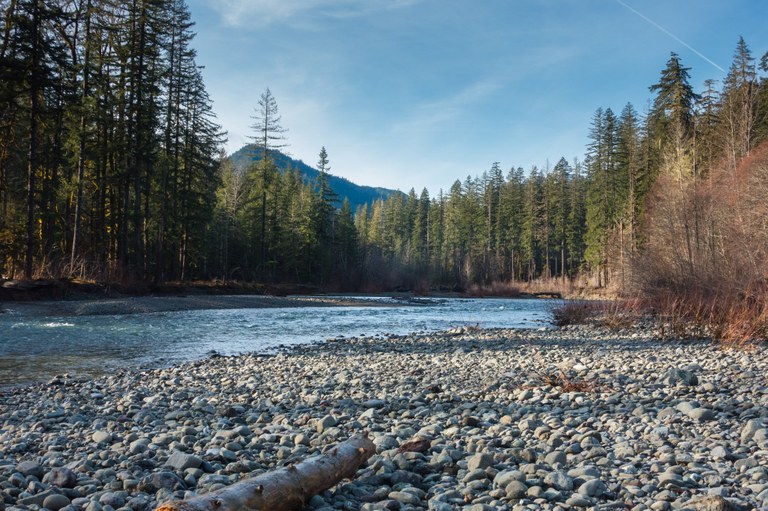 Lower South Fork Skokomish River. Photo by elevatedtv.
Venture up the Lower South Fork Skokomish for an abundance of flora and fauna amid lush old growth. Though advertised as a river ramble, the trail will wind you up into stunning old-growth stands before leading you back down to the river's edge. The trail is dotted with campsites along the way, though Camp Comfort at the 4 mile mark makes a great stopping point in the winter.
> Plan your visit to Lower South Fork Skokomish River using WTA's Hiking Guide
Duckabush River
Location: Hood Canal
Mileage: 10.6 miles, roundtrip
Elevation Gain: 2300 feet
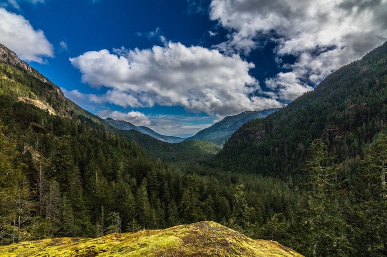 Duckabush River Trail. Photo be Mirek.
This trail is a true woodland wanderer's dream. This popular trail is often dotted with hikers throughout the summer season, but winter adventuring provides a chance at solitude along the Duckabush. After about 5 miles of hiking, you'll reach the aptly named Fivemile Camp where you'll be able to set up camp for the night.
> Plan your visit to Duckabush River using WTA's Hiking Guide
Hoh River Trail
Location: Pacific Coast
Mileage: 10.6 miles, roundtrip
Elevation Gain: 300 feet
 The Hoh River Trail. Photo by gemhikes.
A classic hike in any season, but come winter and you'll find the tourists, hikers and climbers who use this trail in the summer reduced down to just a trickle. After 5 miles of hiking, you'll arrive at Five Mile Island a popular spot for a short overnight trip. If you haven't had enough hiking for one day, you can venture onward to the ranger station at the 9 mile mark for several more camping opportunities.
> Plan your visit to Hoh River Trail using WTA's Hiking Guide
Shi Shi Beach and point of the arches
Location: Pacific Coast
Mileage: 8.0 miles, roundtrip
Elevation Gain: 200 feet
 Shi Shi Beach and Point of the Arches. Photo by Kiloa.
When it comes to picturesque views of the wild and rugged Olympic Coast, Shi Shi Beach and Point of the Arches tops the list. At only 8 miles roundtrip, the hike to Shi Shi beach makes for a perfect early season backpack to help keep you in shape for the summer season. Drop your pack and spend your time relishing in being in one of the most scenic locations in the Northwest. This is one of the most popular beach camping spots in the state, so plan to see other campers and be sure to leave it better than you found it.
> Plan your visit to Shi Shi Beach and Point of the Arches using WTA's Hiking Guide
South Coast Wilderness Trail
Location: Pacific Coast
Mileage: 17.0 miles, one-way
Elevation Gain: 2000 feet
 A sunset over the Pacific Coast with dark blue skies above and shades of orange at the horizon. The sunset is reflecting in the calm rocky waters of the ocean in the foreground. Photo by trip reporter mattj19.
When the doldrums and ho-hums of the winter blues come rolling in, hop back on the trail at a most unexpected place: the coast! While snow may be falling in the high country, the shoreline never sleeps and always abounds with life. Bring a tide table and a good book on this wild and scenic point-to-point traverse of the Olympic Coast. While much of your hike will be across sandy beaches, there are several places that will require you wait for the tide to go out. Along the way, plan to climb up steep headlands with cable ladders, ropes and your hands and knees. A wonderful year round adventure!
> Plan your visit to South Coast Wilderness Trail using WTA's Hiking Guide
North Cascades
East Bank Baker Lake
Location: Highway 20
Mileage: 9.0 miles, roundtrip
Elevation Gain: 500 feet
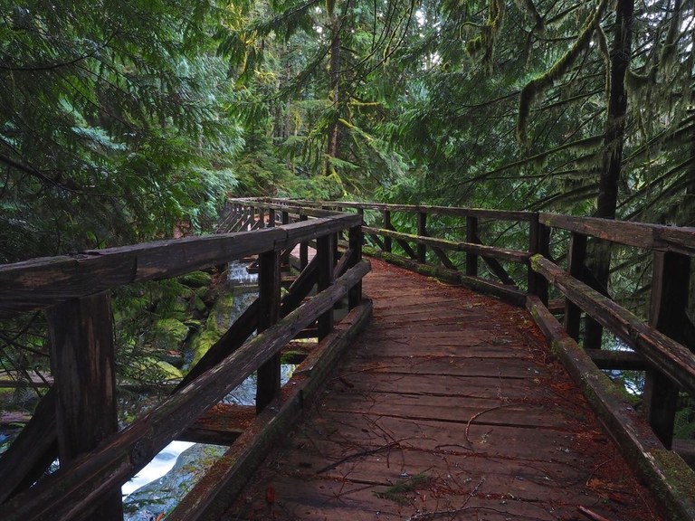 East Bank Baker Lake. Photo by Bob and Barb.
This popular summer trail is a nice off-season trek on a crisp, clear winter day. With the leaves off the trees, views that aren't possible in summer emerge; the surrounding peaks and the mossy green silhouettes of the leafless maple trees cover the hillside. A bonus any time of year are the many creeks, quaint bridges, large old-growth trees and of course, Mount Baker as the main attraction.
Come to a signed intersection at 4.2 miles. The Baker Lake trail continues straight ahead and crosses Noisy Creek. The left fork heads up alongside Noisy Creek and the right fork leads to Noisy Creek campground. A good place to spend the night, there are picnic tables, fire pits and tent sites, plus a backcountry toilet and a metal bear box.
> Plan your visit to East Bank Baker Lake using WTA's Hiking Guide
Thunder Creek
Location: North Cascades Highway - Hwy 20
Mileage: 12.0 miles, roundtrip
Elevation Gain: 1300 feet

A view across the water with snow covered mountains in the center flanked by shadowed tree-lined hills on either side. A layer of bright puffy clouds surround the peaks. Photo by trip reporter Elizabeth Rose.
A pale green creek, big old trees, a variety of understory, and peek-a-boo views of snow-capped peaks. Day-hikers should take it easy, as the joy here is in the journey not the destination. Backpackers, however, may disagree. Families and first-time backpackers will enjoy beautiful camps just two miles from the trailhead. Experienced backpackers will note that Thunder Creek is a gateway to an extensive network of trails -- just make sure you grab your backcountry permit beforehand!
> Plan your visit to Thunder Creek using WTA's Hiking Guide
Central Cascades
Carbon River to Ipsut Falls
Location: Mount Rainier Area
Mileage: 10.8 miles, roundtrip
Elevation Gain: 500 feet
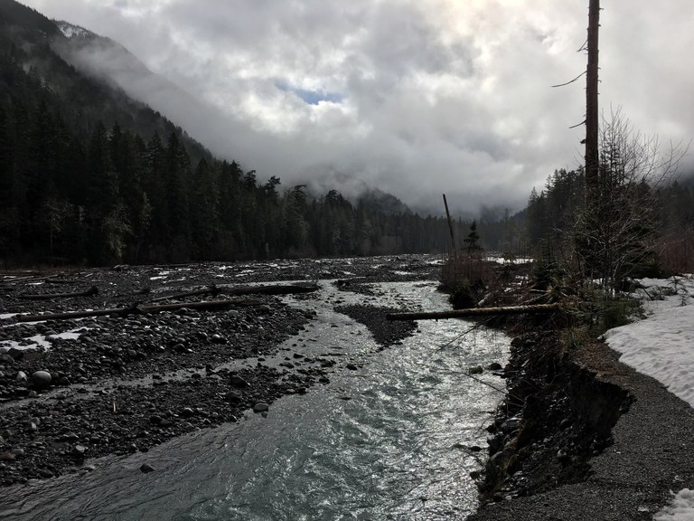
Carbon River to Ipsut Falls. Photo by dmbaughman.
The washed out Carbon River Road has turned the short trek to Ipsut falls into a 5.4 mile forest walk to the Ipsut Falls viewpoint. Along the way, marvel at magnificent old-growth forest, listen for the trilling of birdsong, and pause to take in the power of the Carbon River. From the junction for Chenius Falls, it's another one and a half miles to the Ipsut Creek campground. Pitch camp here, and then make the short 0.3 mile jaunt to view Ipsut Falls.
> Plan your visit to Carbon River and Ipsut Falls using WTA's Hiking Guide
Middle Fork Snoqualmie river
Location: Snoqualmie Pass
Mileage: 12.0 miles, roundtrip
Elevation Gain: 200 feet
 Middle Fork Snoqualmie River. Photo by Junebuggy.
This lovely river ramble weaves in and out of the forest, passing under overhanging cliffs and offering views across the river of jagged Garfield Mountain. Head upstream into the deep, quiet forest. The silence broken only by the murmuring river, the whispering of wind through the trees, or birdsong from the fish-eating birds that live in the area.
Pause on the beautiful volunteer and Forest Service built bridge deck to watch the flow of the river below you. Most day hikers will be content to enjoy lunch here before turning around to head back to your car. Backpackers, however, can continue up the valley into the Alpine Lakes Wilderness.
> Plan your visit to Middle Fork Snoqualmie River using WTA's Hiking Guide
Eastern & Central Washington
Wenaha River Trail
Location: Palouse and Blue Mountains
Mileage: 29.9 miles, one-way
Elevation Gain: 2500 feet
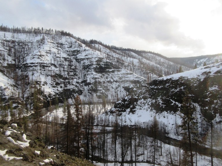 Wenaha River Trail. Photo by Froof_D_Poof.
With a stating elevation below 2000 feet, this hike can be available all-year long on a low-snow year. From the trailhead, it is approximately five miles to the boundary of the Wenaha-Tucannon Wilderness. The trail contours above the Wenaha River, a designated Wild & Scenic River, sometimes hugging the cliffs, and other times coming down to flat benches along the river with access to good campsites.
> Plan your visit to Wenaha River Trail using WTA's Hiking Guide
Lake Creek
Location: Tri-Cities
Mileage: 26.0 miles, roundtrip
Elevation Gain: 340 feet

A cloudy day on the Lake Creek trail. Dark rocky buttes rise up in the background with an overflowing water trough in the foreground. Photo by trip reporter Nathaniel.
The Lake Creek trail is an opportunity to explore one of the few true backcountry experiences in Eastern Washington’s channeled scablands among buttes and mesas carved by ice age floods. You don't commonly think of glaciers when you think of Washington's scabland country, but it was glaciers that were responsible for the flooding that sculpted this unique landscape, carving and gouging the volcanic bedrock into a maze of buttes, mesas and coulees. Expect this to be a cold trip in the winter, so pack accordingly!
> Plan your visit to Lake Creek using WTA's Hiking Guide
Juniper Dunes wilderness
Location: Tri-Cities
Mileage: 15.0 miles, roundtrip
Elevation Gain: 300 feet
 Juniper Dunes Wilderness. Photo by Froof_D_Poof.
This BLM-managed wilderness area is unlike any other Washington wilderness. The wilderness is home to diverse wildlife, both common and rare. It's likely visitors will be able to at least catch a glimpse of the numerous deer and coyotes within the wilderness. The juniper berries attract a large population of birds, especially in winter when forage elsewhere is scarce. Rare animals that can be found here include sagebrush lizard, black-tailed jackrabbit, grasshopper mouse, kangaroo rat, ferruginous hawk, and Swainson's hawk.
When planning a trip to Juniper Dunes, know that an overnight permit is required for backpacking, available for free by contacting the BLM office in Spokane. Campfires are strictly prohibited and there are no water sources within the wilderness area, so all water necessary for the trip must be carried in. Hikers need to be well versed in map and compass navigation skills when visiting here. There are numerous game trails crisscrossing the wilderness, but no maintained hiking trails.
> Plan your visit to Juniper Dunes Wilderness using WTA's Hiking Guide


