
It used to be possible to access Squire Creek Pass from the west, until an landslide destroyed about 200 yards of Squire Creek Road. There is a footpath across the slide now, but it's still a 4.7 mile road walk to where the trail itself begins, so many elect to take the shorter, steeper way in via Eight-mile Trail.
This unmaintained trail climbs steeply up, gaining 2,300 feet in 3 miles. Begin on an old logging road and climb steeply up a long series of switchbacks. Occasional views of surrounding peaks, waterfalls and tiny tarns delight your senses on the way to the pass, entering Boulder River Wilderness along the way.
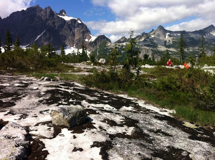
Once you reach the pass, enjoy impressive views and see if you can spot the lookout on Three Fingers to the west. Camping is limited here. Be sure to use existing campsites and please bring a camp stove.
It's possible to make a thru-hike by continuing down the other side of the pass on the aforementioned Squire Creek Pass Trail 654 for 7.7 miles, ending on Forest Service road 2040, but you'll need to arrange a pickup or leave a car at that end.
Squire Creek Pass via Eight-mile Trail

-
 Length
- 5.4 miles, roundtrip
-
 Elevation Gain
- 2,350 feet
-
 Highest Point
- 4,107 feet
Cascading waterfalls from the numerous streams and the frequent tarns located along the way make this an enjoyable hike. Mountain goats are known to frequent the area. During the late summer, ripe huckleberries can be found at the pass. But it comes at a cost -- a steep scramble on an unmaintained trail.
Continue reading
Hiking Squire Creek Pass via Eight-mile Trail

WTA worked here in 2024, 2023, 2020, 2019 and 2017!
Map & Directions
 Trailhead
Before You Go
Parking Pass/Entry Fee
Northwest Forest PassWTA Pro Tip: Save a copy of our directions before you leave! App-based driving directions aren't always accurate and data connections may be unreliable as you drive to the trailhead.
Getting There
From the Darrington Ranger Station, take the Mountain Loop Highway along the west side of the Sauk River. Follow this road for approximately 3.3 miles. Clear Creek Campground should be on the left side and Road 2060 should be on the right side. Turn right and follow Road 2060 for 6.0 miles to the trailhead located on the right.