
Some trails go to lakes, some to high viewpoints. This trail is all about the forest, and what a forest it is! Old-growth trees reach for the sky on either side of a brush-free trail, since understory is minimal when big old trees block out the sunlight. Find fantastic mushrooms here in the fall and forest wildflowers in the spring and early summer.
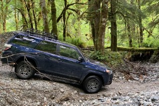
Since the Whitechuck Trail has been washed out this trail has become the main route to climb Glacier Peak. Climbers mix with backpackers and day hikers on the way to various destinations. A popular day trip on this trail is to hike to Mackinaw Shelter, making for 11.0 miles and just 1000 feet of elevation gain, but the whole North Fork Sauk Trail is nearly 9 miles with 5087 feet of gain!
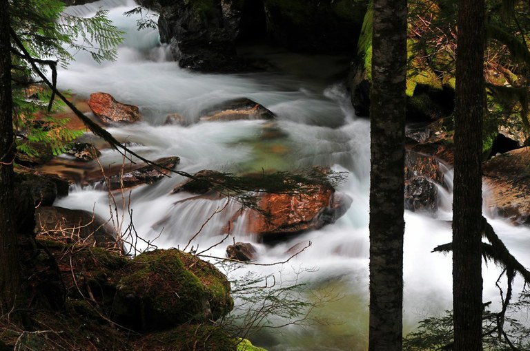
The North Fork Sauk River is never far away, and always in earshot, but seldom seen. At two miles is a junction with the trail to Pilot Ridge. A short walk on a spur trail here takes you over to the North Fork Sauk River. This is among the best viewpoints of the river.
The route has numerous small ups and downs, meandering alongside the river. At the 4-mile mark is Red Creek, where a new bridge makes crossing a snap. During the time that there was no bridge this was a difficult ford, but now hikers can easily carry on to Mackinaw Shelter at 5.5 miles, where the meandering forest hike ends and climbing begins.
As you begin climbing, you come out of the forest and up onto the slopes of the ridges that face Glacier Peak. The trail becomes much steeper and more switchbacked; hiking this in the heat of the day can be exhausting, especially with a pack on. Take it slow and stop in shady spots to catch your breath. Finally, after 3.2 miles of climbing and switchbacks, link up with the Pacific Crest Trail in a gorgeous meadow with stunning views of Glacier Peak. Continue heading south for a little more than a mile to the junction with the Foam Creek Basin climbers trail or the White Pass backcountry campsite.
WTA Pro Tip: If you can't have a hike without views, you can find them, even on this trail. Soon after leaving the trailhead, come to a junction with the Red Mountain Trail. Turning onto this trail, hike one mile. You'll gain 700 feet of elevation before you arrive at the site of the old Red Mountain Lookout.
This is not the top of the mountain but a good viewpoint nonetheless. The lookout site and the first few miles of the North Fork Sauk Trail makes for a good day, allowing for both forest exploration and heart pumping elevation gain.
North Fork Sauk River

-
 Length
- 18.2 miles, roundtrip
-
 Elevation Gain
- 5,078 feet
-
 Highest Point
- 5,949 feet
Some trails go to lakes, some to high viewpoints. This trail is all about the forest, and what a forest it is! Old-growth trees reach for the sky on either side of a brush-free trail, since understory is minimal when the big old trees block out the light. Find fantastic mushrooms here in the fall and forest wildflowers in the spring and early summer.
Continue reading
Hiking North Fork Sauk River

WTA worked here in 2025, 2024, 2023, 2022 and 2015!
North Fork Sauk River
Map & Directions
 Trailhead
Before You Go
Parking Pass/Entry Fee
Northwest Forest PassWTA Pro Tip: Save a copy of our directions before you leave! App-based driving directions aren't always accurate and data connections may be unreliable as you drive to the trailhead.