New Dosewallips River Trail Corridor Links State Park and National Forest
In a win for recreation access, a community-led effort creates a new trail corridor linking the popular Dosewallips State Park to a scenic section of the Olympic National Forest.
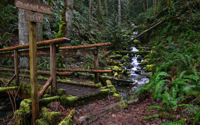
The Dosewallips River flows through some of the most scenic portions of the Olympic Peninsula, weaving through rain forest to the shoreline of Hood Canal where, at the mouth of the river, sits one of Washington's most popular State Parks.
Thanks to a community effort lead by the Trust for Public Land, Dosewallips State Park, its namesake river, and the Olympic National Forest just received new protection and a trail corridor.
Preserving salmon habitat, creating new recreation opportunities
The Trust for Public Land recently purchased three miles of land from Pope Resources along the southern side of the Dosewallips river, creating a trail corridor connecting the Hood Canal and State Park to the Olympic National Park and Forest, including the Buckhorn and Brothers' Wilderness areas.
The Trust also acquired a conservation easement on more than 3,600 acres of working forest surrounding to the park and new trail corridor. A conservation easement allows land to be preserved as a natural area in perpetuity, so even if it changes ownership, it will not be developed.
A similar project is being pursued along the Duckabush River. Both projects are part of the Trust for Public Land's long term project to protect 50,000 acres along Hood Canal in 10 years to ensure "economic and environmental stability of the landscape."
Construction has not yet begun on new trails in the corridor, but this is a strong first step in providing increased access to this scenic treasure.
Comments