What’s the future for the bridge to the Northwest side of Mount Rainier?
In April, the 103-year-old Fairfax Bridge over the Carbon River closed permanently to all vehicle and pedestrian traffic, effectively cutting off access to the northwest side of Mount Rainier National Park. The Washington State Department of Transportation is now considering two options for the future: rebuilding the bridge north of its current location or keeping the bridge permanently closed.
In April, the 103-year-old Fairfax Bridge over the Carbon River, 3 miles south of Carbonado and just outside of Mount Rainier National Park, closed permanently to all vehicle and pedestrian traffic due to deterioration of its steel supports.
This closure effectively cuts off access to the northwest side of Mount Rainier National Park and also nearby U.S. Forest Service lands, with no way to get to trailheads off of Mowich Lake Road (State Route 165) and Carbon River Road. This includes popular hikes like Spray Park, Summit Lake and Tolmie Peak.
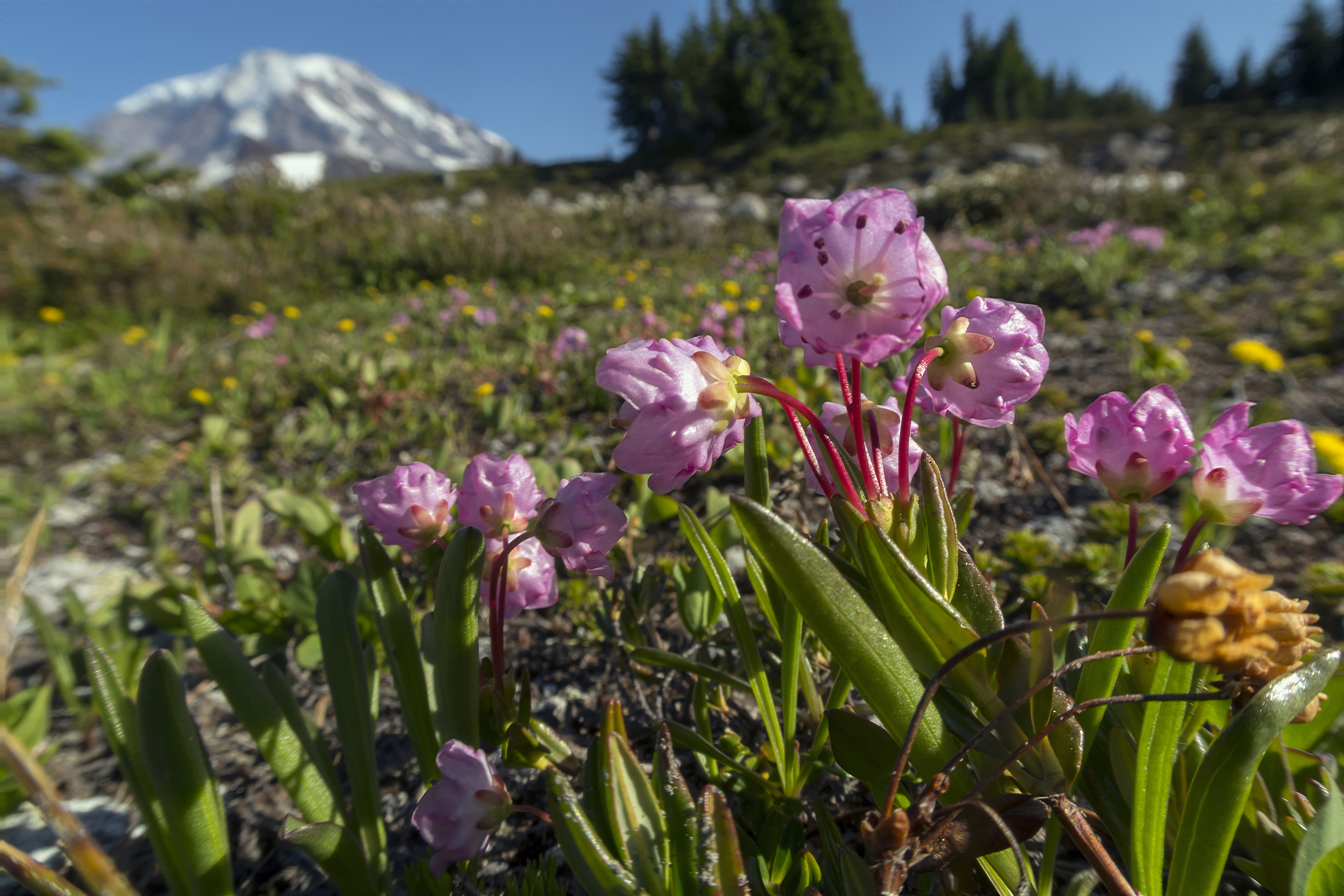
 Photo of Spray Park Trail, currently inaccessible due to the closed bridge, by Steven Hawley.
The Washington State Department of Transportation (WSDOT) initially considered seven alternatives to the bridge closure. To gather public input, they invited online feedback and held two open houses in Carbonado and Wilkeson. Recently, WSDOT shared that they had narrowed down future alternatives to two options:
- Replacing the bridge north of its existing location
- Keeping the bridge permanently closed
Three of the original options involved rerouting State Route 165, but those plans were dismissed because they had price tags of $375 million to $785 million.
It would cost an estimated $160 million to replace the bridge north of its current location. The other remaining option is to leave the bridge closed, which would cost $70 million to $80 million to pay for its demolition and to buy out landowners who live on the other side of the bridge. There currently is no funding for any of the proposed alternatives.
A permanent closure would hurt hikers and local communities
The option to keep the bridge closed (not rebuild) would be to the detriment of hikers, outdoor lovers and anyone who wishes to experience Mount Rainier National Park. It would also be an economic blow to local communities.
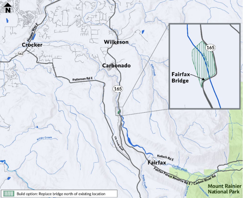
 Map showing location for potential replacement of the bridge courtesy of Washington State Department of Transportation.
The towns along SR 165 that lead up to the closed bridge take pride in being gateways to the national park. Last year, the town of Wilkeson held an event to celebrate the 125th anniversary of Mount Rainier National Park and to raise funds for the park.
Nearby towns support the park, and park visitation supports the towns. There are businesses in Wilkeson that only open during the summer when there is peak visitation to the park.
WTA supports solutions that would re-open access
WTA is talking with the governor’s office and members of Congress about the bridge's closure and its impact on communities and individuals who love this special part of our state.
We'll continue to bring hikers’ voices into the planning for the future of this access point to Mount Rainier.


Comments
Isn't there a big ORV area that is now inaccessible because of the bridge closure? Are they involved in these discussions?
Posted by:
BethS on Oct 01, 2025 12:36 PM
@BethS I'm WTA's advocacy coordinator and wanted to say thanks for your message. Yes, Evans Creek ORV (off-road vehicle) area and campground is one of the sites that's now inaccessible. WTA's initial conversations on the bridge closure have been with representatives in government. We haven't yet talked directly with the ORV community, but working with outdoor recreation partners will be part of future work on this issue.
Posted by:
melanib on Oct 01, 2025 04:59 PM
Who are the representatives we should contact individually to voice our support for rebuilding?
Posted by:
DKDC on Oct 08, 2025 07:27 PM
Is it known why replacing the bridge at its current location was rejected? I would think that would be the least expensive option.
Posted by:
A Tuesday Trekker on Oct 08, 2025 08:45 PM
Is it known why replacing the bridge at its current location was rejected? I would think that would be the least expensive option.
Posted by:
A Tuesday Trekker on Oct 08, 2025 08:45 PM
Tuesday Trekker ... Current location hasn't been rejected; the replacement option is considering locations from the current bridge to about 1/2 mile downstream. WSDOT says building on the current footprint will take 1+ year longer since current bridge would first need to be removed, and current footprint may have more construction challenges due to more rock walls and tighter curves.
Posted by:
Sluggo67 on Oct 09, 2025 11:10 AM
@DKDC I'm WTA's advocacy coordinator. Thanks for your question! There isn't a formal channel for public comment right now, but you could try sharing your thoughts to the email that was accepting public comment in September (SR165FairfaxBridgeStudy@wsdot.wa.gov). You can also contact your state legislators, since this project would require state funding https://leg.wa.gov/legislators/
Posted by:
melanib on Oct 13, 2025 08:26 AM
@Sluggo67 thanks for providing that information. @A Tuesday Trekker if you want more detail about any of the proposed options, they are outlined in WSDOT's report with main points, cost and timeline for each option: https://wsdot.wa.gov/sites/default/files/2025-08/SR-165-Carbon-River-Fairfax-Bridge-DRAFT-Report.pdf
Posted by:
melanib on Oct 13, 2025 08:29 AM