

Boulder Lake is nestled in the Morning Star Natural Resources Conservation Area, which protects native plant communities and wildlife. This area is also unique as warm moisture from the Puget Sound and Pacific Ocean accumulates here, resulting in one of the wettest areas in the North Cascades mountain range.
The trail begins at the Boulder and Grieder lakes trailhead on the south shore of Spada Lake. Hikers will begin with a serene grade of 3 miles, paired with views of the lake and Sultan River, where you may even see eagles hunting. In the past, hikers were able to drive to the Boulder Lake trailhead. The road has since been decommissioned; what is left creates the distinct winding undulations of the trail.
In this lower section, hikers will cross 6-foot bridges and one former vehicle bridge. As it gets warmer, catch a glimpse of a garter snake or two. The trail can be very brushy in early summer, but hikers will be surrounded by salmonberries, blueberries and thimbleberries. There’s a good rest stop to view the lake and two port-a-potties a mile in. About 3 miles in, hikers will come upon an opening with the old trail signs and a decommissioned pit toilet. If you spend the night, you’ll hear owls and be awoken by varied thrush.
As hikers ascend, they’ll be embraced by the lushness of ferns and tree cover. Western toads and slugs are abundant here, too. You will cross Boulder Creek with picturesque rushing falls and a great swimming hole below. Continue the trek up to the hairpin turn, and this hike will begin to mellow into a soft understory of cedar, fir and hemlock. As the trail wraps around the mountain, there are breaks from the tree cover accompanied by views of the ridge across the valley. In these breaks, the trail can be quite rocky, and hikers will appreciate the work of former WTA crews that added stairs to the more difficult sections. If you look carefully, you’ll see deer prints too.
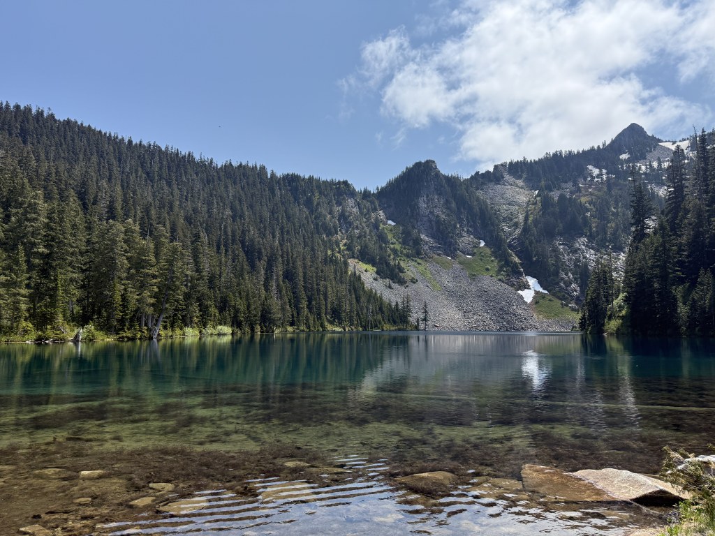
The trail feels less maintained as you continue up, covered in layers of duff and needles, and begins to thin as you climb the switchbacks. As hikers ascend, there will be fewer views of the ridge, but the views will return once hikers near the top and are rewarded with a meadow crossable by an old boardwalk. In the elevation, there are yellow cedars and a natural walking bridge. Sounds of Boulder Creek will accompany hikers and will be crossed again at the top. Once at the lake, it’s a peaceful spot for paddling and fishing. There are nine backcountry primitive campsites, as well as amazing spots to enjoy a great lunch with beautiful views of Errant Peak, Fallacy Peak and Tang Tower.

 Trailhead


